Estimated Value: $374,000 - $431,284
Studio
1
Bath
2,448
Sq Ft
$164/Sq Ft
Est. Value
About This Home
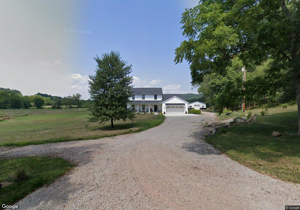
This home is located at 272 Hess Ln, Ray, OH 45672 and is currently estimated at $402,642, approximately $164 per square foot. 272 Hess Ln is a home with nearby schools including Southeastern Elementary School, Southeastern Middle School, and Southeastern High School.
Ownership History
Date
Name
Owned For
Owner Type
Purchase Details
Closed on
Mar 6, 2019
Sold by
Hess Darren M
Bought by
Hess Darren M and Hess Andrea D
Current Estimated Value
Home Financials for this Owner
Home Financials are based on the most recent Mortgage that was taken out on this home.
Original Mortgage
$245,100
Interest Rate
4.12%
Mortgage Type
Adjustable Rate Mortgage/ARM
Create a Home Valuation Report for This Property
The Home Valuation Report is an in-depth analysis detailing your home's value as well as a comparison with similar homes in the area
Purchase History
| Date | Buyer | Sale Price | Title Company |
|---|---|---|---|
| Hess Darren M | -- | Title First Agency Inc |
Source: Public Records
Mortgage History
| Date | Status | Borrower | Loan Amount |
|---|---|---|---|
| Closed | Hess Darren M | $245,100 |
Source: Public Records
Tax History
| Year | Tax Paid | Tax Assessment Tax Assessment Total Assessment is a certain percentage of the fair market value that is determined by local assessors to be the total taxable value of land and additions on the property. | Land | Improvement |
|---|---|---|---|---|
| 2024 | $4,793 | $135,110 | $5,460 | $129,650 |
| 2023 | $4,793 | $135,110 | $5,460 | $129,650 |
| 2022 | $4,897 | $135,110 | $5,460 | $129,650 |
| 2021 | $4,314 | $104,590 | $4,150 | $100,440 |
| 2020 | $4,348 | $104,590 | $4,150 | $100,440 |
| 2019 | $173 | $4,150 | $4,150 | $0 |
| 2018 | $156 | $3,780 | $3,780 | $0 |
| 2017 | $157 | $3,780 | $3,780 | $0 |
| 2016 | $153 | $3,780 | $3,780 | $0 |
| 2015 | $154 | $3,780 | $3,780 | $0 |
| 2014 | $151 | $3,780 | $3,780 | $0 |
| 2013 | $151 | $3,780 | $3,780 | $0 |
Source: Public Records
Map
Nearby Homes
- 1793 Bronx Corner Rd
- 1914 Bronx Corner Rd
- 587 John W Barbee Rd
- 485 Springer Rd
- 34576 U S 35
- 0 U S 35
- 3110 Borland Rd
- 3988 W St Rt 35
- 920 Hanna Ln
- 3732 Borland Rd
- 1011 Lee Hollow Rd
- 379 Mutton Run Rd
- 32120 Fout Rd
- 0 Raysville Rd
- 55130 Hutt Rd
- 0 Hutt Rd
- 53430 State Route 671
- 242 Sour Run Rd
- 31557 French Rd
- 56400 Doles Rd
- 303 Hess Ln
- 36998 Dickey Rd
- 36874 Dickey Rd
- 36864 Dickey Rd
- 36874 Dickey Rd Ray
- 2161 Bronx Corner Rd
- 36862 Dickey Rd
- 36862 Dickey Rd
- 36818 Dickey Rd
- 36832 Dickey Rd
- 0 Dickey Rd
- 2045 Bronx Corner Rd
- 2122 Bronx Corner Rd
- 1983 Bronx Corner Rd
- 2085 Bronx Corner Rd
- 36635 Dickey Rd
- 36635 Dickey Rd
- 2023 Bronx Corner Rd
- 1993 Bronx Corner Rd
- 36882 Dickey Rd
Your Personal Tour Guide
Ask me questions while you tour the home.