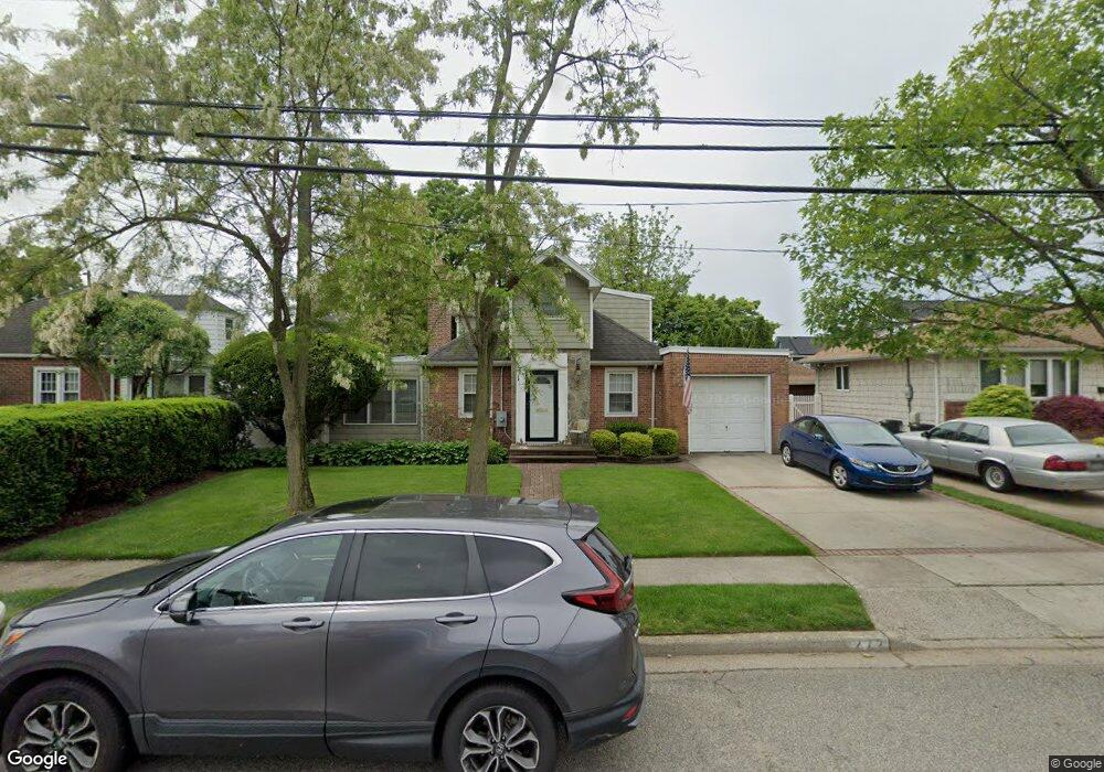
272 Locust St West Hempstead, NY 11552
Estimated Value: $628,779 - $760,000
--
Bed
1
Bath
1,480
Sq Ft
$469/Sq Ft
Est. Value
About This Home
This home is located at 272 Locust St, West Hempstead, NY 11552 and is currently estimated at $694,390, approximately $469 per square foot. 272 Locust St is a home located in Nassau County with nearby schools including Chestnut Street School, West Hempstead Secondary School, and Hebrew Academy of Nassau County (HANC).
Ownership History
Date
Name
Owned For
Owner Type
Purchase Details
Closed on
Jun 12, 1996
Sold by
Levin Harriet
Bought by
Zivotofsky David
Current Estimated Value
Home Financials for this Owner
Home Financials are based on the most recent Mortgage that was taken out on this home.
Original Mortgage
$100,000
Outstanding Balance
$6,511
Interest Rate
8.21%
Estimated Equity
$687,879
Create a Home Valuation Report for This Property
The Home Valuation Report is an in-depth analysis detailing your home's value as well as a comparison with similar homes in the area
Home Values in the Area
Average Home Value in this Area
Purchase History
| Date | Buyer | Sale Price | Title Company |
|---|---|---|---|
| Zivotofsky David | $129,000 | -- |
Source: Public Records
Mortgage History
| Date | Status | Borrower | Loan Amount |
|---|---|---|---|
| Open | Zivotofsky David | $100,000 |
Source: Public Records
Tax History Compared to Growth
Tax History
| Year | Tax Paid | Tax Assessment Tax Assessment Total Assessment is a certain percentage of the fair market value that is determined by local assessors to be the total taxable value of land and additions on the property. | Land | Improvement |
|---|---|---|---|---|
| 2025 | $12,063 | $454 | $237 | $217 |
| 2024 | $3,914 | $460 | $240 | $220 |
| 2023 | $9,241 | $462 | $240 | $222 |
| 2022 | $9,241 | $476 | $248 | $228 |
| 2021 | $8,565 | $470 | $238 | $232 |
| 2020 | $5,084 | $456 | $455 | $1 |
| 2019 | $7,114 | $489 | $488 | $1 |
| 2018 | $7,161 | $521 | $0 | $0 |
| 2017 | $4,564 | $554 | $553 | $1 |
| 2016 | $7,331 | $587 | $450 | $137 |
| 2015 | $2,883 | $619 | $475 | $144 |
| 2014 | $2,883 | $619 | $475 | $144 |
| 2013 | $3,597 | $825 | $633 | $192 |
Source: Public Records
Map
Nearby Homes
- 467 Susan Ct
- 218 Colony St
- 352 Hempstead Ave
- 537 Madison Ave
- 590 Langley Ave
- 613 Adams Ave
- 635 Hempstead Ave
- 106 Sycamore St
- 686 Tanwood Dr
- 303 Nassau Blvd
- 126 Oakland Ave
- 474 Roy St
- 19 Richard St
- 72 Spruce St
- 321 Oakford St
- 350 Paul Place
- 513 Washington Ave
- 87 Elton St
- 518 Nassau Blvd
- 185 Maxine Ct
- 258 Locust St
- 456 Duryea Terrace
- 464 Duryea Terrace
- 463 Locust Terrace
- 453 Locust Terrace
- 468 Duryea Terrace
- 469 Locust Terrace
- 290 Locust St
- 475 Locust Terrace
- 271 Locust St
- 476 Duryea Terrace
- 263 Locust St
- 463 Duryea Terrace
- 261 Locust St
- 255 Locust St
- 255 Locust St
- 250 Locust St
- 479 Locust Terrace
- 296 Locust St
- 465 Duryea Terrace