Estimated Value: $245,767 - $283,000
3
Beds
2
Baths
1,607
Sq Ft
$166/Sq Ft
Est. Value
About This Home
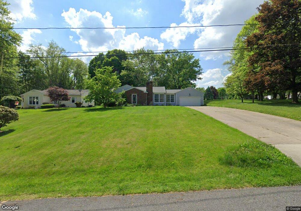
This home is located at 272 N Messner Rd, Akron, OH 44319 and is currently estimated at $266,192, approximately $165 per square foot. 272 N Messner Rd is a home located in Summit County with nearby schools including Nolley Elementary School, Manchester Middle School, and Manchester High School.
Ownership History
Date
Name
Owned For
Owner Type
Purchase Details
Closed on
Jan 23, 2019
Sold by
Adey Carl S and Adey Susan F
Bought by
Garman Karl P and Garman Susan D
Current Estimated Value
Purchase Details
Closed on
Feb 25, 2004
Sold by
Woodcock Todd A and Woodcock Marcia L
Bought by
Adey Carl and Adey Susan
Home Financials for this Owner
Home Financials are based on the most recent Mortgage that was taken out on this home.
Original Mortgage
$124,100
Interest Rate
5.62%
Mortgage Type
Purchase Money Mortgage
Purchase Details
Closed on
May 20, 2002
Sold by
Owen Roger L
Bought by
Woodcock Todd A and Woodcock Marcia L
Home Financials for this Owner
Home Financials are based on the most recent Mortgage that was taken out on this home.
Original Mortgage
$134,900
Interest Rate
7%
Create a Home Valuation Report for This Property
The Home Valuation Report is an in-depth analysis detailing your home's value as well as a comparison with similar homes in the area
Home Values in the Area
Average Home Value in this Area
Purchase History
| Date | Buyer | Sale Price | Title Company |
|---|---|---|---|
| Garman Karl P | -- | None Available | |
| Adey Carl | $146,000 | Real Estate Title | |
| Woodcock Todd A | $142,000 | Bond & Associates Title Agen |
Source: Public Records
Mortgage History
| Date | Status | Borrower | Loan Amount |
|---|---|---|---|
| Previous Owner | Adey Carl | $124,100 | |
| Previous Owner | Woodcock Todd A | $134,900 |
Source: Public Records
Tax History
| Year | Tax Paid | Tax Assessment Tax Assessment Total Assessment is a certain percentage of the fair market value that is determined by local assessors to be the total taxable value of land and additions on the property. | Land | Improvement |
|---|---|---|---|---|
| 2024 | $3,666 | $73,420 | $15,456 | $57,964 |
| 2023 | $3,666 | $73,420 | $15,456 | $57,964 |
| 2022 | $3,368 | $52,549 | $10,962 | $41,587 |
| 2021 | $3,380 | $52,549 | $10,962 | $41,587 |
| 2020 | $3,322 | $52,550 | $10,960 | $41,590 |
| 2019 | $3,356 | $47,600 | $8,990 | $38,610 |
| 2018 | $2,895 | $47,600 | $8,990 | $38,610 |
| 2017 | $2,779 | $47,600 | $8,990 | $38,610 |
| 2016 | $2,784 | $41,400 | $8,990 | $32,410 |
| 2015 | $2,779 | $41,400 | $8,990 | $32,410 |
| 2014 | $2,758 | $41,400 | $8,990 | $32,410 |
| 2013 | $2,862 | $43,220 | $8,990 | $34,230 |
Source: Public Records
Map
Nearby Homes
- 5766 Weaver Rd
- 715 Highland Park Dr
- 771 Leeman Dr
- 477 Deborah Dr
- 5042 Laddie Dr
- 6407 Southview Dr
- 6235 Manchester Rd
- 4 Shrakes Hotel Dr
- 6 Shrakes Hotel Dr
- 7 Shrakes Hotel Dr
- 5 Shrakes Hotel Dr
- 3 Shrakes Hotel Dr
- 6090 Manchester Rd Unit 6096
- 427 Catalina Dr
- 4769 Cherimoya Ave
- lot 8 Whyem Dr
- 0 W Comet Rd Unit 5079117
- 4628 Whyem Dr
- 4710 Pinecrest Dr
- 4472 Broadley Cir
- 262 N Messner Rd
- 318 N Messner Rd
- 240 N Messner Rd Unit 244
- 324 N Messner Rd
- 271 N Messner Rd
- 307 N Messner Rd
- 331 N Messner Rd
- 253 N Messner Rd
- 291 N Messner Rd
- 236 N Messner Rd Unit 238
- 236 N Messner Rd
- 323 N Messner Rd
- 257 N Messner Rd
- 281 N Messner Rd
- 340 N Messner Rd
- 232 N Messner Rd
- 341 N Messner Rd
- 5617 Dailey Rd
- 241 N Messner Rd
- 350 N Messner Rd
Your Personal Tour Guide
Ask me questions while you tour the home.