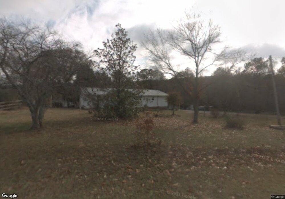
272 Perry Rd Armuchee, GA 30105
Estimated Value: $246,000 - $309,000
Studio
--
Bath
1,918
Sq Ft
$144/Sq Ft
Est. Value
About This Home
This home is located at 272 Perry Rd, Armuchee, GA 30105 and is currently estimated at $275,445, approximately $143 per square foot. 272 Perry Rd is a home with nearby schools including Armuchee High School.
Ownership History
Date
Name
Owned For
Owner Type
Purchase Details
Closed on
Jan 5, 1993
Bought by
P and R
Current Estimated Value
Purchase Details
Closed on
Nov 14, 1980
Bought by
P and R
Purchase Details
Closed on
Jul 18, 1980
Bought by
P and R
Purchase Details
Closed on
Jul 17, 1980
Sold by
Puryear Billy Roy and Puryear Lorie C
Bought by
Puryear Billy Roy
Purchase Details
Closed on
Apr 8, 1971
Bought by
P and R
Purchase Details
Closed on
Apr 7, 1971
Sold by
Maxey Scott
Bought by
Puryear Billy Roy and Puryear Lorie C
Purchase Details
Closed on
Jan 1, 1968
Bought by
P and R
Purchase Details
Closed on
Jan 1, 1967
Sold by
Hicks G L
Bought by
Maxey Scott
Purchase Details
Closed on
Jan 1, 1921
Bought by
Hicks G L
Create a Home Valuation Report for This Property
The Home Valuation Report is an in-depth analysis detailing your home's value as well as a comparison with similar homes in the area
Purchase History
| Date | Buyer | Sale Price | Title Company |
|---|---|---|---|
| P | -- | -- | |
| P | -- | -- | |
| P | -- | -- | |
| Puryear Billy Roy | -- | -- | |
| P | -- | -- | |
| Puryear Billy Roy | $2,000 | -- | |
| P | -- | -- | |
| Maxey Scott | -- | -- | |
| Hicks G L | -- | -- |
Source: Public Records
Tax History
| Year | Tax Paid | Tax Assessment Tax Assessment Total Assessment is a certain percentage of the fair market value that is determined by local assessors to be the total taxable value of land and additions on the property. | Land | Improvement |
|---|---|---|---|---|
| 2025 | $958 | $130,934 | $52,420 | $78,514 |
| 2024 | $958 | $115,489 | $41,936 | $73,553 |
| 2023 | $876 | $106,505 | $41,936 | $64,569 |
| 2022 | $632 | $82,015 | $33,160 | $48,855 |
| 2021 | $499 | $63,867 | $23,595 | $40,272 |
| 2020 | $498 | $59,609 | $20,903 | $38,706 |
| 2019 | $498 | $57,943 | $20,903 | $37,040 |
| 2018 | $504 | $53,639 | $18,153 | $35,486 |
| 2017 | $500 | $52,759 | $18,153 | $34,606 |
| 2016 | $487 | $52,174 | $18,120 | $34,054 |
| 2015 | $1,048 | $52,174 | $18,120 | $34,054 |
| 2014 | $1,048 | $52,174 | $18,120 | $34,054 |
Source: Public Records
Map
Nearby Homes
- 5967 Martha Berry Hwy
- 0 Big Texas Valley Rd NW Unit 10681966
- 00 Big Texas Valley Rd NW
- 4494 Old Summerville Rd
- 6729 Big Texas Valley Rd NW
- 70 Old Summerville Rd
- 1450 Highway 27
- 0 Ben Mosley Cir Unit 25735821
- 0 Ben Mosley Cir Unit 10654033
- 1024 New Rosedale Rd NE
- 0 W Valley Dr Unit 25949847
- 0 Highway 140 Unit 20164671
- 00 Westvalley Dr
- 0 Westvalley Dr NW Unit 7722073
- 0 Westvalley Dr NW Unit 10694893
- 0 Westvalley Dr NW Unit 10694896
- 0 Little Texas Valley Rd NW Unit 7690581
- 0 Little Texas Valley Rd NW Unit 10655120
- 1129 Farmersville Rd
- 722 Floyd Springs Rd NE
Your Personal Tour Guide
Ask me questions while you tour the home.