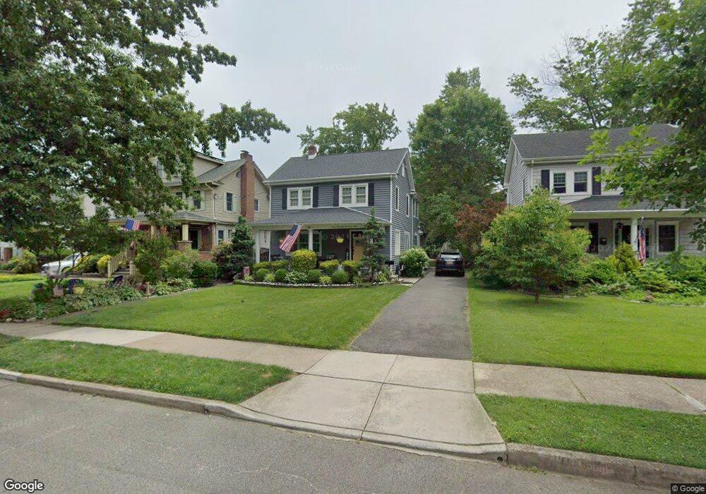
272 Rhoads Ave Haddonfield, NJ 08033
Estimated Value: $784,740 - $996,000
3
Beds
2
Baths
1,664
Sq Ft
$545/Sq Ft
Est. Value
About This Home
This home is located at 272 Rhoads Ave, Haddonfield, NJ 08033 and is currently estimated at $906,435, approximately $544 per square foot. 272 Rhoads Ave is a home located in Camden County with nearby schools including Haddonfield Memorial High School, Christ the King Regional School, and Haddonfield Friends School.
Ownership History
Date
Name
Owned For
Owner Type
Purchase Details
Closed on
Apr 29, 2011
Sold by
Silverman Andrew J and Silverman Francine
Bought by
Ward Brian C and Ward Elizabeth A
Current Estimated Value
Home Financials for this Owner
Home Financials are based on the most recent Mortgage that was taken out on this home.
Original Mortgage
$292,000
Outstanding Balance
$202,365
Interest Rate
4.82%
Mortgage Type
Purchase Money Mortgage
Estimated Equity
$704,070
Purchase Details
Closed on
Jan 18, 2008
Sold by
Keane James O and Keane Thelma M
Bought by
Silverman Andrew J and Silverman Francine
Home Financials for this Owner
Home Financials are based on the most recent Mortgage that was taken out on this home.
Original Mortgage
$95,000
Interest Rate
6.17%
Mortgage Type
New Conventional
Create a Home Valuation Report for This Property
The Home Valuation Report is an in-depth analysis detailing your home's value as well as a comparison with similar homes in the area
Home Values in the Area
Average Home Value in this Area
Purchase History
| Date | Buyer | Sale Price | Title Company |
|---|---|---|---|
| Ward Brian C | $408,000 | -- | |
| Silverman Andrew J | $355,000 | -- |
Source: Public Records
Mortgage History
| Date | Status | Borrower | Loan Amount |
|---|---|---|---|
| Open | Ward Brian C | $292,000 | |
| Previous Owner | Silverman Andrew J | $95,000 |
Source: Public Records
Tax History
| Year | Tax Paid | Tax Assessment Tax Assessment Total Assessment is a certain percentage of the fair market value that is determined by local assessors to be the total taxable value of land and additions on the property. | Land | Improvement |
|---|---|---|---|---|
| 2025 | $14,859 | $459,900 | $188,000 | $271,900 |
| 2024 | $14,662 | $459,900 | $188,000 | $271,900 |
| 2023 | $14,662 | $459,900 | $188,000 | $271,900 |
| 2022 | $14,547 | $459,900 | $188,000 | $271,900 |
| 2021 | $14,473 | $459,900 | $188,000 | $271,900 |
| 2020 | $14,372 | $459,900 | $188,000 | $271,900 |
| 2019 | $143 | $459,900 | $188,000 | $271,900 |
| 2018 | $14,087 | $459,900 | $188,000 | $271,900 |
| 2017 | $10,899 | $364,500 | $188,000 | $176,500 |
| 2016 | $10,654 | $364,500 | $188,000 | $176,500 |
| 2015 | $10,359 | $364,500 | $188,000 | $176,500 |
| 2014 | $10,129 | $364,500 | $188,000 | $176,500 |
Source: Public Records
Map
Nearby Homes
- 318 Ardmore Ave
- 156 Ardmore Ave
- 139 Rhoads Ave
- 123 Hawthorne Ave
- 209 Haddonfield Commons
- 286-288 Lake St
- 105 Denver Ave
- 633 S Edge Park Dr
- 801 Cedar Ave
- 840 Cedar Ave
- 405 E Melrose Ave
- 412 Westmont Ave
- 237 Virginia Ave
- 13 W Euclid Ave
- 13 Wilkins Ave
- 102 A Cherry Parke
- 615 Pardee Ln
- 30 Potter St
- 128 E Cherry Parke
- 32 Potter St
- 276 Rhoads Ave
- 268 Rhoads Ave
- 280 Rhoads Ave
- 264 Rhoads Ave
- 269 Hawthorne Ave
- 284 Rhoads Ave
- 260 Rhoads Ave
- 265 Hawthorne Ave
- 273 Hawthorne Ave
- 277 Hawthorne Ave
- 261 Hawthorne Ave
- 288 Rhoads Ave
- 256 Rhoads Ave
- 261 Rhoads Ave
- 255 Rhoads Ave
- 265 Rhoads Ave
- 251 Rhoads Ave
- 281 Hawthorne Ave
- 257 Hawthorne Ave
- 292 Rhoads Ave
Your Personal Tour Guide
Ask me questions while you tour the home.