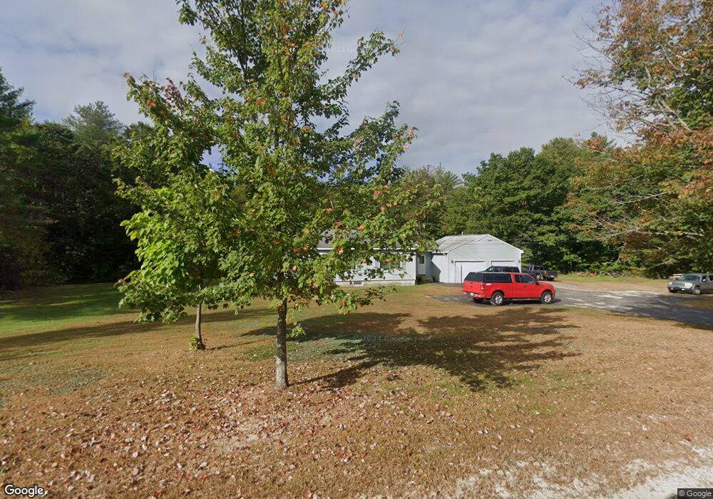
272 Sabbathday Rd New Gloucester, ME 04260
Estimated Value: $397,237 - $536,000
3
Beds
1
Bath
1,392
Sq Ft
$329/Sq Ft
Est. Value
About This Home
This home is located at 272 Sabbathday Rd, New Gloucester, ME 04260 and is currently estimated at $457,309, approximately $328 per square foot. 272 Sabbathday Rd is a home located in Cumberland County with nearby schools including Gray-New Gloucester High School.
Ownership History
Date
Name
Owned For
Owner Type
Purchase Details
Closed on
Jul 17, 2020
Sold by
Peterson Donald M
Bought by
Peterson Donald M and Peterson Shari D
Current Estimated Value
Home Financials for this Owner
Home Financials are based on the most recent Mortgage that was taken out on this home.
Original Mortgage
$119,500
Outstanding Balance
$105,693
Interest Rate
3.2%
Mortgage Type
New Conventional
Estimated Equity
$351,616
Purchase Details
Closed on
Mar 9, 2011
Sold by
Cumberland County Fed Cu
Bought by
Chabe Cindy L
Create a Home Valuation Report for This Property
The Home Valuation Report is an in-depth analysis detailing your home's value as well as a comparison with similar homes in the area
Home Values in the Area
Average Home Value in this Area
Purchase History
| Date | Buyer | Sale Price | Title Company |
|---|---|---|---|
| Peterson Donald M | -- | None Available | |
| Peterson Donald M | -- | None Available | |
| Chabe Cindy L | -- | -- | |
| Chabe Cindy L | -- | -- |
Source: Public Records
Mortgage History
| Date | Status | Borrower | Loan Amount |
|---|---|---|---|
| Open | Peterson Donald M | $119,500 | |
| Closed | Peterson Donald M | $119,500 | |
| Previous Owner | Chabe Cindy L | $100,000 |
Source: Public Records
Tax History
| Year | Tax Paid | Tax Assessment Tax Assessment Total Assessment is a certain percentage of the fair market value that is determined by local assessors to be the total taxable value of land and additions on the property. | Land | Improvement |
|---|---|---|---|---|
| 2025 | $3,696 | $238,928 | $84,000 | $154,928 |
| 2024 | $3,558 | $238,928 | $84,000 | $154,928 |
| 2023 | $3,414 | $238,928 | $84,000 | $154,928 |
| 2022 | $3,297 | $238,928 | $84,000 | $154,928 |
| 2021 | $3,297 | $238,928 | $84,000 | $154,928 |
| 2020 | $3,261 | $238,928 | $84,000 | $154,928 |
| 2019 | $2,856 | $169,000 | $61,400 | $107,600 |
| 2018 | $2,354 | $169,000 | $61,400 | $107,600 |
| 2017 | $2,636 | $169,000 | $61,400 | $107,600 |
| 2016 | $2,484 | $169,000 | $61,400 | $107,600 |
| 2015 | $2,476 | $169,000 | $61,400 | $107,600 |
| 2014 | $2,451 | $169,000 | $61,400 | $107,600 |
| 2013 | $2,273 | $169,000 | $61,400 | $107,600 |
Source: Public Records
Map
Nearby Homes
- 226 Sabbathday Rd
- 14 Golden Way
- TBD Emmaus Rd
- TBD Targett Rd
- 2 Alling Dr
- 65 Blueberry Ln
- 00 N Shore Rd
- 110 Bennett Rd
- 86 Skips Way
- 97 N Raymond Rd
- 173 Weymouth Rd
- 4 Chelsey Ln
- 194 Weymouth Rd
- 15 May Meadow Dr
- 72 Shaw Brook Ln
- 155 & 151 Gloucester Hill Rd
- 224 Shaker Rd
- 163 Valley Rd
- Lot 73A Vogel Rd
- 10 Evelyn's Way
- lot 3 Sabbathday Rd
- Lot 4 Sabbathday Rd
- 260 Sabbathday Rd
- 267 Sabbathday Rd
- 256 Sabbathday Rd
- 6 Oz Dr
- 286 Sabbathday Rd
- 283 Sabbathday Rd
- 884 Snow Hill Rd
- 285 Sabbathday Rd
- 877 Snow Hill Rd
- 250 Sabbathday Rd
- 291 Sabbathday Rd
- 0 Main Street Rt 26 Unit 1454736
- 18 Dermot Dr
- 875 Snow Hill Rd
- 293 Sabbathday Rd
- 873 Snow Hill Rd
- 26 Dermot Dr
- 244 Sabbathday Rd
Your Personal Tour Guide
Ask me questions while you tour the home.