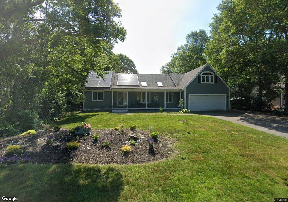
272 Skunknet Rd Centerville, MA 02632
Centerville NeighborhoodEstimated Value: $768,000 - $909,000
About This Home
Property Id: 1414933
This single bedroom, measuring 15' x 25', is available for rent in a nice, quiet and safe private residence.
Bedroom:
The 15' x 25' bedroom comes semi or unfurnished (You may select from furnishings available).
Private Entrance:
Enjoy the convenience of a private entrance.
Storage Room/Office:
This bedroom includes a dedicated storage room, to keep your belongings organized and out of sight, or turn it into an office!
Shared Bathroom: The rental includes access to a well-maintained shared bathroom, the bathroom is regularly cleaned and sanitized.
*** Utilities & Laundry Included 100% ***
Your rent of $400 per week covers ALL utilities! INCLUDING: Electricity, Heat, Hot water, Laundry (2-3 loads/wk.) High-speed internet & Cable!!
Say goodbye to the hassle of setting up and managing multiple bills - everything is taken care of for you.
Rental Requirements:
Prospective tenants are required to submit a rental application and verifiable references as part of the application process.
Terms:
1st & Last monthly rent to move in - NO 3rd Month Security Deposit!
Location:
Conveniently located in a peaceful Centerville neighborhood.
Contact us today to schedule a viewing or for more information.
Ownership History
Purchase Details
Home Financials for this Owner
Home Financials are based on the most recent Mortgage that was taken out on this home.Purchase Details
Home Financials for this Owner
Home Financials are based on the most recent Mortgage that was taken out on this home.Home Values in the Area
Average Home Value in this Area
Purchase History
| Date | Buyer | Sale Price | Title Company |
|---|---|---|---|
| Swartz-Sanborn Amy | -- | None Available | |
| Sanborn Amy Swartz | $410,000 | -- | |
| Sanborn Amy Swartz | $410,000 | -- |
Mortgage History
| Date | Status | Borrower | Loan Amount |
|---|---|---|---|
| Open | Swartz-Sanborn Amy | $285,000 | |
| Previous Owner | Sanborn Amy Swartz | $300,000 |
Property History
| Date | Event | Price | List to Sale | Price per Sq Ft |
|---|---|---|---|---|
| 03/04/2026 03/04/26 | Off Market | $1,600 | -- | -- |
| 01/29/2026 01/29/26 | For Rent | $1,600 | -- | -- |
Tax History
| Year | Tax Paid | Tax Assessment Tax Assessment Total Assessment is a certain percentage of the fair market value that is determined by local assessors to be the total taxable value of land and additions on the property. | Land | Improvement |
|---|---|---|---|---|
| 2025 | $6,732 | $832,200 | $154,200 | $678,000 |
| 2024 | $6,478 | $829,400 | $154,200 | $675,200 |
| 2023 | $6,047 | $725,100 | $140,200 | $584,900 |
| 2022 | $5,958 | $618,000 | $103,800 | $514,200 |
| 2021 | $5,571 | $531,100 | $103,800 | $427,300 |
| 2020 | $5,772 | $526,600 | $103,800 | $422,800 |
| 2019 | $5,408 | $479,400 | $103,800 | $375,600 |
| 2018 | $4,832 | $430,700 | $109,300 | $321,400 |
| 2017 | $4,494 | $417,700 | $109,300 | $308,400 |
| 2016 | $4,508 | $413,600 | $110,200 | $303,400 |
| 2015 | $4,239 | $390,700 | $107,300 | $283,400 |
Map
- 296 Buckskin Path
- 315 Prince Hinckley Rd
- 900 Old Stage Rd
- 51 Larch Ln
- 82 Yacht Club Rd
- 87 Foxglove Rd
- 19 Marrick Ct
- 53 Meadow Farm Rd
- 66 Tern Ln
- 52 Meadow Farm Rd
- 62 Three Ponds Dr
- 200 Lumbert Mill Rd
- 103 Pine Tree Dr
- 1028 Old Falmouth Rd
- 7 Ebenezer
- 324 Patriot Way
- 40 Sachem Dr
- 83 Lake Dr
- 481 Lakeside Dr W
- 10 Sail a Way
- 262 Skunknet Rd
- 282 Skunknet Rd
- 179 Buckskin Path
- 193 Buckskin Path
- 252 Skunknet Rd
- 265 Skunknet Rd
- 292 Skunknet Rd
- 165 Buckskin Path
- 279 Skunknet Rd
- 83 Dolar Davis Rd
- 83 Dolar Davis Rd
- 291 Skunknet Rd
- 205 Buckskin Path
- 271 Skunknet Rd
- 273 Skunknet Rd
- 180 Buckskin Path
- 190 Buckskin Path
- 302 Skunknet Rd
- 151 Buckskin Path
- 73 Dolar Davis Rd
Ask me questions while you tour the home.