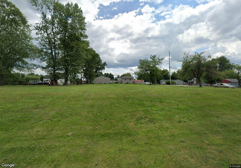
2720 20th St SW Canton, OH 44706
Estimated Value: $78,000 - $200,000
--
Bed
1
Bath
--
Sq Ft
4,792
Sq Ft Lot
About This Home
This home is located at 2720 20th St SW, Canton, OH 44706 and is currently estimated at $119,000. 2720 20th St SW is a home located in Stark County with nearby schools including Early Learning Center @ Schreiber, Cedar Elementary School, and McGregor Elementary School.
Ownership History
Date
Name
Owned For
Owner Type
Purchase Details
Closed on
Dec 21, 2015
Sold by
Stark County Land Reutilization Corp
Bought by
Rodocker Marvin L
Current Estimated Value
Purchase Details
Closed on
Dec 2, 2015
Sold by
Barnes Ada L
Bought by
Stark County Land Reutilization Corp
Purchase Details
Closed on
Feb 16, 1994
Create a Home Valuation Report for This Property
The Home Valuation Report is an in-depth analysis detailing your home's value as well as a comparison with similar homes in the area
Home Values in the Area
Average Home Value in this Area
Purchase History
| Date | Buyer | Sale Price | Title Company |
|---|---|---|---|
| Rodocker Marvin L | -- | None Available | |
| Stark County Land Reutilization Corp | -- | None Available | |
| -- | -- | -- |
Source: Public Records
Tax History Compared to Growth
Tax History
| Year | Tax Paid | Tax Assessment Tax Assessment Total Assessment is a certain percentage of the fair market value that is determined by local assessors to be the total taxable value of land and additions on the property. | Land | Improvement |
|---|---|---|---|---|
| 2025 | $49 | $2,030 | $2,030 | -- |
| 2024 | -- | $2,030 | $2,030 | -- |
| 2023 | $88 | $1,440 | $1,440 | -- |
| 2022 | $43 | $1,440 | $1,440 | $0 |
| 2021 | $86 | $1,440 | $1,440 | $0 |
| 2020 | $82 | $1,230 | $1,230 | $0 |
| 2019 | $72 | $1,230 | $1,230 | $0 |
| 2018 | $72 | $1,230 | $1,230 | $0 |
| 2017 | $76 | $1,090 | $1,090 | $0 |
| 2016 | $6 | $1,090 | $1,090 | $0 |
| 2015 | $39 | $1,090 | $1,090 | $0 |
| 2014 | $580 | $4,800 | $2,870 | $1,930 |
| 2013 | $472 | $10,260 | $2,870 | $7,390 |
Source: Public Records
Map
Nearby Homes
- 1712 Clarendon Ave SW
- 1815 Vine Ave SW
- 2918 17th St SW
- 0 20th St SW
- 1548 Tanner Ave SW
- 3204 14th St SW
- 1729 Gambrinus Ave SW
- 1700 Clark Ave SW
- 1628 Clark Ave SW
- 1263 Homewood Ave SW
- 3040 13th St SW
- 1319 Maryland Ave SW
- 1251 Homewood Ave SW
- 2420 Clyde Place SW
- 1227 Greenfield Ave SW
- 1370 Lee Ct SW
- 1384 Stark Ave SW
- 1246 Raff Rd SW
- 1219 Dueber Ave SW
- 1215 Dueber Ave SW
- 2022 Tanner Ave SW
- 2808 20th St SW
- 1922 Tanner Ave SW
- 2015 Frederick Ave SW
- 2017 Tanner Ave SW
- 2023 Frederick Ave SW
- 2701 20th St SW
- 2807 20th St SW
- 2030 Tanner Ave SW
- 2029 Tanner Ave SW
- 2822 20th St SW
- 2016 Sandwith Ave SW
- 1908 Tanner Ave SW
- 1917 Frederick Ave SW
- 2821 20th St SW
- 1911 Tanner Ave SW
- 2034 Sandwith Ave SW
- 1916 Sandwith Ave SW
- 2020 Frederick Ave SW
- 2007 Sandwith Ave SW
