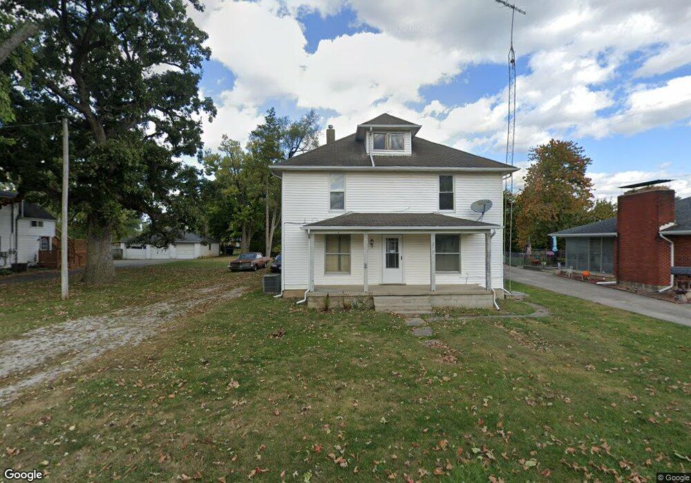
2720 Dwight Rd Springfield, OH 45503
Estimated Value: $143,178 - $187,000
3
Beds
1
Bath
1,800
Sq Ft
$94/Sq Ft
Est. Value
About This Home
This home is located at 2720 Dwight Rd, Springfield, OH 45503 and is currently estimated at $169,545, approximately $94 per square foot. 2720 Dwight Rd is a home located in Clark County with nearby schools including Warder Park-Wayne Elementary School, Schaefer Middle School, and Springfield High School.
Ownership History
Date
Name
Owned For
Owner Type
Purchase Details
Closed on
Jul 1, 2022
Sold by
Rust Family Joint Trust
Bought by
R & D Properties And Investments Llc
Current Estimated Value
Home Financials for this Owner
Home Financials are based on the most recent Mortgage that was taken out on this home.
Original Mortgage
$64,000
Outstanding Balance
$60,627
Interest Rate
5.1%
Mortgage Type
New Conventional
Estimated Equity
$108,918
Purchase Details
Closed on
Jun 4, 2019
Sold by
Rust Ira S and Rust Dorothy J
Bought by
Rust Ira S and Rust Dorothy J
Create a Home Valuation Report for This Property
The Home Valuation Report is an in-depth analysis detailing your home's value as well as a comparison with similar homes in the area
Home Values in the Area
Average Home Value in this Area
Purchase History
| Date | Buyer | Sale Price | Title Company |
|---|---|---|---|
| R & D Properties And Investments Llc | $80,000 | None Listed On Document | |
| Rust Ira S | -- | None Available |
Source: Public Records
Mortgage History
| Date | Status | Borrower | Loan Amount |
|---|---|---|---|
| Open | R & D Properties And Investments Llc | $64,000 |
Source: Public Records
Tax History
| Year | Tax Paid | Tax Assessment Tax Assessment Total Assessment is a certain percentage of the fair market value that is determined by local assessors to be the total taxable value of land and additions on the property. | Land | Improvement |
|---|---|---|---|---|
| 2025 | $2,212 | $60,580 | $22,730 | $37,850 |
| 2024 | $2,156 | $43,120 | $16,320 | $26,800 |
| 2023 | $2,156 | $43,120 | $16,320 | $26,800 |
| 2022 | $2,207 | $43,120 | $16,320 | $26,800 |
| 2021 | $1,901 | $33,740 | $12,750 | $20,990 |
| 2020 | $1,905 | $33,740 | $12,750 | $20,990 |
| 2019 | $1,910 | $33,740 | $12,750 | $20,990 |
| 2018 | $1,688 | $28,470 | $9,280 | $19,190 |
| 2017 | $1,686 | $28,466 | $9,275 | $19,191 |
| 2016 | $1,689 | $28,466 | $9,275 | $19,191 |
| 2015 | $1,683 | $27,773 | $9,275 | $18,498 |
| 2014 | $1,676 | $27,773 | $9,275 | $18,498 |
| 2013 | $1,659 | $27,773 | $9,275 | $18,498 |
Source: Public Records
Map
Nearby Homes
- 907 Bellevue Ave
- 2845 Columbus Ave Unit 5
- 515 Bellevue Ave
- 207 Roseland Ave W
- 2201 Woodside Ave
- 2226 Columbus Ave
- 2224-2226 Columbus Ave
- 419 Bellevue Ave
- 129 N Burnett Rd
- 2124 Woodside Ave
- 2210 Larch St
- 2111 Beatrice St
- 2691 Tecumseh Ave
- 1519 Edgewood Ave
- 2023 Cleveland Ave
- 2020 Woodside Ave
- 2702 Maplewood Ave
- 743 N Belmont Ave
- 121 Willis Ave
- 115 S Burnett Rd
- 2722 Dwight Rd
- 2716 Dwight Rd Unit 2718
- 2725 Dwight Rd
- 2712 Dwight Rd
- 2740 Dwight Rd
- 2708 Dwight Rd
- 2735 Dwight Rd
- 2744 Dwight Rd
- 2729 Dwight Rd
- 2741 Dwight Rd
- 2662 Dwight Rd
- 2701 Dwight Rd
- 2715 Dwight Rd
- 2745 Dwight Rd
- 2659 Dwight Rd
- 2652 Dwight Rd
- 886 Alta Rd
- 2655 Dwight Rd
- 2801 Dwight Rd
- 2653 Dwight Rd
Your Personal Tour Guide
Ask me questions while you tour the home.