Estimated Value: $245,000 - $290,252
4
Beds
3
Baths
1,659
Sq Ft
$164/Sq Ft
Est. Value
About This Home
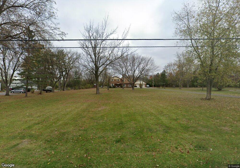
This home is located at 2720 Koop Rd, Lima, OH 45805 and is currently estimated at $271,813, approximately $163 per square foot. 2720 Koop Rd is a home located in Allen County with nearby schools including Maplewood Elementary School, Elmwood Elementary School, and Shawnee Middle School.
Ownership History
Date
Name
Owned For
Owner Type
Purchase Details
Closed on
Sep 26, 2017
Sold by
Mays Robert L and Mays Jan M
Bought by
Mays Michael L and Mays Allison M
Current Estimated Value
Home Financials for this Owner
Home Financials are based on the most recent Mortgage that was taken out on this home.
Original Mortgage
$120,000
Outstanding Balance
$100,421
Interest Rate
3.89%
Mortgage Type
New Conventional
Estimated Equity
$171,392
Purchase Details
Closed on
Oct 1, 1977
Bought by
Mays Robert L
Create a Home Valuation Report for This Property
The Home Valuation Report is an in-depth analysis detailing your home's value as well as a comparison with similar homes in the area
Purchase History
| Date | Buyer | Sale Price | Title Company |
|---|---|---|---|
| Mays Michael L | $150,000 | None Available | |
| Mays Robert L | $10,000 | -- |
Source: Public Records
Mortgage History
| Date | Status | Borrower | Loan Amount |
|---|---|---|---|
| Open | Mays Michael L | $120,000 |
Source: Public Records
Tax History Compared to Growth
Tax History
| Year | Tax Paid | Tax Assessment Tax Assessment Total Assessment is a certain percentage of the fair market value that is determined by local assessors to be the total taxable value of land and additions on the property. | Land | Improvement |
|---|---|---|---|---|
| 2024 | $3,819 | $85,650 | $18,130 | $67,520 |
| 2023 | $3,519 | $69,620 | $14,740 | $54,880 |
| 2022 | $3,515 | $69,620 | $14,740 | $54,880 |
| 2021 | $3,526 | $69,620 | $14,740 | $54,880 |
| 2020 | $2,895 | $58,770 | $15,400 | $43,370 |
| 2019 | $2,895 | $58,770 | $15,400 | $43,370 |
| 2018 | $2,821 | $58,770 | $15,400 | $43,370 |
| 2017 | $2,779 | $54,810 | $15,400 | $39,410 |
| 2016 | $3,330 | $54,810 | $15,400 | $39,410 |
| 2015 | $3,410 | $54,810 | $15,400 | $39,410 |
| 2014 | $3,410 | $54,710 | $15,090 | $39,620 |
| 2013 | $3,104 | $54,710 | $15,090 | $39,620 |
Source: Public Records
Map
Nearby Homes
- N/A Eastown Rd N
- 2940 Koop Rd
- 123 Eagles Point W
- 147 Eagles Point St S
- 2964 Hanover Dr
- 2700 Lowell Ave
- 2921 Canterbury Dr
- 161 S Cable Rd
- 00 Seriff
- 0 Springview Dr
- 514 N Cable Rd
- 2050 W Market St
- 2997 Cletus Pkwy
- 2057 W High St
- 1880 Wendell Ave
- 1641 Whitehall Dr
- 1392 Chancellor Dr
- 1918 Oakland Pkwy
- 250 Squire Ln
- 858 Mackenzie Dr