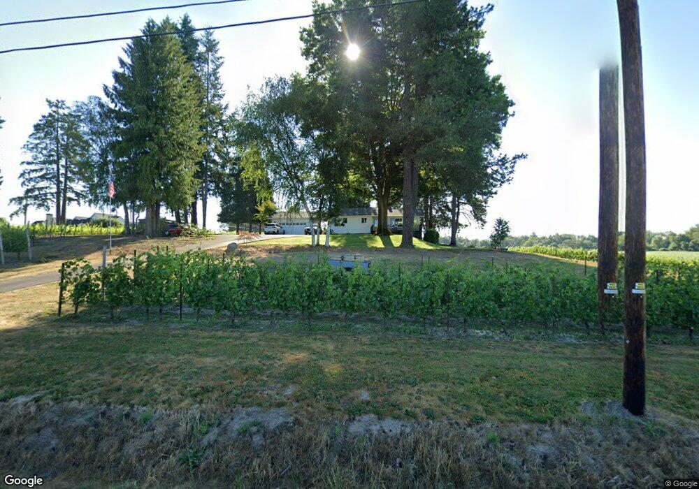
2720 NW Hill Rd McMinnville, OR 97128
Estimated Value: $815,000 - $1,076,000
3
Beds
2
Baths
1,602
Sq Ft
$603/Sq Ft
Est. Value
About This Home
This home is located at 2720 NW Hill Rd, McMinnville, OR 97128 and is currently estimated at $966,224, approximately $603 per square foot. 2720 NW Hill Rd is a home located in Yamhill County with nearby schools including Memorial Elementary School, Patton Middle School, and McMinnville High School.
Ownership History
Date
Name
Owned For
Owner Type
Purchase Details
Closed on
Mar 31, 2023
Sold by
Thompson Ron E
Bought by
Thompson Ron E and Thompson Rhonda J
Current Estimated Value
Home Financials for this Owner
Home Financials are based on the most recent Mortgage that was taken out on this home.
Original Mortgage
$510,000
Outstanding Balance
$495,084
Interest Rate
6.32%
Mortgage Type
New Conventional
Estimated Equity
$471,140
Purchase Details
Closed on
Mar 28, 2023
Sold by
William C Landgraf Trust and Diane L Landgraf Trust
Bought by
Thompson Ron E
Home Financials for this Owner
Home Financials are based on the most recent Mortgage that was taken out on this home.
Original Mortgage
$510,000
Outstanding Balance
$495,084
Interest Rate
6.32%
Mortgage Type
New Conventional
Estimated Equity
$471,140
Create a Home Valuation Report for This Property
The Home Valuation Report is an in-depth analysis detailing your home's value as well as a comparison with similar homes in the area
Home Values in the Area
Average Home Value in this Area
Purchase History
| Date | Buyer | Sale Price | Title Company |
|---|---|---|---|
| Thompson Ron E | -- | Ticor Title | |
| Thompson Ron E | $975,000 | Ticor Title |
Source: Public Records
Mortgage History
| Date | Status | Borrower | Loan Amount |
|---|---|---|---|
| Open | Thompson Ron E | $510,000 |
Source: Public Records
Tax History Compared to Growth
Tax History
| Year | Tax Paid | Tax Assessment Tax Assessment Total Assessment is a certain percentage of the fair market value that is determined by local assessors to be the total taxable value of land and additions on the property. | Land | Improvement |
|---|---|---|---|---|
| 2024 | $3,716 | $296,865 | -- | -- |
| 2023 | $3,601 | $288,220 | $0 | $0 |
| 2022 | $3,229 | $279,828 | $0 | $0 |
| 2021 | $3,151 | $271,679 | $0 | $0 |
| 2020 | $3,064 | $263,766 | $0 | $0 |
| 2019 | $2,978 | $256,084 | $0 | $0 |
| 2018 | $2,883 | $248,628 | $0 | $0 |
| 2017 | $2,822 | $242,285 | $0 | $0 |
| 2016 | $2,772 | $235,229 | $0 | $0 |
| 2015 | $2,691 | $228,381 | $0 | $0 |
| 2014 | $2,623 | $221,733 | $0 | $0 |
Source: Public Records
Map
Nearby Homes
- 0 NW Baker Creek Rd
- 1576 NW Jackson St Unit 95
- 1573 NW Adelaide St Unit 92
- 1595 NW Adelaide St Unit 93
- 1596 NW Jackson St Unit 94
- 1594 NW Tracy St Unit 55
- 1590 NW Tracy St Unit 54
- 1941 NW Haun Dr
- 1554 NW Jackson St Unit 96
- 1577 NW Jackson St Unit 103
- 1532 NW Jackson St Unit 97
- 1597 NW Jackson St Unit 104
- 1520 NW Jackson St Unit 98
- 1557 NW Adelaide St Unit 91
- 1539 NW Adelaide Dr Unit 90
- 1559 NW Jackson St Unit 102
- 1527 NW Jackson St Unit 101
- 1582 NW Adelaide St Unit 87
- 1596 NW Adelaide St Unit 86
- 1508 NW Adelaide St Unit 33
- 2760 NW Hill Rd
- 2691 NW Hill Rd
- 11100 NW Brentano Ln
- 10950 NW Brentano Ln
- 10901 NW Brentano Ln
- 2850 NW Hill Rd
- 10800 NW Brentano Ln
- 10771 NW Brentano Ln
- 2960 NW Hill Rd
- 0 NW Brentano Ln
- 10715 NW Brentano Ln
- 10700 NW Brentano Ln
- 2795 NW Hill Rd
- 2787 NW Hill Rd
- 2767 NW Hill Rd
- 2753 NW Hill Rd
- 2709 NW Hill Rd
- 2731 NW Hill Rd
- 2717 NW Hill Rd