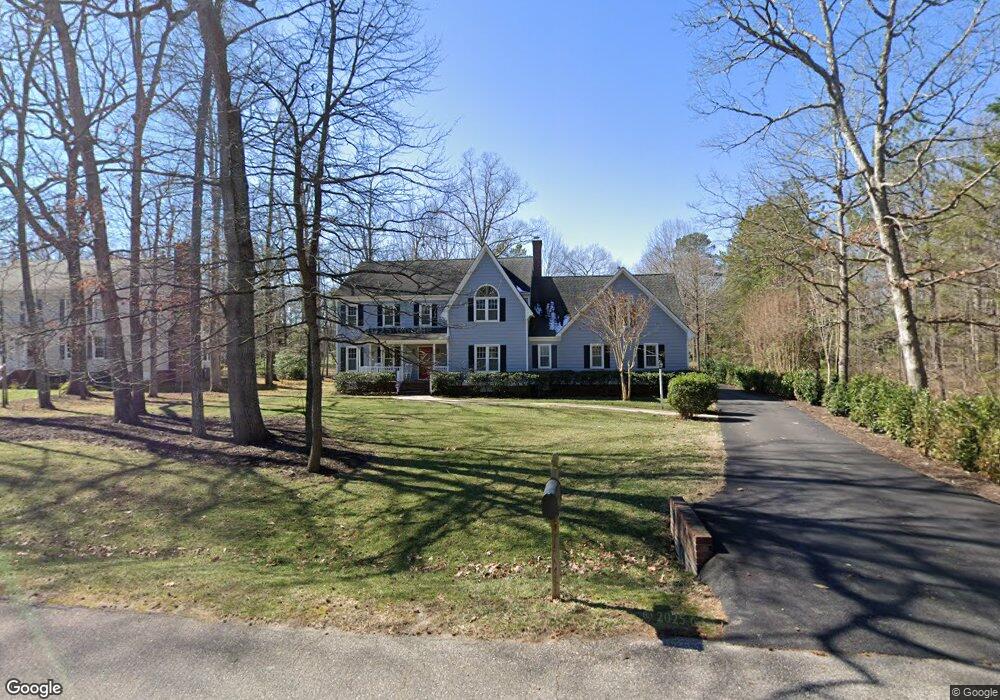
2720 Queenswood Rd Midlothian, VA 23113
Salisbury NeighborhoodEstimated Value: $758,000 - $823,000
4
Beds
3
Baths
3,323
Sq Ft
$237/Sq Ft
Est. Value
About This Home
This home is located at 2720 Queenswood Rd, Midlothian, VA 23113 and is currently estimated at $788,694, approximately $237 per square foot. 2720 Queenswood Rd is a home located in Chesterfield County with nearby schools including Bettie Weaver Elementary School, Midlothian Middle School, and Midlothian High School.
Ownership History
Date
Name
Owned For
Owner Type
Purchase Details
Closed on
Sep 23, 2021
Sold by
Marker Caroline C
Bought by
Marker Caroline C and Caroline C Marker Revocable Trust
Current Estimated Value
Purchase Details
Closed on
Aug 2, 2001
Sold by
Hancock Tyler W
Bought by
Marker Daryl W and Marker Caroline C
Purchase Details
Closed on
Jan 31, 2001
Bought by
Hancock Tyler W and Hancock Brenda V
Home Financials for this Owner
Home Financials are based on the most recent Mortgage that was taken out on this home.
Original Mortgage
$450,000
Interest Rate
7.14%
Create a Home Valuation Report for This Property
The Home Valuation Report is an in-depth analysis detailing your home's value as well as a comparison with similar homes in the area
Home Values in the Area
Average Home Value in this Area
Purchase History
| Date | Buyer | Sale Price | Title Company |
|---|---|---|---|
| Marker Caroline C | -- | None Listed On Document | |
| Marker Daryl W | $340,000 | -- | |
| Hancock Tyler W | $79,950 | -- |
Source: Public Records
Mortgage History
| Date | Status | Borrower | Loan Amount |
|---|---|---|---|
| Previous Owner | Hancock Tyler W | $450,000 |
Source: Public Records
Tax History Compared to Growth
Tax History
| Year | Tax Paid | Tax Assessment Tax Assessment Total Assessment is a certain percentage of the fair market value that is determined by local assessors to be the total taxable value of land and additions on the property. | Land | Improvement |
|---|---|---|---|---|
| 2025 | $6,203 | $694,200 | $131,000 | $563,200 |
| 2024 | $6,203 | $652,200 | $111,000 | $541,200 |
| 2023 | $5,596 | $614,900 | $106,000 | $508,900 |
| 2022 | $5,315 | $577,700 | $103,000 | $474,700 |
| 2021 | $5,052 | $524,800 | $101,000 | $423,800 |
| 2020 | $4,805 | $505,800 | $101,000 | $404,800 |
| 2019 | $4,805 | $505,800 | $101,000 | $404,800 |
| 2018 | $4,589 | $483,100 | $101,000 | $382,100 |
| 2017 | $4,462 | $464,800 | $100,000 | $364,800 |
| 2016 | $4,391 | $457,400 | $96,000 | $361,400 |
| 2015 | $4,258 | $440,900 | $96,000 | $344,900 |
| 2014 | $4,102 | $424,700 | $96,000 | $328,700 |
Source: Public Records
Map
Nearby Homes
- 14110 Netherfield Dr
- 13901 Dunkeld Terrace
- 14100 Worchester Ct
- 2540 Kentford Rd
- 3020 Mount Hill Dr
- 2360 Castlebridge Rd
- 14335 Lander Rd
- 16037 Aspect Way
- 16033 Aspect Way
- 16112 Esteem Way
- 1175 Cardinal Crest Terrace
- 16116 Esteem Way
- 16106 Swallowtail Place
- 2725 Stonegate Ct
- 3200 Queens Grant Dr
- 1813 Gildenborough Ct
- 3231 Queens Grant Dr
- 2303 Bream Dr
- 14942 Bridge Spring Dr
- 513 Totten Dr
- 2730 Queenswood Rd
- 2710 Queenswood Rd
- 2601 Leafield Terrace
- 2600 Leafield Terrace
- 2701 Queenswood Rd
- 2700 Queenswood Rd
- 2725 Queenswood Rd
- 2611 Leafield Terrace
- 14101 Grangewood Rd
- 14121 Grangewood Rd
- 14111 Grangewood Rd
- 14110 Helmsley Rd
- 2735 Queenswood Rd
- 14131 Grangewood Rd
- 14010 Helmsley Rd
- 2610 Leafield Terrace
- 14120 Helmsley Rd
- 2745 Queenswood Rd
- 2606 Helmsley Ct
- 2621 Leafield Terrace