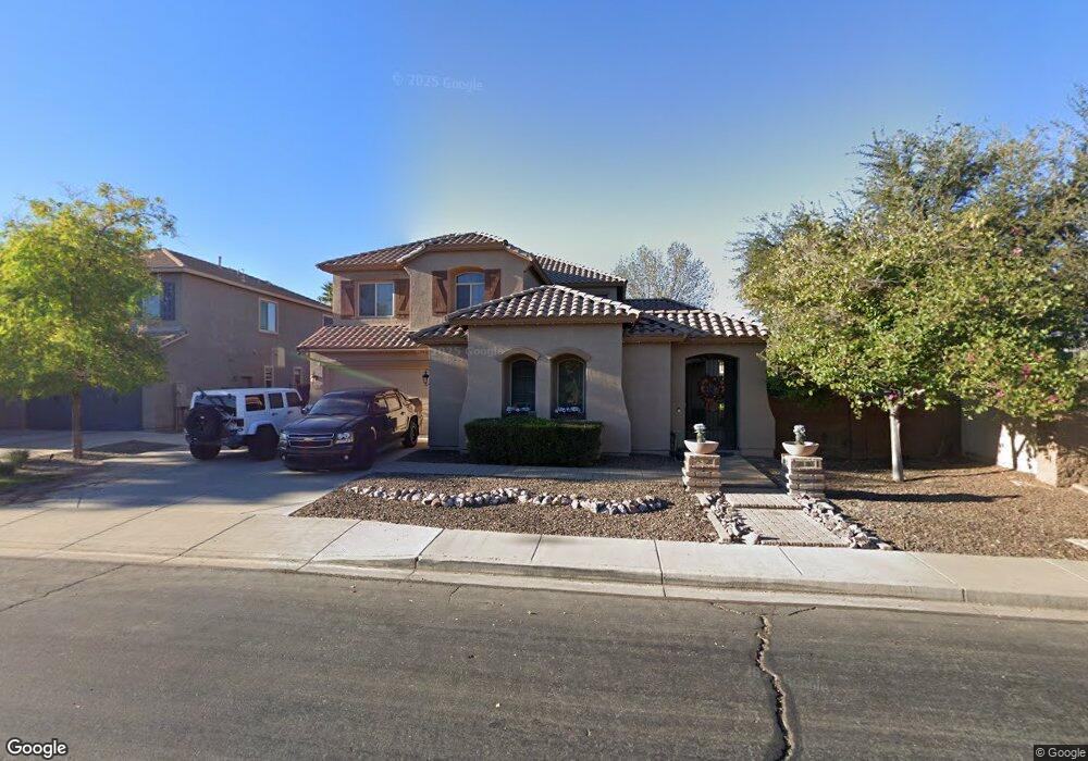
2721 E Azalea Dr Chandler, AZ 85286
South Chandler NeighborhoodEstimated Value: $750,000 - $798,265
4
Beds
3
Baths
3,056
Sq Ft
$252/Sq Ft
Est. Value
About This Home
This home is located at 2721 E Azalea Dr, Chandler, AZ 85286 and is currently estimated at $771,316, approximately $252 per square foot. 2721 E Azalea Dr is a home located in Maricopa County with nearby schools including Audrey & Robert Ryan Elementary School, Santan Junior High School, and Legacy Traditional School - Chandler.
Ownership History
Date
Name
Owned For
Owner Type
Purchase Details
Closed on
Apr 22, 2017
Sold by
Brown Tina M
Bought by
Brown Michael R
Current Estimated Value
Home Financials for this Owner
Home Financials are based on the most recent Mortgage that was taken out on this home.
Original Mortgage
$320,000
Outstanding Balance
$266,941
Interest Rate
4.3%
Mortgage Type
New Conventional
Estimated Equity
$504,375
Purchase Details
Closed on
Jan 5, 2005
Sold by
Sunwest Communities Inc
Bought by
Brown Michael R and Brown Tina M
Home Financials for this Owner
Home Financials are based on the most recent Mortgage that was taken out on this home.
Original Mortgage
$215,000
Interest Rate
5.73%
Mortgage Type
New Conventional
Create a Home Valuation Report for This Property
The Home Valuation Report is an in-depth analysis detailing your home's value as well as a comparison with similar homes in the area
Home Values in the Area
Average Home Value in this Area
Purchase History
| Date | Buyer | Sale Price | Title Company |
|---|---|---|---|
| Brown Michael R | -- | Security Title Agency Inc | |
| Brown Michael R | $283,230 | First American Title Ins Co | |
| Sunwest Communities Inc | -- | First American Title Ins Co | |
| Sunwest Valley Developers Inc | -- | First American Title Ins Co |
Source: Public Records
Mortgage History
| Date | Status | Borrower | Loan Amount |
|---|---|---|---|
| Open | Brown Michael R | $320,000 | |
| Previous Owner | Brown Michael R | $215,000 |
Source: Public Records
Tax History Compared to Growth
Tax History
| Year | Tax Paid | Tax Assessment Tax Assessment Total Assessment is a certain percentage of the fair market value that is determined by local assessors to be the total taxable value of land and additions on the property. | Land | Improvement |
|---|---|---|---|---|
| 2025 | $3,138 | $41,860 | -- | -- |
| 2024 | $3,828 | $39,867 | -- | -- |
| 2023 | $3,828 | $56,180 | $11,230 | $44,950 |
| 2022 | $3,708 | $42,100 | $8,420 | $33,680 |
| 2021 | $4,371 | $39,960 | $7,990 | $31,970 |
| 2020 | $3,211 | $36,910 | $7,380 | $29,530 |
| 2019 | $3,090 | $34,420 | $6,880 | $27,540 |
| 2018 | $2,990 | $32,650 | $6,530 | $26,120 |
| 2017 | $2,789 | $31,760 | $6,350 | $25,410 |
| 2016 | $2,687 | $31,800 | $6,360 | $25,440 |
| 2015 | $2,600 | $30,380 | $6,070 | $24,310 |
Source: Public Records
Map
Nearby Homes
- 3371 S Roger Ct
- 3380 S Roger Ct
- 2571 E Balsam Ct
- 2576 E Dogwood Dr
- 3330 S Gilbert Rd Unit 1072
- 3330 S Gilbert Rd Unit 2062
- 3330 S Gilbert Rd Unit 2066
- 3330 S Gilbert Rd Unit 2018
- 3330 S Gilbert Rd Unit 2032
- 3330 S Gilbert Rd Unit 1003
- 3330 S Gilbert Rd Unit 1075
- 3330 S Gilbert Rd Unit 1024
- 3330 S Gilbert Rd Unit 2008
- 3330 S Gilbert Rd Unit 2001
- 3330 S Gilbert Rd Unit 2013
- 2960 E Sunrise Place
- 2541 E Wisteria Dr
- 2489 E Sequoia Dr
- 2901 E Iris Dr
- 2198 E Wisteria Dr
- 2731 E Azalea Dr
- 3351 S Roger Ct
- 3361 S Roger Ct
- 2720 E Azalea Dr
- 3352 S Kimberlee Ct
- 3362 S Kimberlee Ct
- 2730 E Azalea Dr
- 2740 E Azalea Dr
- 2750 E Azalea Dr
- 2739 E Balsam Dr
- 2629 E Desert Broom Place
- 3381 S Roger Ct
- 3350 S Roger Ct
- 3372 S Kimberlee Ct
- 2638 E Desert Broom Place
- 0000 E Desert Bloom Dr
- 2749 E Balsam Dr
- 3360 S Roger Ct
- 2760 E Azalea Dr
- 2619 E Desert Broom Place