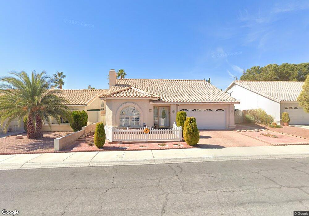
2721 Quail Roost Way Las Vegas, NV 89117
The Section Seven NeighborhoodEstimated Value: $462,582 - $485,000
2
Beds
2
Baths
1,700
Sq Ft
$277/Sq Ft
Est. Value
About This Home
This home is located at 2721 Quail Roost Way, Las Vegas, NV 89117 and is currently estimated at $471,646, approximately $277 per square foot. 2721 Quail Roost Way is a home located in Clark County with nearby schools including M J Christensen Elementary School, Clifford J Lawrence Junior High School, and Bonanza High School.
Ownership History
Date
Name
Owned For
Owner Type
Purchase Details
Closed on
Dec 6, 2007
Sold by
Gay Clara V and Montoya Clara V
Bought by
The Montoya Living Trust
Current Estimated Value
Purchase Details
Closed on
Aug 23, 2007
Sold by
Gay Clara V
Bought by
Gay Clara V
Purchase Details
Closed on
Oct 24, 1997
Sold by
Kuida Evelyn L and Ledford Gayle L
Bought by
Gay Thomas R and Gay Clara V
Create a Home Valuation Report for This Property
The Home Valuation Report is an in-depth analysis detailing your home's value as well as a comparison with similar homes in the area
Home Values in the Area
Average Home Value in this Area
Purchase History
| Date | Buyer | Sale Price | Title Company |
|---|---|---|---|
| The Montoya Living Trust | -- | None Available | |
| Gay Clara V | -- | None Available | |
| Gay Thomas R | $145,000 | United Title |
Source: Public Records
Tax History Compared to Growth
Tax History
| Year | Tax Paid | Tax Assessment Tax Assessment Total Assessment is a certain percentage of the fair market value that is determined by local assessors to be the total taxable value of land and additions on the property. | Land | Improvement |
|---|---|---|---|---|
| 2025 | $2,192 | $92,348 | $37,100 | $55,248 |
| 2024 | $2,129 | $92,348 | $37,100 | $55,248 |
| 2023 | $2,129 | $91,751 | $38,500 | $53,251 |
| 2022 | $2,067 | $78,666 | $29,750 | $48,916 |
| 2021 | $2,007 | $74,243 | $27,300 | $46,943 |
| 2020 | $1,946 | $72,357 | $25,550 | $46,807 |
| 2019 | $1,889 | $73,298 | $26,950 | $46,348 |
| 2018 | $1,834 | $71,741 | $26,600 | $45,141 |
| 2017 | $2,325 | $70,916 | $24,850 | $46,066 |
| 2016 | $1,737 | $63,945 | $17,500 | $46,445 |
| 2015 | $1,733 | $56,064 | $16,450 | $39,614 |
| 2014 | $1,682 | $49,790 | $8,750 | $41,040 |
Source: Public Records
Map
Nearby Homes
- 2712 Quail Roost Way
- 2913 Domino Way
- 9113 Anchor Cove Ct
- 9429 Abalone Way
- 9100 Shelter Cove Ct
- 9021 Feather River Ct
- 8913 Antioch Way
- 8932 Antioch Way
- 9544 Lazy River Dr
- 2825 Waterview Dr
- 2757 Lodestone Dr Unit 59
- 2761 Lodestone Dr Unit 63
- 3009 Periscope Ct
- 2200 S Fort Apache Rd Unit 1025
- 2200 S Fort Apache Rd Unit 2202
- 2200 S Fort Apache Rd Unit 1077
- 2200 S Fort Apache Rd Unit 2073
- 2200 S Fort Apache Rd Unit 2237
- 2200 S Fort Apache Rd Unit 2192
- 2200 S Fort Apache Rd Unit 1038
- 2717 Quail Roost Way
- 2725 Quail Roost Way
- 2724 Cloudsdale Cir
- 2713 Quail Roost Way
- 2729 Quail Roost Way
- 2728 Cloudsdale Cir
- 2720 Cloudsdale Cir Unit na
- 2720 Cloudsdale Cir
- 2716 Cloudsdale Cir
- 2732 Cloudsdale Cir
- 2724 Quail Roost Way
- 2728 Quail Roost Way
- 2709 Quail Roost Way
- 2720 Quail Roost Way
- 2732 Quail Roost Way
- 2712 Cloudsdale Cir
- 2716 Quail Roost Way
- 2736 Quail Roost Way
- 2705 Quail Roost Way
- 2708 Cloudsdale Cir