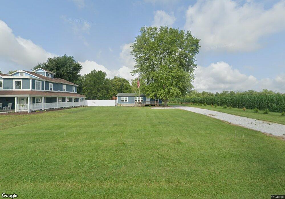
2721 S Hurst Cemetery Rd Homer, IN 46146
Estimated Value: $141,000 - $487,596
--
Bed
2
Baths
1,232
Sq Ft
$213/Sq Ft
Est. Value
About This Home
This home is located at 2721 S Hurst Cemetery Rd, Homer, IN 46146 and is currently estimated at $262,865, approximately $213 per square foot. 2721 S Hurst Cemetery Rd is a home located in Rush County with nearby schools including Rushville Consolidated High School.
Ownership History
Date
Name
Owned For
Owner Type
Purchase Details
Closed on
May 29, 2020
Sold by
Lumpkin Steven E
Bought by
Lumpkin Sara
Current Estimated Value
Purchase Details
Closed on
Jun 7, 2012
Sold by
Duke Glen R and Duke Jacqueline M
Bought by
Lumpkin Steven M and Lumpkin Steven E
Home Financials for this Owner
Home Financials are based on the most recent Mortgage that was taken out on this home.
Original Mortgage
$72,344
Outstanding Balance
$49,948
Interest Rate
3.75%
Mortgage Type
FHA
Estimated Equity
$212,917
Create a Home Valuation Report for This Property
The Home Valuation Report is an in-depth analysis detailing your home's value as well as a comparison with similar homes in the area
Home Values in the Area
Average Home Value in this Area
Purchase History
| Date | Buyer | Sale Price | Title Company |
|---|---|---|---|
| Lumpkin Sara | -- | None Available | |
| Lumpkin Steven M | -- | None Available |
Source: Public Records
Mortgage History
| Date | Status | Borrower | Loan Amount |
|---|---|---|---|
| Open | Lumpkin Steven M | $72,344 |
Source: Public Records
Tax History Compared to Growth
Tax History
| Year | Tax Paid | Tax Assessment Tax Assessment Total Assessment is a certain percentage of the fair market value that is determined by local assessors to be the total taxable value of land and additions on the property. | Land | Improvement |
|---|---|---|---|---|
| 2024 | $2,471 | $395,400 | $32,100 | $363,300 |
| 2023 | $2,623 | $367,900 | $29,600 | $338,300 |
| 2022 | $2,784 | $345,900 | $31,100 | $314,800 |
| 2021 | $3,222 | $366,300 | $48,400 | $317,900 |
| 2020 | $1,480 | $202,600 | $45,800 | $156,800 |
| 2019 | $1,324 | $194,500 | $46,500 | $148,000 |
| 2018 | $431 | $94,700 | $28,700 | $66,000 |
| 2017 | $166 | $61,700 | $21,700 | $40,000 |
| 2016 | $185 | $70,300 | $21,700 | $48,600 |
| 2014 | $106 | $65,900 | $21,700 | $44,200 |
| 2013 | $106 | $56,700 | $21,700 | $35,000 |
Source: Public Records
Map
Nearby Homes
- 7142 W 125 S
- 9288 Indiana 44
- 0 E State Road 44 Rd Unit 202537245
- 9488 W 250 S
- near 7160 E 200 North Rd
- Tract 2: 8342 S 650 W
- Tract 1: 8342 S 650 W
- 2192 N 700 W
- 2194 N 700 W
- 2045 N 900 W
- 0 E 700 N
- 1406 U S 52
- 2481 W Brown Rd
- 3100 W Brown Rd
- 2772 W Brown Rd
- 2900 W Brown Rd
- 7371 S 200 W
- 2316 W Brown Rd
- 903 W 3rd St
- 1141 Sugar Hill Dr
- 2506 S Hurst Cemetery Rd
- 3031 S 725 W
- 2935 S Hurst Cemetery Rd
- 2524 S Hurst Cemetery Rd
- 7015 W 250 S
- 7001 W 250 S
- 7035 W 250 S
- 7049 W 250 S
- 7081 W 250 S
- 7109 W 250 S
- 7143 W 250 S
- 7012 W 250 S
- 7004 W 250 S
- 7002 W 250 S
- 7002 W 250 S Unit Homer
- 7068 W 250 S
- 7082 W 250 S
- 7086 W 250 S
- 2490 S Hurst Cemetery Rd
- 7122 W 250 S