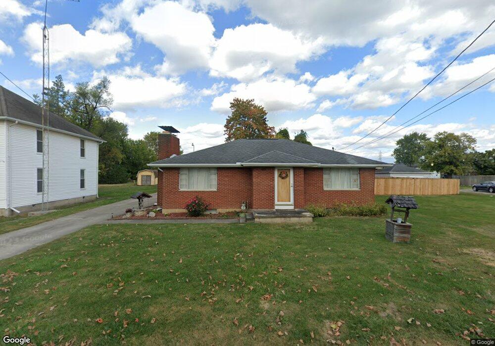
2722 Dwight Rd Springfield, OH 45503
Estimated Value: $176,000 - $201,000
2
Beds
1
Bath
1,452
Sq Ft
$130/Sq Ft
Est. Value
About This Home
This home is located at 2722 Dwight Rd, Springfield, OH 45503 and is currently estimated at $188,759, approximately $129 per square foot. 2722 Dwight Rd is a home located in Clark County with nearby schools including Warder Park-Wayne Elementary School, Schaefer Middle School, and Springfield High School.
Ownership History
Date
Name
Owned For
Owner Type
Purchase Details
Closed on
Jan 21, 2022
Sold by
Weeks Ii Roger A and Weeks Dawn M
Bought by
Hackathorne Stephanie and Hackathorne Don L
Current Estimated Value
Home Financials for this Owner
Home Financials are based on the most recent Mortgage that was taken out on this home.
Original Mortgage
$134,140
Outstanding Balance
$123,440
Interest Rate
3.45%
Mortgage Type
New Conventional
Estimated Equity
$65,319
Create a Home Valuation Report for This Property
The Home Valuation Report is an in-depth analysis detailing your home's value as well as a comparison with similar homes in the area
Home Values in the Area
Average Home Value in this Area
Purchase History
| Date | Buyer | Sale Price | Title Company |
|---|---|---|---|
| Hackathorne Stephanie | $141,200 | Prominent Title | |
| Hackathorne Stephanie | $141,200 | Prominent Title |
Source: Public Records
Mortgage History
| Date | Status | Borrower | Loan Amount |
|---|---|---|---|
| Open | Hackathorne Stephanie | $134,140 | |
| Closed | Hackathorne Stephanie | $134,140 |
Source: Public Records
Tax History
| Year | Tax Paid | Tax Assessment Tax Assessment Total Assessment is a certain percentage of the fair market value that is determined by local assessors to be the total taxable value of land and additions on the property. | Land | Improvement |
|---|---|---|---|---|
| 2025 | $2,198 | $57,570 | $15,610 | $41,960 |
| 2024 | $2,143 | $42,850 | $11,210 | $31,640 |
| 2023 | $2,143 | $42,850 | $11,210 | $31,640 |
| 2022 | $2,193 | $42,850 | $11,210 | $31,640 |
| 2021 | $1,906 | $33,840 | $8,760 | $25,080 |
| 2020 | $1,911 | $33,840 | $8,760 | $25,080 |
| 2019 | $1,915 | $33,840 | $8,760 | $25,080 |
| 2018 | $1,741 | $29,360 | $6,370 | $22,990 |
| 2017 | $1,739 | $29,362 | $6,370 | $22,992 |
| 2016 | $1,741 | $29,362 | $6,370 | $22,992 |
| 2015 | $1,729 | $28,536 | $6,370 | $22,166 |
| 2014 | $1,722 | $28,536 | $6,370 | $22,166 |
| 2013 | $1,704 | $28,536 | $6,370 | $22,166 |
Source: Public Records
Map
Nearby Homes
- 907 Bellevue Ave
- 2845 Columbus Ave Unit 5
- 515 Bellevue Ave
- 207 Roseland Ave W
- 2201 Woodside Ave
- 2226 Columbus Ave
- 2224-2226 Columbus Ave
- 419 Bellevue Ave
- 129 N Burnett Rd
- 2124 Woodside Ave
- 2210 Larch St
- 2111 Beatrice St
- 2691 Tecumseh Ave
- 1519 Edgewood Ave
- 2023 Cleveland Ave
- 2020 Woodside Ave
- 2702 Maplewood Ave
- 743 N Belmont Ave
- 121 Willis Ave
- 115 S Burnett Rd
- 2720 Dwight Rd
- 2740 Dwight Rd
- 2725 Dwight Rd
- 2744 Dwight Rd
- 2735 Dwight Rd
- 2716 Dwight Rd Unit 2718
- 2729 Dwight Rd
- 2741 Dwight Rd
- 2712 Dwight Rd
- 2745 Dwight Rd
- 2708 Dwight Rd
- 2715 Dwight Rd
- 2801 Dwight Rd
- 2701 Dwight Rd
- 2662 Dwight Rd
- 2748 Dwight Rd
- 2803 Dwight Rd
- 2659 Dwight Rd
- 737 Patrick Rd
- 2652 Dwight Rd
Your Personal Tour Guide
Ask me questions while you tour the home.