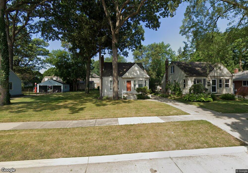
2726 Hubbard St Unit Bldg-Unit Dearborn, MI 48124
Southwestern Outer Drive NeighborhoodEstimated Value: $225,000 - $243,000
3
Beds
2
Baths
1,125
Sq Ft
$208/Sq Ft
Est. Value
About This Home
This home is located at 2726 Hubbard St Unit Bldg-Unit, Dearborn, MI 48124 and is currently estimated at $234,118, approximately $208 per square foot. 2726 Hubbard St Unit Bldg-Unit is a home located in Wayne County with nearby schools including Whitmore-Bolles Elementary School, Smith Middle School, and Edsel Ford High School.
Ownership History
Date
Name
Owned For
Owner Type
Purchase Details
Closed on
Oct 13, 2022
Sold by
Gonzalez Victor
Bought by
Sekulich James
Current Estimated Value
Home Financials for this Owner
Home Financials are based on the most recent Mortgage that was taken out on this home.
Original Mortgage
$136,435
Outstanding Balance
$131,153
Interest Rate
5.89%
Mortgage Type
New Conventional
Estimated Equity
$102,966
Purchase Details
Closed on
Mar 7, 2018
Sold by
Davis Oneita S
Bought by
Ganzalez Vioter
Create a Home Valuation Report for This Property
The Home Valuation Report is an in-depth analysis detailing your home's value as well as a comparison with similar homes in the area
Home Values in the Area
Average Home Value in this Area
Purchase History
| Date | Buyer | Sale Price | Title Company |
|---|---|---|---|
| Sekulich James | $209,900 | -- | |
| Ganzalez Vioter | $133,000 | Title One Inc |
Source: Public Records
Mortgage History
| Date | Status | Borrower | Loan Amount |
|---|---|---|---|
| Open | Sekulich James | $136,435 |
Source: Public Records
Tax History Compared to Growth
Tax History
| Year | Tax Paid | Tax Assessment Tax Assessment Total Assessment is a certain percentage of the fair market value that is determined by local assessors to be the total taxable value of land and additions on the property. | Land | Improvement |
|---|---|---|---|---|
| 2025 | $3,462 | $99,300 | $0 | $0 |
| 2024 | $3,462 | $86,000 | $0 | $0 |
| 2023 | $3,276 | $75,300 | $0 | $0 |
| 2022 | $2,996 | $69,200 | $0 | $0 |
| 2021 | $3,481 | $64,900 | $0 | $0 |
| 2019 | $457 | $54,600 | $0 | $0 |
| 2018 | $1,968 | $49,000 | $0 | $0 |
| 2017 | $565 | $45,900 | $0 | $0 |
| 2016 | $1,841 | $44,200 | $0 | $0 |
| 2015 | $3,480 | $35,950 | $0 | $0 |
| 2013 | $3,390 | $33,900 | $0 | $0 |
| 2011 | -- | $38,500 | $0 | $0 |
Source: Public Records
Map
Nearby Homes
- 2631 Parker St
- 22949 Cleveland St
- 2943 Queen St
- 22740 Cleveland St
- 3004 Lincoln St
- 2425 Grindley Park St
- 2920 Grindley Park St
- 23121 Madison St
- 22205 Columbia St
- 23140 Cleveland St
- 2216 Grindley Park St
- 2721 Pardee Ave
- 20761 Outer Dr
- 23256 Cleveland St
- 2235 Geneva St
- 3260 Lincoln St
- 2218 Geneva St
- 3101 Roosevelt St
- 3412 Vassar St
- 2906 Syracuse St
- 2726 Hubbard St
- 2734 Hubbard St
- 2710 Hubbard St
- 2740 Hubbard St
- 2700 Hubbard St
- 2750 Hubbard St
- 2741 Bennett St
- 2731 Bennett St
- 2749 Bennett St
- 2725 Bennett St
- 2757 Bennett St
- 2800 Hubbard St
- 2650 Hubbard St
- 2717 Bennett St
- 2803 Bennett St
- 2727 Hubbard St
- 2719 Hubbard St
- 2735 Hubbard St
- 2810 Hubbard St
- 2640 Hubbard St