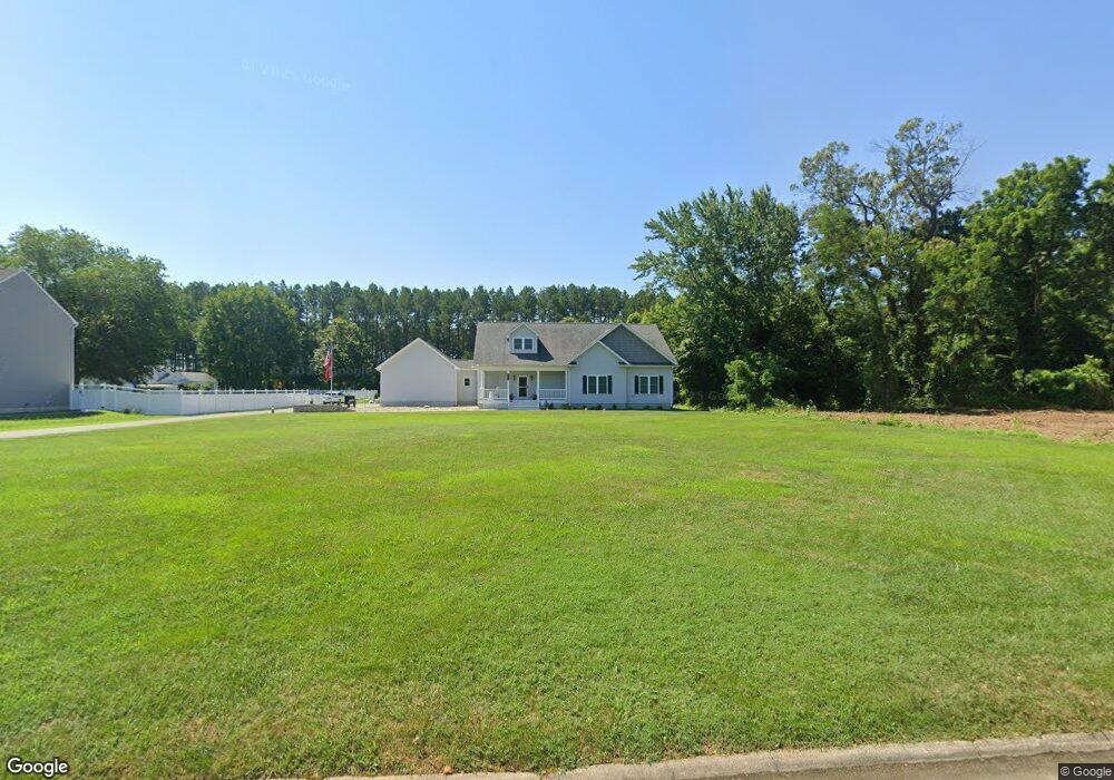
27265 St Andrews Ln Easton, MD 21601
Estimated Value: $755,000 - $1,203,000
--
Bed
--
Bath
4,068
Sq Ft
$227/Sq Ft
Est. Value
About This Home
This home is located at 27265 St Andrews Ln, Easton, MD 21601 and is currently estimated at $924,212, approximately $227 per square foot. 27265 St Andrews Ln is a home located in Talbot County with nearby schools including St. Michaels Elementary School, St. Michaels Middle/High School, and Easton High School.
Ownership History
Date
Name
Owned For
Owner Type
Purchase Details
Closed on
Aug 21, 2017
Sold by
Capstone Resdve Llc
Bought by
Wodzisz Michael L and Wodzisz Lisa M
Current Estimated Value
Home Financials for this Owner
Home Financials are based on the most recent Mortgage that was taken out on this home.
Original Mortgage
$335,200
Outstanding Balance
$280,225
Interest Rate
4.03%
Mortgage Type
Commercial
Estimated Equity
$643,987
Purchase Details
Closed on
Sep 24, 2014
Sold by
Richland Homes Inc
Bought by
Capstone Resdev Llc
Purchase Details
Closed on
Mar 28, 2006
Sold by
Passyn & Passyn Llc
Bought by
Richland Homes Inc
Purchase Details
Closed on
Mar 7, 2006
Sold by
Passyn & Passyn Llc
Bought by
Richland Homes Inc
Create a Home Valuation Report for This Property
The Home Valuation Report is an in-depth analysis detailing your home's value as well as a comparison with similar homes in the area
Home Values in the Area
Average Home Value in this Area
Purchase History
| Date | Buyer | Sale Price | Title Company |
|---|---|---|---|
| Wodzisz Michael L | $74,900 | Eastern Shore Title Co | |
| Capstone Resdev Llc | $5,639 | None Available | |
| Richland Homes Inc | $170,000 | -- | |
| Richland Homes Inc | $170,000 | -- |
Source: Public Records
Mortgage History
| Date | Status | Borrower | Loan Amount |
|---|---|---|---|
| Open | Wodzisz Michael L | $335,200 |
Source: Public Records
Tax History Compared to Growth
Tax History
| Year | Tax Paid | Tax Assessment Tax Assessment Total Assessment is a certain percentage of the fair market value that is determined by local assessors to be the total taxable value of land and additions on the property. | Land | Improvement |
|---|---|---|---|---|
| 2025 | $4,908 | $589,333 | $0 | $0 |
| 2024 | $4,908 | $548,300 | $118,000 | $430,300 |
| 2023 | $4,653 | $548,300 | $118,000 | $430,300 |
| 2022 | $4,325 | $548,300 | $118,000 | $430,300 |
| 2021 | $4,101 | $584,900 | $117,700 | $467,200 |
| 2020 | $4,101 | $562,800 | $0 | $0 |
| 2019 | $4,076 | $540,700 | $0 | $0 |
| 2018 | $737 | $102,600 | $102,600 | $0 |
| 2017 | $701 | $102,600 | $0 | $0 |
| 2016 | $920 | $102,600 | $0 | $0 |
| 2015 | $1,058 | $143,200 | $0 | $0 |
| 2014 | $1,058 | $143,200 | $0 | $0 |
Source: Public Records
Map
Nearby Homes
- 27232 Hayward Trail
- 27240 Hayward Trail
- 8534 Northbend Rd
- 27460 Rest Cir
- 27843 Saint Michaels Rd
- 27413 Ferry Bridge Rd
- 8453 Ingleton Rd
- 0 Unionville Rd Unit MDTA2008824
- 8629 Unionville Rd
- 8061 N Fork Blvd
- 0 Lot 16 N Unit MDTA2012070
- 28309 Village Lake Way
- 28298 Ayres Square
- 7852 Woodland Cir
- 9170 Hunting Creek Ln
- 28028 Playtor Rd
- 9517 Gulleys Cove Ln
- 66 Johnson St
- 9361 Woodstock Ln
- 28522 Waterview Dr
- 0 St Andrews Ln Unit 1007136872
- 0 St Andrews Ln Unit 1007070870
- 0 St Andrews Ln Unit 1007059754
- 0 St Andrews Lane Rd Unit 1006982704
- 0 St Andrews Ln Unit 1006975982
- 0 St Andrews Lane Rd Unit 1006912250
- 0 St Andrews Ln Unit 1006425136
- 0 St Andrews Rd Unit 1006422232
- 0 St Andrews Lane Rd Unit TA7556821
- 0 St Andrews Lane Rd Unit TA7801228
- 0 St Andrews Lane Rd Unit TA7916791
- 0 St Andrews Lane Rd Unit TA8028965
- 0 St Andrews Ln Unit TA8289142
- 0 St Andrews Ln Unit TA8320056
- 0 St Andrews Ln Unit TA6855339
- 0 St Andrews Unit TA6647969
- 0 St Andrews Rd Unit TA6850860
- 6 St Andrews Ln
- 0 St Andrews Ln Unit 1009908084
- 0 St Andrews Ln Unit 1004820354