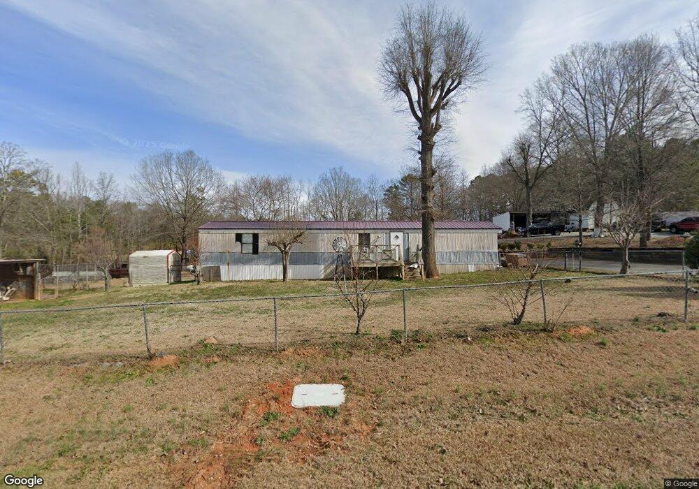
2727 Lesslie Dale Rd Rock Hill, SC 29730
Estimated Value: $104,291 - $214,000
--
Bed
--
Bath
924
Sq Ft
$187/Sq Ft
Est. Value
About This Home
This home is located at 2727 Lesslie Dale Rd, Rock Hill, SC 29730 and is currently estimated at $172,573, approximately $186 per square foot. 2727 Lesslie Dale Rd is a home located in York County with nearby schools including Independence Elementary School, Castle Heights Middle School, and Rock Hill High School.
Ownership History
Date
Name
Owned For
Owner Type
Purchase Details
Closed on
Jan 16, 2018
Sold by
Barrett Douglas R
Bought by
Sandoval Guillermo Valdez and Sandoval Yuri
Current Estimated Value
Purchase Details
Closed on
Sep 14, 2007
Sold by
Founders Fcu
Bought by
Barrett Douglas R
Purchase Details
Closed on
Jun 11, 2007
Sold by
Holt Kevin Gene
Bought by
Founders Fcu
Purchase Details
Closed on
Feb 13, 2003
Sold by
Malone Betty F
Bought by
Holt Kevin
Purchase Details
Closed on
Oct 30, 2000
Sold by
The Matherson Co
Bought by
Malone Betty F
Create a Home Valuation Report for This Property
The Home Valuation Report is an in-depth analysis detailing your home's value as well as a comparison with similar homes in the area
Home Values in the Area
Average Home Value in this Area
Purchase History
| Date | Buyer | Sale Price | Title Company |
|---|---|---|---|
| Sandoval Guillermo Valdez | $37,000 | None Available | |
| Barrett Douglas R | $30,201 | None Available | |
| Founders Fcu | $500 | None Available | |
| Holt Kevin | $10,000 | -- | |
| Malone Betty F | $9,995 | -- | |
| Watson Joseph | $169,000 | -- |
Source: Public Records
Tax History Compared to Growth
Tax History
| Year | Tax Paid | Tax Assessment Tax Assessment Total Assessment is a certain percentage of the fair market value that is determined by local assessors to be the total taxable value of land and additions on the property. | Land | Improvement |
|---|---|---|---|---|
| 2024 | $849 | $2,334 | $1,680 | $654 |
| 2023 | $857 | $2,334 | $1,680 | $654 |
| 2022 | $806 | $2,334 | $1,680 | $654 |
| 2021 | -- | $2,334 | $1,680 | $654 |
| 2020 | $784 | $2,334 | $0 | $0 |
| 2019 | $748 | $2,160 | $0 | $0 |
| 2018 | $672 | $2,160 | $0 | $0 |
| 2017 | $643 | $1,980 | $0 | $0 |
| 2016 | $622 | $1,980 | $0 | $0 |
| 2014 | $597 | $1,980 | $1,500 | $480 |
| 2013 | $597 | $2,010 | $1,500 | $510 |
Source: Public Records
Map
Nearby Homes
- 161 Billy Claude Cir
- 141 Edenvale Rd
- 281 Schoolside Dr
- 1580 Anderson Rd S
- 172 Neely Store Rd
- 2510 Firetower Rd
- 2003 Capel Ct
- 508 Bridgestone Ln
- 3339 Lesslie Hwy Unit 2
- 611 Pondway Downs
- 111 Emily Crest Ln
- 623 Neelys Creek Rd
- 2488 Catawba Church Rd
- 1903 Manning Place
- 356 Emma Wood Ln
- 631 Anderson Rd S
- 1034 Neely Store Rd
- 3943 Walker Rd
- 3943 Walker Rd Unit LOT ONLY
- 2999 Starnes Dr
- 2733 Lesslie Dale Rd
- 2742 Lesslie Dale Rd
- 2756 Lesslie Dale Rd
- 2759 Lesslie Dale Rd
- 2728 Lesslie Dale Rd
- 2775 Lesslie Dale Rd
- 2745 Lesslie Dale Rd
- 2770 Lesslie Dale Rd
- 2784 Lesslie Dale Rd
- 2747 Fire Tower Rd
- 2799 Lesslie Dale Rd
- 2798 Lesslie Dale Rd
- 2898 Lesslie Dale Rd
- 2814 Lesslie Dale Rd
- 2811 Lesslie Dale Rd
- 2835 Lesslie Dale Rd
- 2828 Lesslie Dale Rd
- 111 Schoolside Dr
- 2849 Lesslie Dale Rd
- 119 Schoolside Dr