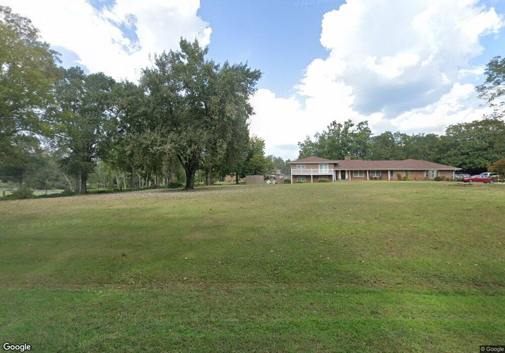
2728 E Highway 5 Carrollton, GA 30116
Estimated Value: $287,000 - $385,000
2
Beds
2
Baths
1,742
Sq Ft
$193/Sq Ft
Est. Value
About This Home
This home is located at 2728 E Highway 5, Carrollton, GA 30116 and is currently estimated at $336,426, approximately $193 per square foot. 2728 E Highway 5 is a home located in Carroll County with nearby schools including Roopville Elementary School, Central Middle School, and Central High School.
Ownership History
Date
Name
Owned For
Owner Type
Purchase Details
Closed on
Oct 29, 2009
Sold by
Murphy Claselle C
Bought by
Hearn Adam C
Current Estimated Value
Home Financials for this Owner
Home Financials are based on the most recent Mortgage that was taken out on this home.
Original Mortgage
$115,733
Outstanding Balance
$75,298
Interest Rate
4.93%
Mortgage Type
New Conventional
Estimated Equity
$261,128
Create a Home Valuation Report for This Property
The Home Valuation Report is an in-depth analysis detailing your home's value as well as a comparison with similar homes in the area
Home Values in the Area
Average Home Value in this Area
Purchase History
| Date | Buyer | Sale Price | Title Company |
|---|---|---|---|
| Hearn Adam C | $110,000 | -- |
Source: Public Records
Mortgage History
| Date | Status | Borrower | Loan Amount |
|---|---|---|---|
| Open | Hearn Adam C | $115,733 |
Source: Public Records
Tax History Compared to Growth
Tax History
| Year | Tax Paid | Tax Assessment Tax Assessment Total Assessment is a certain percentage of the fair market value that is determined by local assessors to be the total taxable value of land and additions on the property. | Land | Improvement |
|---|---|---|---|---|
| 2024 | $1,924 | $108,372 | $12,097 | $96,275 |
| 2023 | $1,924 | $97,518 | $9,678 | $87,840 |
| 2022 | $1,547 | $76,956 | $6,452 | $70,504 |
| 2021 | $1,379 | $65,499 | $5,162 | $60,337 |
| 2020 | $1,265 | $59,099 | $4,692 | $54,407 |
| 2019 | $1,190 | $54,532 | $4,692 | $49,840 |
| 2018 | $1,095 | $48,472 | $4,385 | $44,087 |
| 2017 | $1,098 | $48,472 | $4,385 | $44,087 |
| 2016 | $1,098 | $48,472 | $4,385 | $44,087 |
| 2015 | $997 | $39,651 | $4,266 | $35,386 |
| 2014 | $1,001 | $39,652 | $4,266 | $35,386 |
Source: Public Records
Map
Nearby Homes
- 2732 E Highway 5
- 2752 E Highway 5
- 1724 Lowell Rd
- 232 Lowell Ln
- 246 Lowell Ln
- 1700 Lowell Rd
- 1725 Lowell Rd
- 237 Lowell Ln
- 201 Lowell Ln
- 47 Liberty Church Rd
- 52 Liberty Church Rd
- 284 Lowell Ln
- 151 Lowell Ln
- 2800 E Highway 5
- 1651 Lowell Rd
- 2452 E Highway 5
- 00 Duncan Rd
- 0 Duncan Rd
- 0 Duncan Rd Unit 20043974
- 0 Duncan Rd Unit 7276438