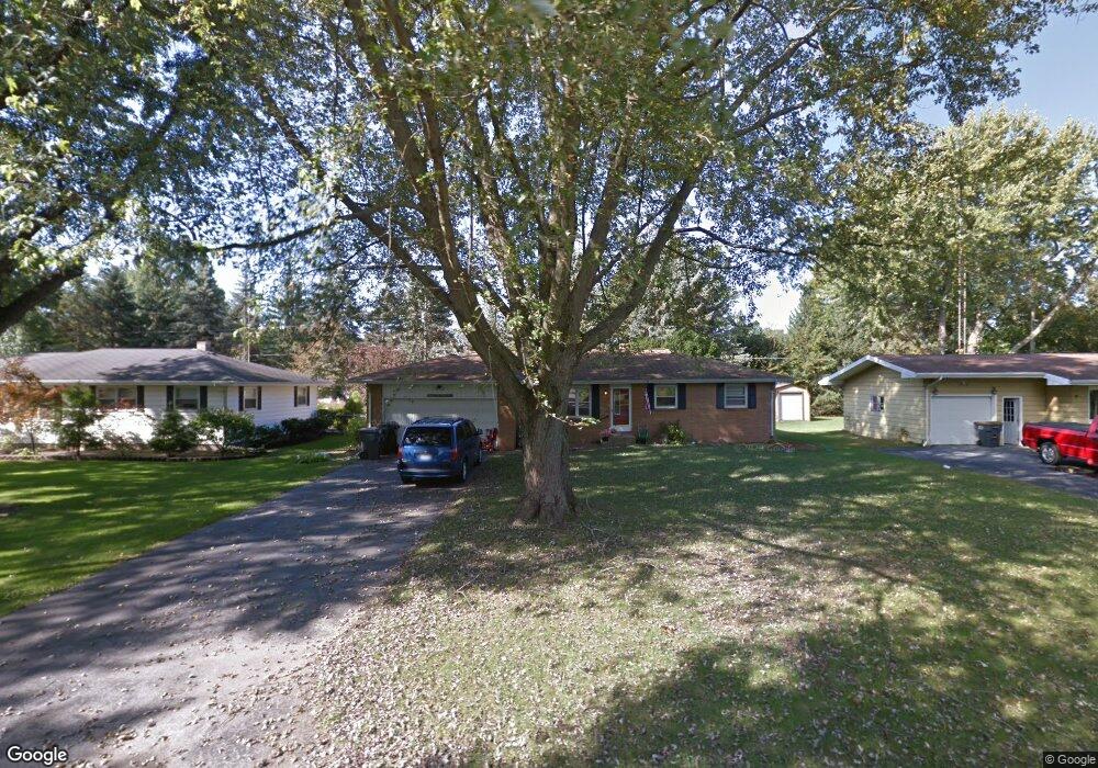
2728 N Trail Ln Saint Joseph, MI 49085
Vineland NeighborhoodEstimated Value: $268,000 - $285,000
3
Beds
2
Baths
1,440
Sq Ft
$191/Sq Ft
Est. Value
About This Home
This home is located at 2728 N Trail Ln, Saint Joseph, MI 49085 and is currently estimated at $274,382, approximately $190 per square foot. 2728 N Trail Ln is a home located in Berrien County with nearby schools including Upton Middle School, St. Joseph High School, and Trinity Lutheran School.
Ownership History
Date
Name
Owned For
Owner Type
Purchase Details
Closed on
Apr 20, 2010
Sold by
Tokarz Thomas A and The Edward J Tokarz Revocable
Bought by
Degraff Carry S
Current Estimated Value
Home Financials for this Owner
Home Financials are based on the most recent Mortgage that was taken out on this home.
Original Mortgage
$115,862
Outstanding Balance
$78,569
Interest Rate
5.37%
Mortgage Type
FHA
Estimated Equity
$195,813
Purchase Details
Closed on
Jun 4, 2004
Sold by
Tokarz Edward J
Bought by
Tokarz Edward J and Tokarz Revocable Livi Edward J
Create a Home Valuation Report for This Property
The Home Valuation Report is an in-depth analysis detailing your home's value as well as a comparison with similar homes in the area
Home Values in the Area
Average Home Value in this Area
Purchase History
| Date | Buyer | Sale Price | Title Company |
|---|---|---|---|
| Degraff Carry S | $118,000 | Multiple | |
| Tokarz Edward J | -- | -- |
Source: Public Records
Mortgage History
| Date | Status | Borrower | Loan Amount |
|---|---|---|---|
| Open | Degraff Carry S | $115,862 |
Source: Public Records
Tax History Compared to Growth
Tax History
| Year | Tax Paid | Tax Assessment Tax Assessment Total Assessment is a certain percentage of the fair market value that is determined by local assessors to be the total taxable value of land and additions on the property. | Land | Improvement |
|---|---|---|---|---|
| 2025 | $2,647 | $126,500 | $0 | $0 |
| 2024 | $1,676 | $124,300 | $0 | $0 |
| 2023 | $1,597 | $120,100 | $0 | $0 |
| 2022 | $1,521 | $88,100 | $0 | $0 |
| 2021 | $2,318 | $86,700 | $15,100 | $71,600 |
| 2020 | $2,171 | $80,600 | $0 | $0 |
| 2019 | $2,079 | $73,700 | $11,000 | $62,700 |
| 2018 | $1,992 | $73,700 | $0 | $0 |
| 2017 | $1,963 | $71,900 | $0 | $0 |
| 2016 | $1,913 | $69,700 | $0 | $0 |
| 2015 | $1,885 | $68,200 | $0 | $0 |
| 2014 | $1,284 | $65,300 | $0 | $0 |
Source: Public Records
Map
Nearby Homes
- 2705 Oakwood Ln
- 2865 Carrie Ln
- 985 Jean Ann Dr
- 1050 Jean Ann Dr
- V/L Niles Rd
- 2469 Washington Ave
- 2837 Washington Ave
- 2510 Bay Pointe Dr
- 2401 Bay Pointe Dr
- 2500 Bay Pointe Dr
- 944 Eagle Point Dr
- 924 Eagle Point Dr
- 2317 S Pointe Way Unit 5
- 2841 Niles Rd
- 1189 Lydia Dr
- 649 Grant Ave
- 753 Lattimer Dr
- 816 Saint Joseph Dr
- Parcel 2-B Niles Road M-63
- 940 Vineland Rd
- 2716 N Trail Ln
- 2742 N Trail Ln
- 2752 N Trail Ln
- 2706 N Trail Ln
- 1071 Willow Dr
- 1070 Willow Dr
- 2781 N Trail Ln
- 2692 N Trail Ln
- 1053 Willow Dr
- 1069 Vinewood Dr
- 1052 Willow Dr
- 2695 N Trail Ln
- 1043 Willow Dr
- 1042 Willow Dr
- 1051 Vinewood Dr
- 2684 N Trail Ln
- 1040 Lausman Dr
- 2776 N Trail Ln
- 2790 N Trail Ln
- 1074 Vinewood Dr