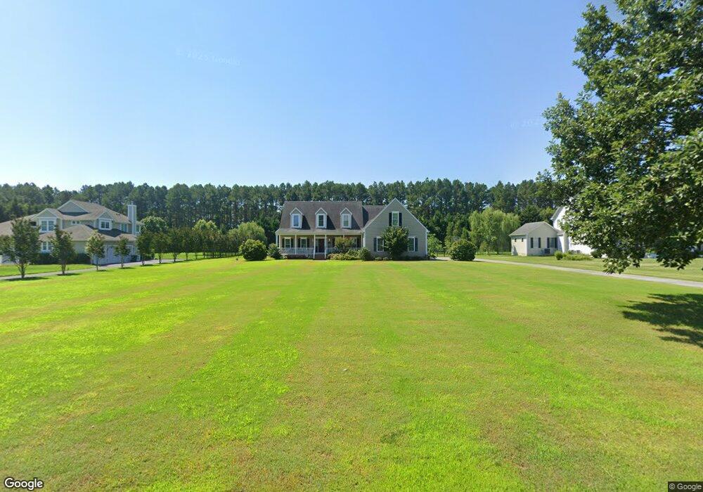
27289 St Andrews Ln Easton, MD 21601
Estimated Value: $695,000 - $754,000
--
Bed
1
Bath
3,086
Sq Ft
$234/Sq Ft
Est. Value
About This Home
This home is located at 27289 St Andrews Ln, Easton, MD 21601 and is currently estimated at $723,309, approximately $234 per square foot. 27289 St Andrews Ln is a home located in Talbot County with nearby schools including St. Michaels Elementary School, St. Michaels Middle/High School, and Easton High School.
Ownership History
Date
Name
Owned For
Owner Type
Purchase Details
Closed on
Oct 2, 2020
Sold by
Ruane Paul R and Ruane Linda E
Bought by
Williams Katherine M
Current Estimated Value
Home Financials for this Owner
Home Financials are based on the most recent Mortgage that was taken out on this home.
Original Mortgage
$416,500
Outstanding Balance
$370,455
Interest Rate
2.9%
Mortgage Type
New Conventional
Estimated Equity
$352,854
Purchase Details
Closed on
Mar 18, 2011
Sold by
Wsb Realty Llc
Bought by
Ruane Paul R and Ruane Linda E
Create a Home Valuation Report for This Property
The Home Valuation Report is an in-depth analysis detailing your home's value as well as a comparison with similar homes in the area
Home Values in the Area
Average Home Value in this Area
Purchase History
| Date | Buyer | Sale Price | Title Company |
|---|---|---|---|
| Williams Katherine M | $490,000 | Eastern Shore Title Company | |
| Ruane Paul R | $91,000 | Eastern Shore Title Company |
Source: Public Records
Mortgage History
| Date | Status | Borrower | Loan Amount |
|---|---|---|---|
| Open | Williams Katherine M | $416,500 |
Source: Public Records
Tax History Compared to Growth
Tax History
| Year | Tax Paid | Tax Assessment Tax Assessment Total Assessment is a certain percentage of the fair market value that is determined by local assessors to be the total taxable value of land and additions on the property. | Land | Improvement |
|---|---|---|---|---|
| 2025 | $4,426 | $513,767 | $0 | $0 |
| 2024 | $4,426 | $487,800 | $150,400 | $337,400 |
| 2023 | $4,196 | $487,800 | $150,400 | $337,400 |
| 2022 | $3,900 | $487,800 | $150,400 | $337,400 |
| 2021 | $8,051 | $512,600 | $150,000 | $362,600 |
| 2020 | $3,570 | $500,133 | $0 | $0 |
| 2019 | $3,526 | $487,667 | $0 | $0 |
| 2018 | $3,160 | $475,200 | $169,000 | $306,200 |
| 2017 | $2,969 | $462,867 | $0 | $0 |
| 2016 | $2,816 | $450,533 | $0 | $0 |
| 2015 | $1,030 | $438,200 | $0 | $0 |
| 2014 | $1,030 | $438,200 | $0 | $0 |
Source: Public Records
Map
Nearby Homes
- 27240 Hayward Trail
- 27232 Hayward Trail
- 8534 Northbend Rd
- 27460 Rest Cir
- 27843 Saint Michaels Rd
- 27413 Ferry Bridge Rd
- 0 Unionville Rd Unit MDTA2008824
- 8453 Ingleton Rd
- 8629 Unionville Rd
- 8061 N Fork Blvd
- 0 Lot 16 N Unit MDTA2012070
- 28309 Village Lake Way
- 28298 Ayres Square
- 7852 Woodland Cir
- 28028 Playtor Rd
- 0 Hunting Creek Ln Unit MDTA2011738
- 66 Johnson St
- 9517 Gulleys Cove Ln
- 9170 Hunting Creek Ln
- 9361 Woodstock Ln
- 27289 Saint Andrews Ln
- 27285 St Andrews Ln
- 27279 St Andrews Ln
- 0 Saint Andrews Ln
- 27282 Saint Andrews Ln
- 27295 Saint Michaels Rd
- 27286 St Andrews Ln
- 27282 St Andrews Ln
- 8373 Doncaster Rd
- 27362 Saint Michaels Rd
- 0 St Andrews Ln Unit TA7315945
- 0 St Andrews Ln Unit TA8005020
- 27280 Saint Michaels Rd
- 27276 St Andrews Ln
- 27270 St Andrews Ln
- 27265 St Andrews Ln
- 0 St Andrews Ln Unit 1007136872
- 0 St Andrews Ln Unit 1007070870
- 0 St Andrews Ln Unit 1007059754
- 0 St Andrews Lane Rd Unit 1006982704