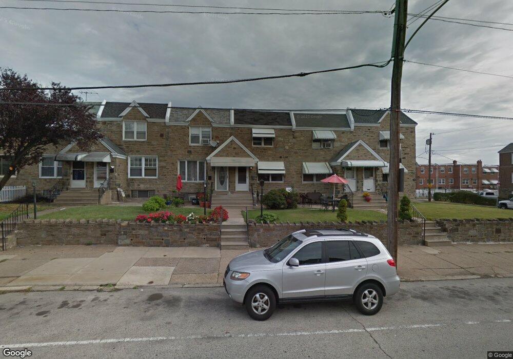
2729 Unruh Ave Philadelphia, PA 19149
Mayfair NeighborhoodEstimated Value: $265,000 - $292,000
3
Beds
1
Bath
1,376
Sq Ft
$200/Sq Ft
Est. Value
About This Home
This home is located at 2729 Unruh Ave, Philadelphia, PA 19149 and is currently estimated at $275,077, approximately $199 per square foot. 2729 Unruh Ave is a home located in Philadelphia County with nearby schools including Lincoln High School, Mayfair Elementary School, and Blessed Trinity Regional Catholic School.
Ownership History
Date
Name
Owned For
Owner Type
Purchase Details
Closed on
Nov 24, 2003
Sold by
Campbell Julia and Fitzpatrick Eileen Campbell
Bought by
Chau Charity
Current Estimated Value
Home Financials for this Owner
Home Financials are based on the most recent Mortgage that was taken out on this home.
Original Mortgage
$79,200
Interest Rate
6.03%
Mortgage Type
Purchase Money Mortgage
Purchase Details
Closed on
Feb 27, 1995
Sold by
Bricker Rose
Bought by
Bricker Norma and Mcginnis Rosemary
Create a Home Valuation Report for This Property
The Home Valuation Report is an in-depth analysis detailing your home's value as well as a comparison with similar homes in the area
Home Values in the Area
Average Home Value in this Area
Purchase History
| Date | Buyer | Sale Price | Title Company |
|---|---|---|---|
| Chau Charity | $99,000 | -- | |
| Bricker Norma | -- | -- |
Source: Public Records
Mortgage History
| Date | Status | Borrower | Loan Amount |
|---|---|---|---|
| Closed | Chau Charity | $79,200 |
Source: Public Records
Tax History Compared to Growth
Tax History
| Year | Tax Paid | Tax Assessment Tax Assessment Total Assessment is a certain percentage of the fair market value that is determined by local assessors to be the total taxable value of land and additions on the property. | Land | Improvement |
|---|---|---|---|---|
| 2025 | $3,157 | $278,800 | $55,760 | $223,040 |
| 2024 | $3,157 | $278,800 | $55,760 | $223,040 |
| 2023 | $3,157 | $225,500 | $45,100 | $180,400 |
| 2022 | $2,527 | $180,500 | $45,100 | $135,400 |
| 2021 | $2,174 | $0 | $0 | $0 |
| 2020 | $2,174 | $0 | $0 | $0 |
| 2019 | $2,086 | $0 | $0 | $0 |
| 2018 | $1,433 | $0 | $0 | $0 |
| 2017 | $1,853 | $0 | $0 | $0 |
| 2016 | $1,433 | $0 | $0 | $0 |
| 2015 | $1,372 | $0 | $0 | $0 |
| 2014 | -- | $132,400 | $25,912 | $106,488 |
| 2012 | -- | $16,384 | $1,752 | $14,632 |
Source: Public Records
Map
Nearby Homes
- 2731 Unruh Ave
- 2827 Fanshawe St
- 2711 Unruh Ave
- 2720 Unruh Ave
- 2840 Fanshawe St
- 2712 Knorr St
- 6749 E Roosevelt Blvd
- 2943 Knorr St
- 2249 Knorr St
- 2818 Gilham St
- 3015 Rawle St
- 2241 Knorr St
- 2818 Hellerman St
- 6524 Battersby St
- 3013 Gilham St
- 2911 Passmore St
- 2923 Disston St
- 2248 Disston St
- 2910 Passmore St
- 2169 Knorr St
- 2727 Unruh Ave
- 2725 Unruh Ave
- 2733 Unruh Ave
- 2723 Unruh Ave
- 2721 Unruh Ave
- 6714 Revere St
- 6714 Revere St Unit R
- 2719 Unruh Ave
- 2717 Unruh Ave
- 6716 Revere St
- 2715 Unruh Ave
- 6718 Revere St
- 2801 Unruh Ave
- 2713 Unruh Ave
- 6720 Revere St
- 2803 Unruh Ave
- 2711 Unruh Ave Unit 1ST. FLOOR
- 6722 Revere St
- 2805 Unruh Ave
- 6724 Revere St