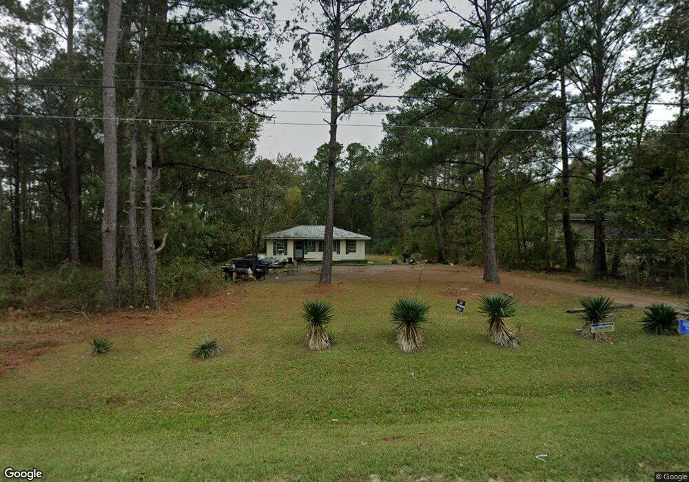
273 Bill Carter Rd Midway, GA 31320
Estimated Value: $97,446 - $240,000
3
Beds
1
Bath
916
Sq Ft
$184/Sq Ft
Est. Value
About This Home
This home is located at 273 Bill Carter Rd, Midway, GA 31320 and is currently estimated at $168,112, approximately $183 per square foot. 273 Bill Carter Rd is a home located in Liberty County with nearby schools including Liberty Elementary School, Midway Middle School, and Liberty County High School.
Ownership History
Date
Name
Owned For
Owner Type
Purchase Details
Closed on
Mar 5, 1997
Sold by
Jim Walter Homes In
Bought by
Scott Randolph
Current Estimated Value
Purchase Details
Closed on
Jan 7, 1997
Sold by
Roberts Lois
Bought by
Mid State Trust Ii
Purchase Details
Closed on
Aug 1, 1981
Bought by
Roberts Lois
Create a Home Valuation Report for This Property
The Home Valuation Report is an in-depth analysis detailing your home's value as well as a comparison with similar homes in the area
Home Values in the Area
Average Home Value in this Area
Purchase History
| Date | Buyer | Sale Price | Title Company |
|---|---|---|---|
| Scott Randolph | $25,000 | -- | |
| Jim Walter Homes In | -- | -- | |
| Mid State Trust Ii | $23,500 | -- | |
| Roberts Lois | -- | -- |
Source: Public Records
Tax History Compared to Growth
Tax History
| Year | Tax Paid | Tax Assessment Tax Assessment Total Assessment is a certain percentage of the fair market value that is determined by local assessors to be the total taxable value of land and additions on the property. | Land | Improvement |
|---|---|---|---|---|
| 2024 | $182 | $21,927 | $3,298 | $18,629 |
| 2023 | $182 | $19,913 | $3,298 | $16,615 |
| 2022 | $174 | $16,612 | $3,298 | $13,314 |
| 2021 | $174 | $15,189 | $3,298 | $11,891 |
| 2020 | $164 | $15,378 | $3,298 | $12,080 |
| 2019 | $164 | $15,566 | $3,298 | $12,268 |
| 2018 | $164 | $15,755 | $3,298 | $12,457 |
| 2017 | $525 | $15,944 | $3,298 | $12,646 |
| 2016 | $164 | $16,132 | $3,298 | $12,834 |
| 2015 | $444 | $15,382 | $2,548 | $12,834 |
| 2014 | $444 | $16,192 | $2,548 | $13,644 |
| 2013 | -- | $14,460 | $2,196 | $12,264 |
Source: Public Records
Map
Nearby Homes
- 7337 E Oglethorpe Hwy
- 6228 E Oglethorpe Hwy
- 6223 E Oglethorpe Hwy
- 218 Shade Tree Dr
- 176 Dave Williams Rd
- 266 River Bend Dr
- 327 River Bend Dr
- 9 Ashlynn Ln
- 334 Isaac Stevens Rd
- 90 Charleston Ct
- 124 Denham Ln
- 124 Denham Ln
- 0 E Oglethorpe Unit 10592168
- 0 E Oglethorpe Unit SA333651
- 0 E Oglethorpe Unit 153327
- TRACT 2 U S Highway 84 E
- TRACT 1 U S Highway 84 E
- 0 Main Trail Unit 10385280
- Lot 18 Main Trail
- 151 Turning Point Ln
- 251 Bill Carter Rd
- 569 Bill Carter Rd
- Lot 0 Bill Carter Rd
- 206 Bill Carter Rd
- 352 Bill Carter Rd
- 385 Bill Carter Rd
- 384 Bill Carter Rd
- 406 Bill Carter Rd
- 428 Bill Carter Rd
- 421 Bill Carter Rd
- 7399 E Oglethorpe Hwy
- 7311 E Oglethorpe Hwy
- 478 Bill Carter Rd
- 475 Bill Carter Rd
- 7337 E Oglethorpe Hwy
- 504 Bill Carter Rd
- 7439 E Oglethorpe Hwy
- 466 Bill Carter Rd
- 7543 E Oglethorpe Hwy
- 7527 E Oglethorpe Hwy