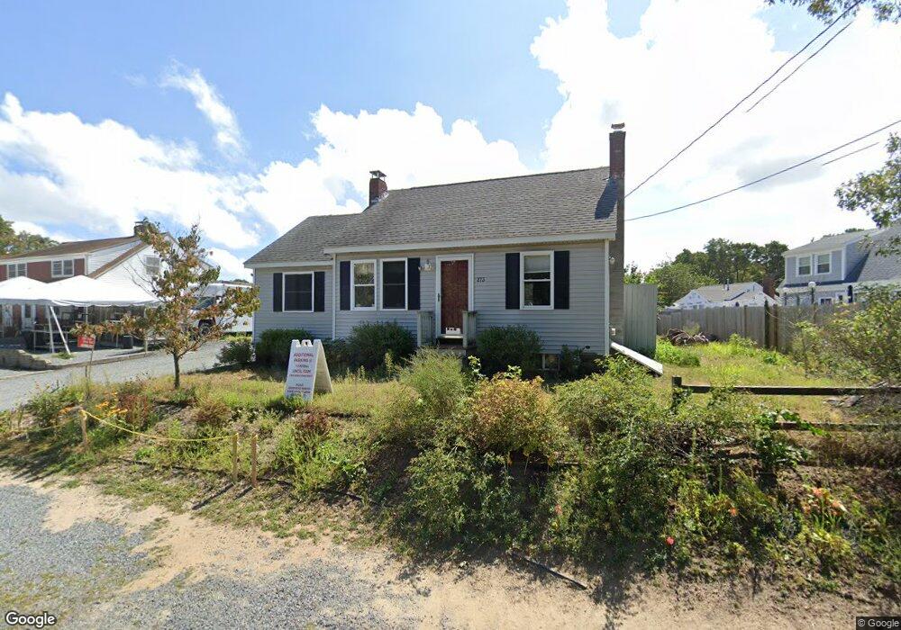
273 Lower County Rd Dennis Port, MA 02639
Dennis Port NeighborhoodEstimated Value: $488,000 - $612,065
3
Beds
1
Bath
1,088
Sq Ft
$517/Sq Ft
Est. Value
About This Home
This home is located at 273 Lower County Rd, Dennis Port, MA 02639 and is currently estimated at $562,766, approximately $517 per square foot. 273 Lower County Rd is a home located in Barnstable County with nearby schools including Dennis-Yarmouth Regional High School and St. Pius X. School.
Ownership History
Date
Name
Owned For
Owner Type
Purchase Details
Closed on
Feb 19, 2020
Sold by
A & C Videira Rt
Bought by
572 Property Association
Current Estimated Value
Home Financials for this Owner
Home Financials are based on the most recent Mortgage that was taken out on this home.
Original Mortgage
$199,000
Outstanding Balance
$175,824
Interest Rate
3.6%
Mortgage Type
New Conventional
Estimated Equity
$386,942
Purchase Details
Closed on
Jan 25, 2012
Sold by
Videira Amilcar B and Videira Connie M
Bought by
A & C Videira Rt
Purchase Details
Closed on
Jul 22, 2008
Sold by
Int Beacon
Bought by
Videira Amilcar B and Videira Connie M
Purchase Details
Closed on
Oct 17, 2007
Sold by
Zahavi Haim
Bought by
Int Beacon
Create a Home Valuation Report for This Property
The Home Valuation Report is an in-depth analysis detailing your home's value as well as a comparison with similar homes in the area
Home Values in the Area
Average Home Value in this Area
Purchase History
| Date | Buyer | Sale Price | Title Company |
|---|---|---|---|
| 572 Property Association | $199,000 | None Available | |
| A & C Videira Rt | -- | -- | |
| Videira Amilcar B | $140,000 | -- | |
| Int Beacon | $205,000 | -- |
Source: Public Records
Mortgage History
| Date | Status | Borrower | Loan Amount |
|---|---|---|---|
| Open | 572 Property Association | $199,000 |
Source: Public Records
Tax History Compared to Growth
Tax History
| Year | Tax Paid | Tax Assessment Tax Assessment Total Assessment is a certain percentage of the fair market value that is determined by local assessors to be the total taxable value of land and additions on the property. | Land | Improvement |
|---|---|---|---|---|
| 2025 | $2,320 | $535,800 | $224,600 | $311,200 |
| 2024 | $2,137 | $486,800 | $216,000 | $270,800 |
| 2023 | $2,089 | $447,400 | $196,400 | $251,000 |
| 2022 | $2,027 | $362,000 | $176,900 | $185,100 |
| 2021 | $2,106 | $349,300 | $198,200 | $151,100 |
| 2020 | $1,896 | $310,900 | $173,400 | $137,500 |
| 2019 | $1,814 | $294,000 | $170,000 | $124,000 |
| 2018 | $1,750 | $276,000 | $161,900 | $114,100 |
| 2017 | $1,605 | $260,900 | $150,300 | $110,600 |
| 2016 | $1,862 | $285,200 | $190,800 | $94,400 |
| 2015 | $1,825 | $285,200 | $190,800 | $94,400 |
| 2014 | $1,737 | $273,600 | $179,200 | $94,400 |
Source: Public Records
Map
Nearby Homes
- 22 Ferncliff Rd
- 37-A Beach Hills Rd
- 37 Beach Hills Rd
- 102 Sea St
- 262 Old Wharf Rd Unit 67
- 262 Old Wharf Rd Unit 5
- 262 Old Wharf Rd Unit 5
- 262 Old Wharf Rd Unit 20
- 262 Old Wharf Rd Unit 87
- 31 Easy St
- 402 Old Wharf Rd
- 402 Old Wharf Rd
- 241 Old Wharf Rd Unit 82
- 241 Old Wharf Rd Unit 127
- 241 Old Wharf Rd Unit 90
- 22 Wixon Rd
- 405 Old Wharf Rd Unit B204
- 405 Old Wharf Rd Unit B204
- 217 Old Wharf Rd Unit 64
- 11 Ocean Park W
- 279 Lower County Rd
- 269 Lower County Rd
- 218A Shad Hole Rd
- 218 Shad Hole Rd
- 218-A Shad Hole Rd
- 220A Shad Hole Rd
- 220 Shad Hole Rd
- 3 Laurel Rd
- 1 Laurel Rd
- 1 Laurel Rd Unit 1
- 1 Laurel Rd Unit U3
- 5 Laurel Rd
- 220-A Shad Hole Rd
- 11 Laurel Rd
- 222 Shad Hole Rd
- 9 Laurel Rd
- 224 Shad Hole Rd
- 224 Shad Hole Rd Unit 1
- 217 Shad Hole Rd
- 226 Shad Hole Rd