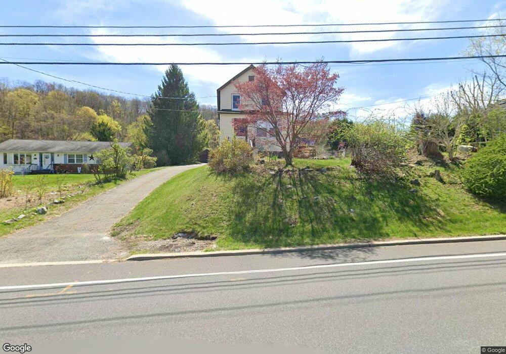
273 Munsonhurst Rd Franklin, NJ 07416
Estimated Value: $314,296 - $360,000
--
Bed
--
Bath
1,024
Sq Ft
$327/Sq Ft
Est. Value
About This Home
This home is located at 273 Munsonhurst Rd, Franklin, NJ 07416 and is currently estimated at $334,574, approximately $326 per square foot. 273 Munsonhurst Rd is a home located in Sussex County with nearby schools including Franklin Elementary School, Wallkill Valley Regional High School, and Immaculate Conception Regional School.
Ownership History
Date
Name
Owned For
Owner Type
Purchase Details
Closed on
Aug 28, 2023
Sold by
Sevek Chester Roy
Bought by
Stapert Denise Marie
Current Estimated Value
Purchase Details
Closed on
Jun 20, 2002
Sold by
Stapert Denise Marie
Bought by
Stapert Denise Marie and Sevek Chester Roy
Home Financials for this Owner
Home Financials are based on the most recent Mortgage that was taken out on this home.
Original Mortgage
$85,000
Interest Rate
6.81%
Purchase Details
Closed on
May 30, 2002
Sold by
Sevek Chester Roy and Sevek Gail L
Bought by
Stapert Denise Marie
Home Financials for this Owner
Home Financials are based on the most recent Mortgage that was taken out on this home.
Original Mortgage
$85,000
Interest Rate
6.81%
Create a Home Valuation Report for This Property
The Home Valuation Report is an in-depth analysis detailing your home's value as well as a comparison with similar homes in the area
Home Values in the Area
Average Home Value in this Area
Purchase History
| Date | Buyer | Sale Price | Title Company |
|---|---|---|---|
| Stapert Denise Marie | -- | None Listed On Document | |
| Stapert Denise Marie | -- | None Listed On Document | |
| Stapert Denise Marie | -- | Commonwealth Land Title Ins | |
| Stapert Denise Marie | $140,000 | Commonwealth Land Title Ins |
Source: Public Records
Mortgage History
| Date | Status | Borrower | Loan Amount |
|---|---|---|---|
| Previous Owner | Stapert Denise Marie | $85,000 |
Source: Public Records
Tax History Compared to Growth
Tax History
| Year | Tax Paid | Tax Assessment Tax Assessment Total Assessment is a certain percentage of the fair market value that is determined by local assessors to be the total taxable value of land and additions on the property. | Land | Improvement |
|---|---|---|---|---|
| 2025 | $5,409 | $224,400 | $94,400 | $130,000 |
| 2024 | $5,354 | $203,800 | $78,800 | $125,000 |
| 2023 | $5,354 | $194,200 | $72,700 | $121,500 |
| 2022 | $4,940 | $116,900 | $57,200 | $59,700 |
| 2021 | $4,798 | $116,900 | $57,200 | $59,700 |
| 2020 | $4,647 | $116,900 | $57,200 | $59,700 |
| 2019 | $4,436 | $116,900 | $57,200 | $59,700 |
| 2018 | $4,362 | $116,900 | $57,200 | $59,700 |
| 2017 | $4,255 | $116,900 | $57,200 | $59,700 |
| 2016 | $4,163 | $116,900 | $57,200 | $59,700 |
| 2015 | $4,176 | $116,900 | $57,200 | $59,700 |
| 2014 | $4,069 | $116,900 | $57,200 | $59,700 |
Source: Public Records
Map
Nearby Homes
- 270 Munsonhurst Rd
- 6 Spring St
- 49 Edison Ave
- 64 Edison Ave
- 9 Madden Ave
- 33 Glenbrook Rd
- 113 Munsonhurst Rd
- 111 Munsonhurst Rd
- 109 Munsonhurst Rd
- 8 Plaskon Terrace
- 10 Avenue B
- 12 Richards St
- 11 Zimmer Dr
- 16 Wildcat Rd
- 285 Wild Cat Rd
- 69 New Jersey 23
- 10 Hemlock Dr
- 7 Woodland Rd
- 149 Maple Rd
- 33 Maple Rd
- 265 Munsonhurst Rd
- 275 Munsonhurst Rd
- 272 Munsonhurst Rd
- 274 Munsonhurst Rd
- 259 Munsonhurst Rd
- 266 Munsonhurst Rd
- 1 Main St
- 261 Munsonhurst Rd
- 276 Munsonhurst Rd
- 257 Munsonhurst Rd
- 250 Munsonhurst Rd
- 9 Main St
- 4 Main St
- 3 Beardslee Hill Dr
- 5 Beardslee Hill Dr
- 1 Beardslee Hill Dr
- 253 Munsonhurst Rd
- 11 Main St
- 11 Main St Unit A
- 11 Main St Unit 1