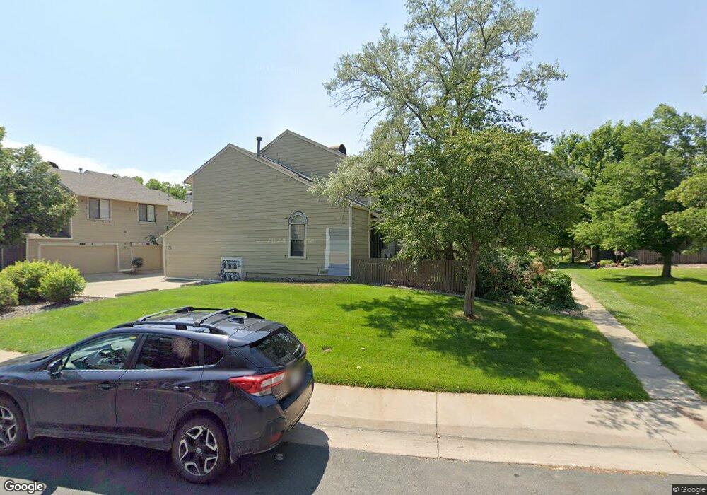
273 S Taft Ct Unit 41 Louisville, CO 80027
Estimated Value: $328,181 - $425,000
1
Bed
1
Bath
624
Sq Ft
$603/Sq Ft
Est. Value
About This Home
This home is located at 273 S Taft Ct Unit 41, Louisville, CO 80027 and is currently estimated at $376,295, approximately $603 per square foot. 273 S Taft Ct Unit 41 is a home located in Boulder County with nearby schools including Fireside Elementary School, Monarch K-8 School, and Monarch High School.
Ownership History
Date
Name
Owned For
Owner Type
Purchase Details
Closed on
Jan 19, 2017
Sold by
Million Gwendolyn
Bought by
Million Gwendolyn
Current Estimated Value
Purchase Details
Closed on
Jul 1, 2011
Sold by
Baugh Ken
Bought by
Million Gwendolyn
Home Financials for this Owner
Home Financials are based on the most recent Mortgage that was taken out on this home.
Original Mortgage
$125,320
Outstanding Balance
$86,379
Interest Rate
4.55%
Mortgage Type
New Conventional
Estimated Equity
$289,916
Purchase Details
Closed on
Jun 27, 2003
Sold by
Savino Rose M
Bought by
Baugh Ken
Home Financials for this Owner
Home Financials are based on the most recent Mortgage that was taken out on this home.
Original Mortgage
$146,470
Interest Rate
5.27%
Mortgage Type
FHA
Create a Home Valuation Report for This Property
The Home Valuation Report is an in-depth analysis detailing your home's value as well as a comparison with similar homes in the area
Home Values in the Area
Average Home Value in this Area
Purchase History
| Date | Buyer | Sale Price | Title Company |
|---|---|---|---|
| Million Gwendolyn | -- | None Available | |
| Million Gwendolyn | $162,900 | First Colorado Title | |
| Baugh Ken | $151,000 | First Colorado Title |
Source: Public Records
Mortgage History
| Date | Status | Borrower | Loan Amount |
|---|---|---|---|
| Open | Million Gwendolyn | $125,320 | |
| Previous Owner | Baugh Ken | $146,470 |
Source: Public Records
Tax History Compared to Growth
Tax History
| Year | Tax Paid | Tax Assessment Tax Assessment Total Assessment is a certain percentage of the fair market value that is determined by local assessors to be the total taxable value of land and additions on the property. | Land | Improvement |
|---|---|---|---|---|
| 2025 | $1,247 | $23,525 | -- | $23,525 |
| 2024 | $1,247 | $23,525 | -- | $23,525 |
| 2023 | $1,226 | $20,576 | -- | $24,261 |
| 2022 | $1,094 | $18,313 | $0 | $18,313 |
| 2021 | $2,006 | $21,657 | $0 | $21,657 |
| 2020 | $1,819 | $19,441 | $0 | $19,441 |
| 2019 | $1,793 | $19,441 | $0 | $19,441 |
| 2018 | $1,692 | $18,936 | $0 | $18,936 |
| 2017 | $1,658 | $20,935 | $0 | $20,935 |
| 2016 | $1,293 | $14,702 | $0 | $14,702 |
| 2015 | $1,226 | $12,083 | $0 | $12,083 |
| 2014 | $1,033 | $12,083 | $0 | $12,083 |
Source: Public Records
Map
Nearby Homes
- 279 S Taft Ct Unit 53
- 284 S Taft Ct Unit 76
- 323 S Taft Ct Unit 26
- 305 S Taft Ct Unit 33
- 362 S Taft Ct Unit 108
- 641 W Dahlia St
- 749 Apple Ct
- 118 S Tanager Ct
- 159 S Polk Ave
- 174 Cherrywood Ln
- 812 W Mulberry St
- 546 Ridgeview Dr
- 539 Coal Creek Ln
- 567 Manorwood Ln
- 590 Manorwood Ln N
- 572 Ridgeview Dr
- 408 Fillmore Ct
- 620 Ridgeview Dr
- 494 Owl Dr Unit 4
- 322 Diamond Cir
- 275 S Taft Ct Unit 42
- 271 S Taft Ct Unit 40
- 269 S Taft Ct Unit 39
- 267 S Taft Ct Unit 38
- 265 S Taft Ct Unit 37
- 281 S Taft Ct Unit 52
- 283 S Taft Ct Unit 51
- 285 S Taft Ct Unit 50
- 287 S Taft Ct Unit 49
- 289 S Taft Ct Unit 48
- 291 S Taft Ct Unit 47
- 293 S Taft Ct Unit 46
- 299 S Taft Ct Unit 43
- 295 S Taft Ct Unit 45
- 297 S Taft Ct Unit 44
- 268 S Taft Ct Unit 60
- 274 S Taft Ct Unit 57
- 274 S Taft Ct Unit 1057
- 315 S Taft Ct Unit 30
- 317 S Taft Ct Unit 29