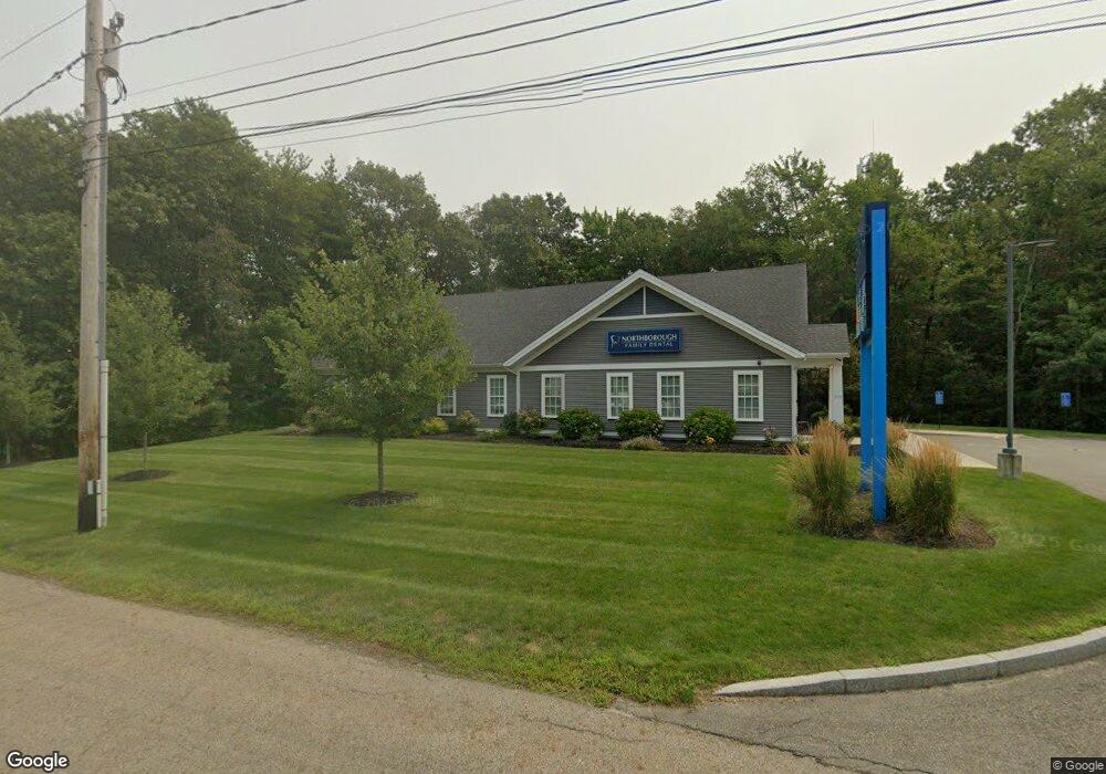
273 SW Cutoff Northborough, MA 01532
--
Bed
--
Bath
4,160
Sq Ft
6.45
Acres
About This Home
This home is located at 273 SW Cutoff, Northborough, MA 01532. 273 SW Cutoff is a home located in Worcester County with nearby schools including Fannie E. Proctor Elementary School, Robert E. Melican Middle School, and Algonquin Regional High School.
Ownership History
Date
Name
Owned For
Owner Type
Purchase Details
Closed on
Dec 2, 2018
Sold by
Diamond Towers 5 Llc
Bought by
293 West Main Realty Llc
Home Financials for this Owner
Home Financials are based on the most recent Mortgage that was taken out on this home.
Original Mortgage
$1,237,000
Outstanding Balance
$1,085,553
Interest Rate
4.8%
Mortgage Type
Commercial
Purchase Details
Closed on
Dec 13, 2013
Sold by
Linda Rt
Bought by
Tellurian Acquisition
Create a Home Valuation Report for This Property
The Home Valuation Report is an in-depth analysis detailing your home's value as well as a comparison with similar homes in the area
Home Values in the Area
Average Home Value in this Area
Purchase History
| Date | Buyer | Sale Price | Title Company |
|---|---|---|---|
| 293 West Main Realty Llc | $300,000 | -- | |
| Tellurian Acquisition | $450,000 | -- |
Source: Public Records
Mortgage History
| Date | Status | Borrower | Loan Amount |
|---|---|---|---|
| Open | 293 West Main Realty Llc | $1,237,000 |
Source: Public Records
Tax History Compared to Growth
Tax History
| Year | Tax Paid | Tax Assessment Tax Assessment Total Assessment is a certain percentage of the fair market value that is determined by local assessors to be the total taxable value of land and additions on the property. | Land | Improvement |
|---|---|---|---|---|
| 2025 | $35,729 | $2,507,300 | $780,300 | $1,727,000 |
| 2024 | $35,487 | $2,485,100 | $668,700 | $1,816,400 |
| 2023 | $33,820 | $2,286,700 | $638,500 | $1,648,200 |
| 2022 | $32,701 | $1,983,100 | $614,400 | $1,368,700 |
| 2021 | $33,622 | $1,963,900 | $614,400 | $1,349,500 |
| 2020 | $29,139 | $1,689,200 | $614,400 | $1,074,800 |
| 2019 | $14,715 | $858,000 | $244,800 | $613,200 |
| 2018 | $14,980 | $861,400 | $242,600 | $618,800 |
| 2017 | $15,169 | $872,300 | $242,600 | $629,700 |
| 2016 | $14,977 | $872,300 | $242,600 | $629,700 |
| 2015 | $9,486 | $567,000 | $312,400 | $254,600 |
| 2014 | $9,189 | $553,900 | $312,400 | $241,500 |
Source: Public Records
Map
Nearby Homes
- 22 Hitching Post Ln
- 11 Hillside Rd
- 139 Davis St
- 59 Indian Meadow Dr
- 1 Hamilton Rd
- 65 Commons Dr Unit 502
- 65 Commons Dr Unit 410
- 85 Commons Dr Unit 210
- 457 Walnut St
- 24 Brook St
- 39 Harvard Ave
- 10 Falcon Dr
- 562 South St
- 603 South St
- 64 Arch St
- 49 Arch St Unit 2
- 198 South St
- 223 South St
- 185-187 South St
- 165 Green St
- 1 Belmont St
- 1 Belmont St
- 3 Belmont St
- 20 Village at Smith Pond Unit 20
- 24 Hitching Post Ln
- 23 Hitching Post Ln
- 21 Hitching Post Ln
- 10,008 Shops Way
- 86 Lawrence St
- 80 Lawrence St
- 52 Lawrence St
- 20 Hitching Post Ln
- 19 Hitching Post Ln
- 18 Hitching Post Ln
- 17 Hitching Post Ln
- 20 Hitching Post Ln Unit 20
- 18 Hitching Post Ln Unit 18
- 10,010 Shops Way Unit N
- 10,010 Shops Way Unit N-M
- 10,010 Shops Way Unit M