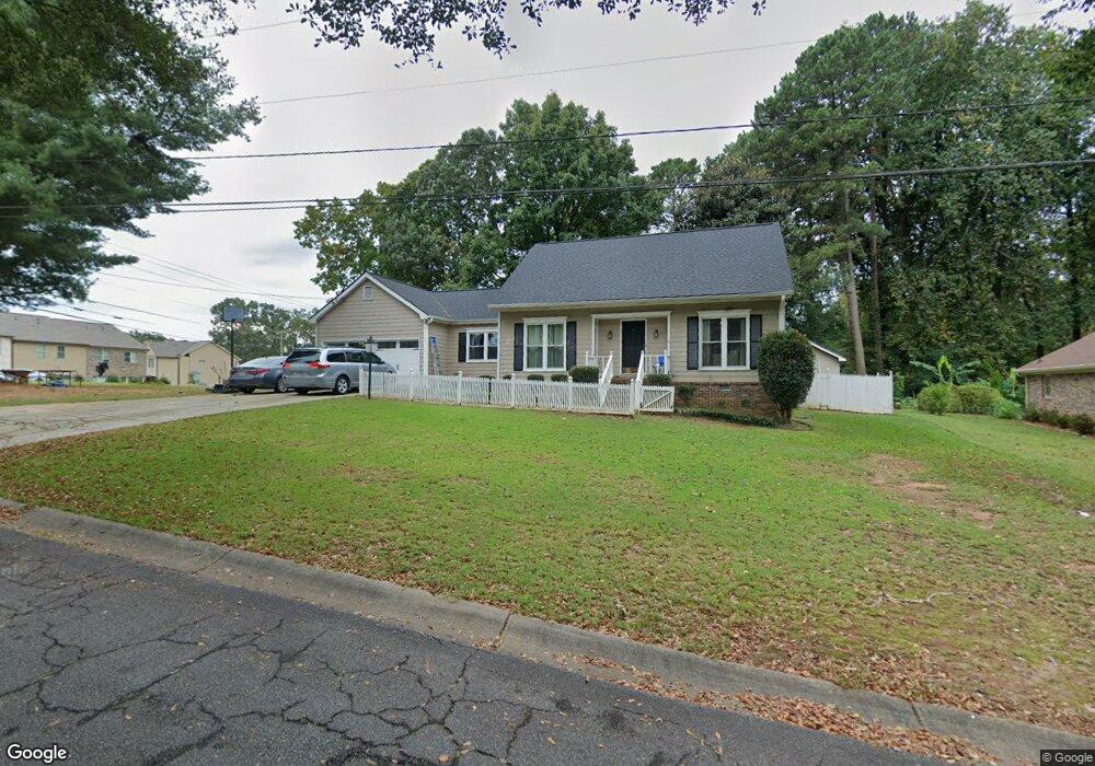
273 Windsong Ln SW Lilburn, GA 30047
Estimated Value: $302,000 - $349,000
3
Beds
2
Baths
1,512
Sq Ft
$219/Sq Ft
Est. Value
About This Home
This home is located at 273 Windsong Ln SW, Lilburn, GA 30047 and is currently estimated at $331,230, approximately $219 per square foot. 273 Windsong Ln SW is a home located in Gwinnett County with nearby schools including Camp Creek Elementary School, Trickum Middle School, and Parkview High School.
Ownership History
Date
Name
Owned For
Owner Type
Purchase Details
Closed on
Feb 9, 2010
Sold by
Fitzgerald Richard
Bought by
Wu John
Current Estimated Value
Purchase Details
Closed on
Dec 12, 1997
Sold by
Dupree Wallace and Dupree Sally W
Bought by
Boothe Althea I
Home Financials for this Owner
Home Financials are based on the most recent Mortgage that was taken out on this home.
Original Mortgage
$126,176
Interest Rate
7.2%
Mortgage Type
FHA
Create a Home Valuation Report for This Property
The Home Valuation Report is an in-depth analysis detailing your home's value as well as a comparison with similar homes in the area
Home Values in the Area
Average Home Value in this Area
Purchase History
| Date | Buyer | Sale Price | Title Company |
|---|---|---|---|
| Wu John | $110,000 | -- | |
| Boothe Althea I | $129,500 | -- |
Source: Public Records
Mortgage History
| Date | Status | Borrower | Loan Amount |
|---|---|---|---|
| Previous Owner | Boothe Althea I | $126,176 |
Source: Public Records
Tax History Compared to Growth
Tax History
| Year | Tax Paid | Tax Assessment Tax Assessment Total Assessment is a certain percentage of the fair market value that is determined by local assessors to be the total taxable value of land and additions on the property. | Land | Improvement |
|---|---|---|---|---|
| 2024 | $2,563 | $96,640 | $30,000 | $66,640 |
| 2023 | $2,563 | $84,960 | $24,800 | $60,160 |
| 2022 | $2,326 | $84,960 | $24,800 | $60,160 |
| 2021 | $1,973 | $65,720 | $19,600 | $46,120 |
| 2020 | $2,467 | $65,720 | $19,600 | $46,120 |
| 2019 | $2,329 | $60,760 | $19,600 | $41,160 |
| 2018 | $2,138 | $55,320 | $16,800 | $38,520 |
| 2016 | $1,639 | $41,960 | $12,400 | $29,560 |
| 2015 | $1,821 | $46,360 | $10,400 | $35,960 |
| 2014 | -- | $46,360 | $10,400 | $35,960 |
Source: Public Records
Map
Nearby Homes
- 223 Windsong Ln SW
- 4491 Bryant Dr SW
- 146 King David Dr SW
- 4358 Louis Rd SW
- 4338 Louis Rd SW
- 4627 Nantucket Dr SW
- 3799 Annsbury Ct
- The Idlewild Plan at Annsbury Park
- The Maisie II Plan at Annsbury Park
- The Davis Plan at Annsbury Park
- The Yarmouth Plan at Annsbury Park
- The Talbot Plan at Annsbury Park
- The Tyndall Plan at Annsbury Park
- The Sadler Plan at Annsbury Park
- 4018 Annsbury Ct
- 3999 Annsbury Ct
- 327 Round Pond Dr
- 4131 Tillrock Ln
- 4151 Tillrock Ln
- 4171 Tillrock Ln
- 4463 Arcado Rd SW
- 263 Windsong Ln SW Unit 1
- 272 Arcado Rd NW
- 4452 Arcado Rd SW
- 4452 Arcado Rd SW Unit 10
- 4452 Arcado Rd SW Unit 32
- 4452 Arcado Rd SW Unit 2
- 4371 Fulson Dr
- 262 Windsong Ln SW
- 253 Windsong Ln SW Unit 1
- 253 Windsong Ln SW
- 266 King David Dr SW
- 276 King David Dr SW
- 256 King David Dr SW
- 0 Fulson Ct Unit 8778187
- 0 Fulson Ct Unit 8708497
- 0 Fulson Ct Unit 8903881
- 0 Fulson Ct Unit 8777830
- 0 Fulson Ct Unit 8776238
- 252 Windsong Ln SW