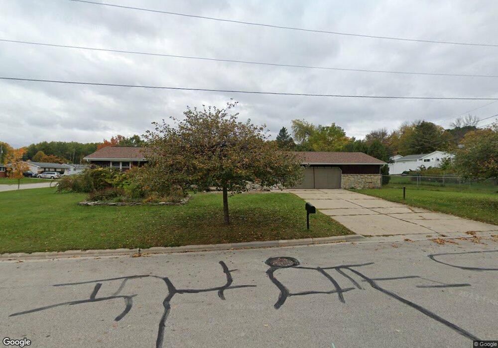
2730 Ramada Ln Green Bay, WI 54304
Westside NeighborhoodEstimated Value: $285,000 - $308,000
--
Bed
--
Bath
--
Sq Ft
0.26
Acres
About This Home
This home is located at 2730 Ramada Ln, Green Bay, WI 54304 and is currently estimated at $294,168. 2730 Ramada Ln is a home located in Brown County with nearby schools including King Elementary School, Lombardi Middle School, and Southwest High School.
Ownership History
Date
Name
Owned For
Owner Type
Purchase Details
Closed on
Feb 14, 2019
Sold by
Kreuser Joseph W and Kreuser Patricia R
Bought by
Grzeskowiak Alvin and Grzeskowiak Dorothy
Current Estimated Value
Home Financials for this Owner
Home Financials are based on the most recent Mortgage that was taken out on this home.
Original Mortgage
$63,750
Outstanding Balance
$55,933
Interest Rate
4.4%
Mortgage Type
New Conventional
Estimated Equity
$238,235
Create a Home Valuation Report for This Property
The Home Valuation Report is an in-depth analysis detailing your home's value as well as a comparison with similar homes in the area
Home Values in the Area
Average Home Value in this Area
Purchase History
| Date | Buyer | Sale Price | Title Company |
|---|---|---|---|
| Grzeskowiak Alvin | $85,000 | Bay Title & Abstract |
Source: Public Records
Mortgage History
| Date | Status | Borrower | Loan Amount |
|---|---|---|---|
| Open | Grzeskowiak Alvin | $63,750 |
Source: Public Records
Tax History Compared to Growth
Tax History
| Year | Tax Paid | Tax Assessment Tax Assessment Total Assessment is a certain percentage of the fair market value that is determined by local assessors to be the total taxable value of land and additions on the property. | Land | Improvement |
|---|---|---|---|---|
| 2024 | $3,235 | $177,100 | $41,600 | $135,500 |
| 2023 | $3,074 | $177,100 | $41,600 | $135,500 |
| 2022 | $3,017 | $177,100 | $41,600 | $135,500 |
| 2021 | $2,733 | $122,600 | $28,800 | $93,800 |
| 2020 | $2,779 | $122,600 | $28,800 | $93,800 |
| 2019 | $2,684 | $122,600 | $28,800 | $93,800 |
| 2018 | $2,627 | $122,600 | $28,800 | $93,800 |
| 2017 | $2,605 | $122,600 | $28,800 | $93,800 |
| 2016 | $2,561 | $122,600 | $28,800 | $93,800 |
| 2015 | $2,666 | $122,600 | $28,800 | $93,800 |
| 2014 | $2,799 | $122,600 | $28,800 | $93,800 |
| 2013 | $2,799 | $122,600 | $28,800 | $93,800 |
Source: Public Records
Map
Nearby Homes
- 1433 Baumgart Rd Unit 1435
- 2640 He Nis Ra Ln
- 2550 He Nis Ra Ln
- 2993 Fleetwood Dr
- 2439 W Point Rd
- 2441 Matchwood Ln
- 3023 Crusade Ln
- 2060 Wintergreen Ct
- 516 Country Club Rd
- 2044 Ann Ln
- 3096 S Sandstone Ct
- 3097 S Sandstone Ct
- 2466 Parkwood Dr
- 2060 Trissino Way
- 916 Square Terrace
- 1973 Knotty Pine Dr
- 3102 Sandstone Ct
- 1602 W Crusade Ln
- 1000 Rolling Green Dr
- 1940 Renaissance Ct
- 1401 Brocoin Way
- 1339 Brocoin Way
- 1400 Baumgart Rd
- 2729 Ramada Ln
- 2733 Ramada Ln
- 1410 Brocoin Way
- 1340 Brocoin Way
- 1333 Brocoin Way
- 2737 Ramada Ln
- 1334 Brocoin Way
- 2739 Ramada Ln
- 1424 Baumgart Rd
- 1327 Brocoin Way
- 1407 Baumgart Rd
- 1328 Baumgart Rd
- 1401 Baumgart Rd
- 1413 Baumgart Rd
- 1434 Baumgart Rd
- 2726 W Point Rd
- 2734 W Point Rd