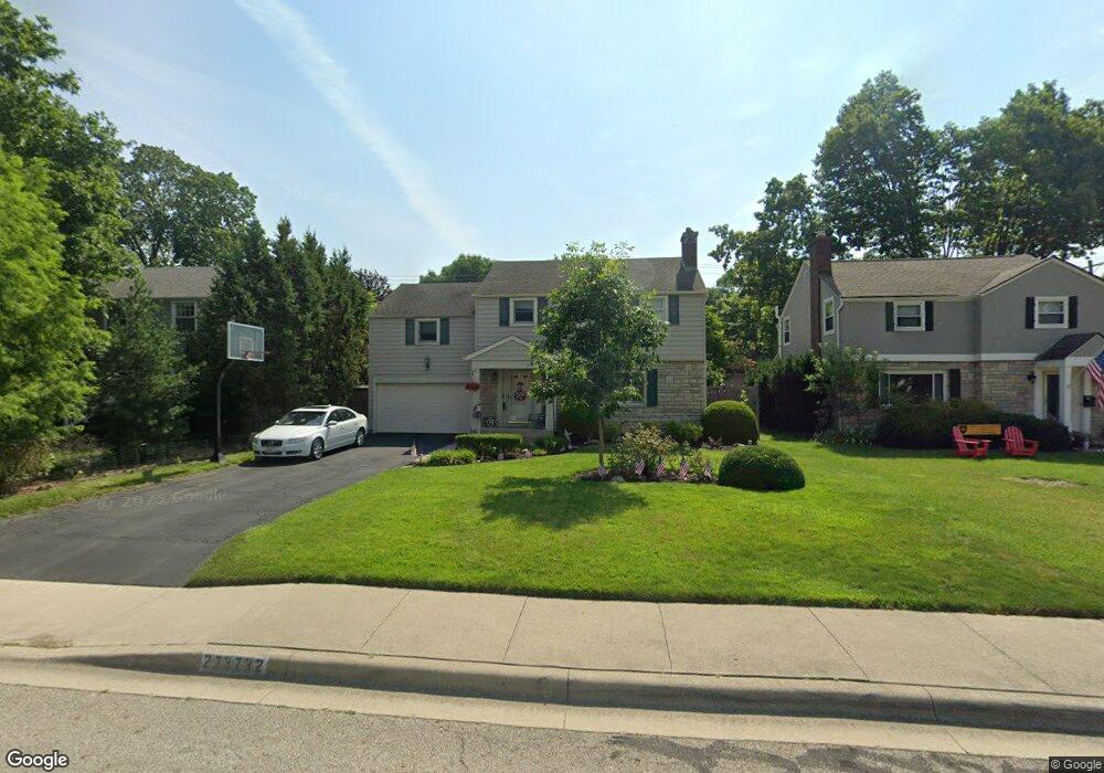
2732 Andover Rd Columbus, OH 43221
Estimated Value: $769,000 - $947,000
5
Beds
3
Baths
2,832
Sq Ft
$291/Sq Ft
Est. Value
About This Home
This home is located at 2732 Andover Rd, Columbus, OH 43221 and is currently estimated at $824,302, approximately $291 per square foot. 2732 Andover Rd is a home located in Franklin County with nearby schools including Tremont Elementary School, Jones Middle School, and Upper Arlington High School.
Ownership History
Date
Name
Owned For
Owner Type
Purchase Details
Closed on
Mar 23, 2001
Sold by
Bennett Duane C and Bennett Emily M
Bought by
Root Ralph H and Root Margaret M
Current Estimated Value
Home Financials for this Owner
Home Financials are based on the most recent Mortgage that was taken out on this home.
Original Mortgage
$242,000
Outstanding Balance
$83,689
Interest Rate
7.02%
Estimated Equity
$740,613
Purchase Details
Closed on
Jan 18, 1995
Sold by
Yuschak David
Bought by
Bennett Duane C and Bennett Emily M
Home Financials for this Owner
Home Financials are based on the most recent Mortgage that was taken out on this home.
Original Mortgage
$167,400
Interest Rate
6.88%
Mortgage Type
New Conventional
Purchase Details
Closed on
Apr 1, 1980
Create a Home Valuation Report for This Property
The Home Valuation Report is an in-depth analysis detailing your home's value as well as a comparison with similar homes in the area
Home Values in the Area
Average Home Value in this Area
Purchase History
| Date | Buyer | Sale Price | Title Company |
|---|---|---|---|
| Root Ralph H | $285,000 | Title First Agency Inc | |
| Bennett Duane C | $186,000 | -- | |
| -- | $78,000 | -- |
Source: Public Records
Mortgage History
| Date | Status | Borrower | Loan Amount |
|---|---|---|---|
| Open | Root Ralph H | $242,000 | |
| Closed | Bennett Duane C | $167,400 |
Source: Public Records
Tax History
| Year | Tax Paid | Tax Assessment Tax Assessment Total Assessment is a certain percentage of the fair market value that is determined by local assessors to be the total taxable value of land and additions on the property. | Land | Improvement |
|---|---|---|---|---|
| 2025 | $12,062 | $208,360 | $86,000 | $122,360 |
| 2024 | $12,062 | $208,360 | $86,000 | $122,360 |
| 2023 | $11,913 | $208,360 | $86,000 | $122,360 |
| 2022 | $11,268 | $161,250 | $42,420 | $118,830 |
| 2021 | $9,974 | $161,250 | $42,420 | $118,830 |
| 2020 | $9,886 | $161,250 | $42,420 | $118,830 |
| 2019 | $8,970 | $129,360 | $42,420 | $86,940 |
| 2018 | $8,328 | $129,360 | $42,420 | $86,940 |
| 2017 | $8,901 | $129,360 | $42,420 | $86,940 |
| 2016 | $7,743 | $117,110 | $36,610 | $80,500 |
| 2015 | $7,736 | $117,110 | $36,610 | $80,500 |
| 2014 | $7,745 | $117,110 | $36,610 | $80,500 |
| 2013 | $3,699 | $106,470 | $33,285 | $73,185 |
Source: Public Records
Map
Nearby Homes
- 2727 Westmont Blvd
- 2583 Wexford Rd
- 3015 Welsford Rd
- 2748 Tremont Rd
- 2018 Inchcliff Rd
- 1869 Tewksbury Rd
- 3106 Somerford Rd
- 2026 Jervis Rd
- 1565 Berkshire Rd
- 3175 Tremont Rd Unit 504
- 3175 Tremont Rd Unit 313
- 1744 Ridgecliff Rd Unit 12
- 1535 Doone Rd
- 1842 Ridgecliff Rd
- 2167 Fairfax Rd
- 2979 Avalon Rd
- 2227 Zollinger Rd
- 3161 Avalon Rd
- 1621 Waltham Rd Unit B
- 2000 Northwest Blvd Unit D
- 2724 Andover Rd
- 2740 Andover Rd
- 2748 Andover Rd
- 2716 Andover Rd
- 2729 Welsford Rd
- 2737 Welsford Rd
- 2721 Welsford Rd
- 2745 Welsford Rd
- 2713 Welsford Rd
- 2756 Andover Rd
- 2751 Welsford Rd
- 1880 Northam Rd Unit 900
- 2764 Andover Rd
- 2761 Welsford Rd
- 2695 Welsford Rd
- 2716 Welsford Rd
- 2728 Welsford Rd
- 2772 Andover Rd
- 2705 Andover Rd
- 2692 Andover Rd