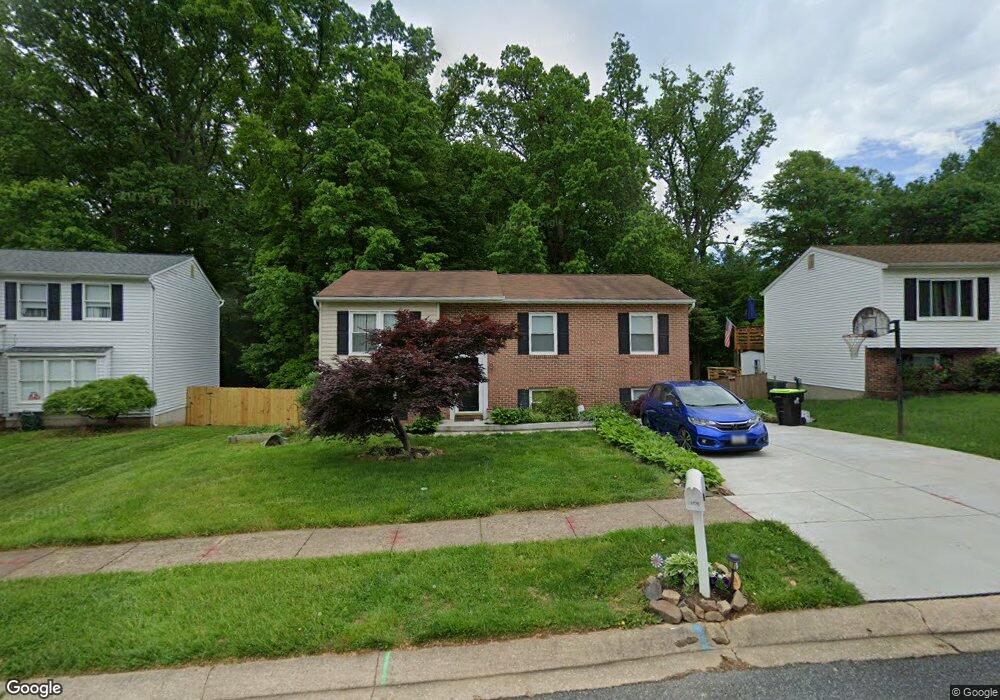
2732 Merrick Way Abingdon, MD 21009
Estimated Value: $311,275 - $423,000
Studio
1
Bath
1,052
Sq Ft
$358/Sq Ft
Est. Value
About This Home
This home is located at 2732 Merrick Way, Abingdon, MD 21009 and is currently estimated at $376,319, approximately $357 per square foot. 2732 Merrick Way is a home located in Harford County with nearby schools including William S. James Elementary School, Patterson Mill Middle School, and Patterson Mill High School.
Ownership History
Date
Name
Owned For
Owner Type
Purchase Details
Closed on
Feb 27, 1989
Sold by
Rollins Howard E
Bought by
Crane Robert A
Current Estimated Value
Purchase Details
Closed on
Aug 12, 1986
Sold by
Stapf Charles Q & Sons Inc
Bought by
Rollins Howard E
Home Financials for this Owner
Home Financials are based on the most recent Mortgage that was taken out on this home.
Original Mortgage
$84,493
Interest Rate
10.4%
Create a Home Valuation Report for This Property
The Home Valuation Report is an in-depth analysis detailing your home's value as well as a comparison with similar homes in the area
Home Values in the Area
Average Home Value in this Area
Purchase History
| Date | Buyer | Sale Price | Title Company |
|---|---|---|---|
| Crane Robert A | $97,500 | -- | |
| Rollins Howard E | $83,500 | -- |
Source: Public Records
Mortgage History
| Date | Status | Borrower | Loan Amount |
|---|---|---|---|
| Previous Owner | Rollins Howard E | $84,493 |
Source: Public Records
Tax History
| Year | Tax Paid | Tax Assessment Tax Assessment Total Assessment is a certain percentage of the fair market value that is determined by local assessors to be the total taxable value of land and additions on the property. | Land | Improvement |
|---|---|---|---|---|
| 2025 | $2,906 | $285,200 | $0 | $0 |
| 2024 | $2,906 | $266,600 | $0 | $0 |
| 2023 | $2,703 | $248,000 | $82,900 | $165,100 |
| 2022 | $2,643 | $242,467 | $0 | $0 |
| 2021 | $2,670 | $236,933 | $0 | $0 |
| 2020 | $2,670 | $231,400 | $82,900 | $148,500 |
| 2019 | $2,648 | $229,467 | $0 | $0 |
| 2018 | $2,602 | $227,533 | $0 | $0 |
| 2017 | $2,580 | $225,600 | $0 | $0 |
| 2016 | -- | $224,033 | $0 | $0 |
| 2015 | $2,781 | $222,467 | $0 | $0 |
| 2014 | $2,781 | $220,900 | $0 | $0 |
Source: Public Records
Map
Nearby Homes
- 2712 Parallel Path
- 2608 Laurel Valley Garth
- 2513 Kenna Ct Unit 7
- 133 Spruce Woods Ct
- 113 Laurel Valley Ct
- 2921 Shelley Ct
- 2902 Preston Ln
- 108 Laurel Valley Ct
- 2923 Alconbury Ct
- 2930 Haddington Ct
- 104 Singer Rd
- 2917 Brightwater Ln
- 311 Laurel Woods Dr
- 2818 Singer Woods Dr
- 301 Tall Pines Ct Unit A
- 2961 Harrogate Way
- 200 Maple Wreath Ct
- 3109 Eden Dr
- 3101 Cardinal Way Unit D
- 115 Hastings Ct
- 2800 Merrick Way
- 2730 Merrick Way
- 2728 Merrick Way
- 2726 Merrick Way
- 46 Boxthorn Rd
- 2721 Merrick Way
- 2721 Long Meadow Dr
- 2719 Merrick Way
- 2724 Merrick Way
- 48 Boxthorn Rd
- 44 Boxthorn Rd
- 42 Boxthorn Rd
- 2806 Merrick Way
- 34 Mitchell Dr
- 36 Mitchell Dr
- 2717 Merrick Way
- 2714 Long Meadow Dr
- 2722 Merrick Way
- 2719 Long Meadow Dr
- 32 Mitchell Dr
Your Personal Tour Guide
Ask me questions while you tour the home.