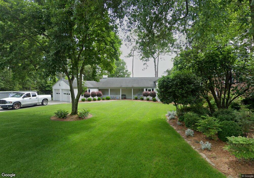
2732 Sterling Point Dr Portsmouth, VA 23703
Churchland NeighborhoodEstimated Value: $497,000 - $639,783
3
Beds
2
Baths
2,725
Sq Ft
$212/Sq Ft
Est. Value
About This Home
This home is located at 2732 Sterling Point Dr, Portsmouth, VA 23703 and is currently estimated at $576,446, approximately $211 per square foot. 2732 Sterling Point Dr is a home located in Portsmouth City with nearby schools including Churchland Elementary School, Churchland Academy Elementary School, and Churchland Middle School.
Ownership History
Date
Name
Owned For
Owner Type
Purchase Details
Closed on
May 18, 2004
Sold by
Wren Kenneth
Current Estimated Value
Home Financials for this Owner
Home Financials are based on the most recent Mortgage that was taken out on this home.
Original Mortgage
$314,000
Interest Rate
5.81%
Mortgage Type
New Conventional
Purchase Details
Closed on
Jul 20, 2001
Sold by
Hutts Patrick H
Bought by
Wrenn Kenneth W
Home Financials for this Owner
Home Financials are based on the most recent Mortgage that was taken out on this home.
Original Mortgage
$180,000
Interest Rate
7.16%
Create a Home Valuation Report for This Property
The Home Valuation Report is an in-depth analysis detailing your home's value as well as a comparison with similar homes in the area
Home Values in the Area
Average Home Value in this Area
Purchase History
| Date | Buyer | Sale Price | Title Company |
|---|---|---|---|
| -- | $392,500 | -- | |
| Wrenn Kenneth W | $264,500 | -- |
Source: Public Records
Mortgage History
| Date | Status | Borrower | Loan Amount |
|---|---|---|---|
| Previous Owner | -- | $314,000 | |
| Previous Owner | Wrenn Kenneth W | $180,000 |
Source: Public Records
Tax History Compared to Growth
Tax History
| Year | Tax Paid | Tax Assessment Tax Assessment Total Assessment is a certain percentage of the fair market value that is determined by local assessors to be the total taxable value of land and additions on the property. | Land | Improvement |
|---|---|---|---|---|
| 2025 | $7,613 | $618,740 | $277,740 | $341,000 |
| 2024 | $7,613 | $604,170 | $277,740 | $326,430 |
| 2023 | $7,072 | $565,780 | $277,740 | $288,040 |
| 2022 | $7,132 | $548,630 | $274,990 | $273,640 |
| 2021 | $6,810 | $523,820 | $266,980 | $256,840 |
| 2020 | $6,582 | $506,310 | $254,270 | $252,040 |
| 2019 | $6,551 | $503,920 | $254,270 | $249,650 |
| 2018 | $6,551 | $503,920 | $254,270 | $249,650 |
| 2017 | $6,551 | $503,920 | $254,270 | $249,650 |
| 2016 | $6,551 | $503,920 | $254,270 | $249,650 |
| 2015 | $6,312 | $485,510 | $235,860 | $249,650 |
| 2014 | $6,166 | $485,510 | $235,860 | $249,650 |
Source: Public Records
Map
Nearby Homes
- 3130 Sterling Point Dr
- 3128 Sterling Point Dr
- 3620 Point Elizabeth Dr
- 2805 Acres Rd
- 4305 Manchester Rd
- 415 Tareyton Ln
- 2935 Bruce Station
- 68 Sandie Point Ln
- 400 Kay Rd
- 3705 Whitechapel Arch
- 4412 Gannon Rd
- 32 Sandie Point Ln
- 34 Sandie Point Ln
- 22 Sandie Point Ln
- 14 Sandie Point Ln
- 330 Thelmar Ln
- 3909 Point Elizabeth Dr
- 4417 Gannon Rd
- 3826 Whitechapel Arch
- 4011 Reese Dr S
- 2728 Sterling Point Dr
- 2736 Sterling Point Dr
- 2724 Sterling Point Dr
- 2721 Sterling Point Dr
- 2717 Sterling Point Dr
- 2713 Sterling Point Dr
- 2716 Sterling Point Dr
- 2725 Sterling Point Dr
- 2740 Sterling Point Dr
- 5109 Moonlit Ave
- 2709 Sterling Point Dr
- 2714 Sterling Point Dr
- 5101 Moonlit Ave
- 2742 Sterling Point Dr
- 2712 Sterling Point Dr
- 5104 Moonlit Ave
- 5100 Moonlit Ave
- 2708 Sterling Point Dr
- 2702 Island Rd
- 2804 Sterling Point Dr