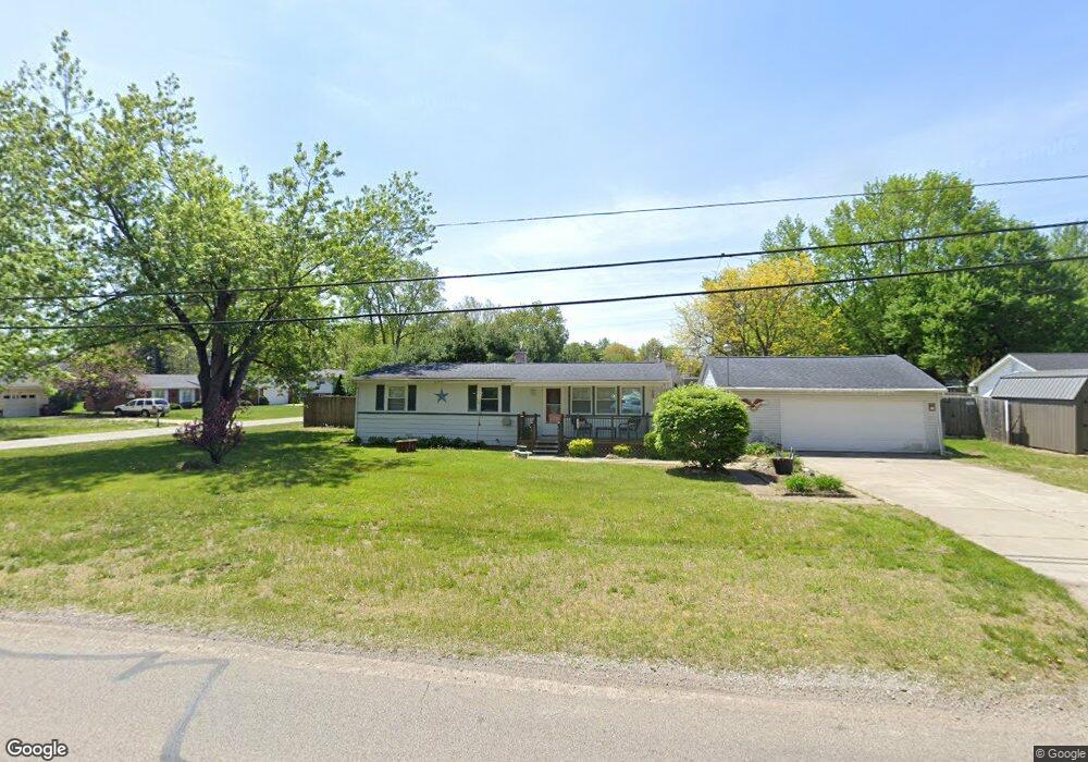
2733 Consear Rd Lambertville, MI 48144
Estimated Value: $162,382 - $264,000
Studio
--
Bath
--
Sq Ft
14,810
Sq Ft Lot
About This Home
This home is located at 2733 Consear Rd, Lambertville, MI 48144 and is currently estimated at $212,096. 2733 Consear Rd is a home located in Monroe County with nearby schools including Monroe Road Elementary School, Bedford Junior High School, and Bedford High School.
Ownership History
Date
Name
Owned For
Owner Type
Purchase Details
Closed on
May 23, 2023
Sold by
Richard James Turski and Richard Marilou Judith
Bought by
Breivik Nicholas M and Breivik Kimberly S
Current Estimated Value
Home Financials for this Owner
Home Financials are based on the most recent Mortgage that was taken out on this home.
Original Mortgage
$80,000
Outstanding Balance
$77,731
Interest Rate
6.28%
Mortgage Type
New Conventional
Estimated Equity
$134,365
Purchase Details
Closed on
Jul 27, 2009
Sold by
Turski Richard James and Turski Marilou Judith
Bought by
Turski Marilou Judith and Turski Richard James
Create a Home Valuation Report for This Property
The Home Valuation Report is an in-depth analysis detailing your home's value as well as a comparison with similar homes in the area
Home Values in the Area
Average Home Value in this Area
Purchase History
| Date | Buyer | Sale Price | Title Company |
|---|---|---|---|
| Breivik Nicholas M | $100,000 | Greater Metropolitan Title | |
| Turski Marilou Judith | -- | -- |
Source: Public Records
Mortgage History
| Date | Status | Borrower | Loan Amount |
|---|---|---|---|
| Open | Breivik Nicholas M | $80,000 |
Source: Public Records
Tax History
| Year | Tax Paid | Tax Assessment Tax Assessment Total Assessment is a certain percentage of the fair market value that is determined by local assessors to be the total taxable value of land and additions on the property. | Land | Improvement |
|---|---|---|---|---|
| 2025 | $856 | $78,900 | $78,900 | $0 |
| 2024 | $831 | $76,600 | $0 | $0 |
| 2023 | $490 | $61,200 | $0 | $0 |
| 2022 | $1,144 | $61,200 | $0 | $0 |
| 2021 | $1,651 | $59,600 | $0 | $0 |
| 2020 | $1,637 | $44,700 | $0 | $0 |
| 2019 | $1,623 | $44,700 | $0 | $0 |
| 2018 | $1,550 | $41,600 | $0 | $0 |
| 2017 | $1,530 | $41,600 | $0 | $0 |
| 2016 | $1,546 | $39,300 | $0 | $0 |
| 2015 | $1,555 | $36,500 | $0 | $0 |
| 2014 | $1,555 | $36,500 | $0 | $0 |
| 2013 | $1,685 | $36,200 | $0 | $0 |
Source: Public Records
Map
Nearby Homes
- 2416 Sutton Dr
- 2933 W Dean Rd
- 8115 Douglas Rd
- 8037 Wiseman Rd
- 2194 W Dean Rd
- 1944 Stoneybrook Ln
- 3405 Shadywood Dr
- 8951 Jackman Rd
- 3254 Pleasant Dr
- 3415 Woodmont Dr
- 1747 Center Dr
- 7494 Montri Dr
- 9107 Pine Forest Cir
- 7331 Elmwood Dr
- 7346 Silo Meadows Dr
- 7322 Silo Meadows Dr
- 9115 Summerfield Rd
- 0 Jackman Lots 1 and 2 Rd Unit 50201182
- 1944 W Sterns Rd
- 7100 Taylor Ave
- 8569 Sandra Kay Dr
- 2745 Consear Rd
- 8566 Barbara Lee Dr
- 8553 Sandra Kay Dr
- 8584 Sandra Kay Dr
- 8568 Sandra Kay Dr
- 8554 Barbara Lee Dr
- 8540 Barbara Lee Dr
- 8541 Sandra Kay Dr
- 8552 Sandra Kay Dr
- 8577 Barbara Lee Dr
- 8565 Barbara Lee Dr
- 8565 Barbara Lee Dr
- 2659 Consear Rd
- 8553 Barbara Lee Dr
- 8553 Barbara Lee Dr
- 8537 Sandra Kay Dr
- 2631 Consear Rd
- 8539 Barbara Lee Dr
- 8539 Barbara Lee Dr
Your Personal Tour Guide
Ask me questions while you tour the home.