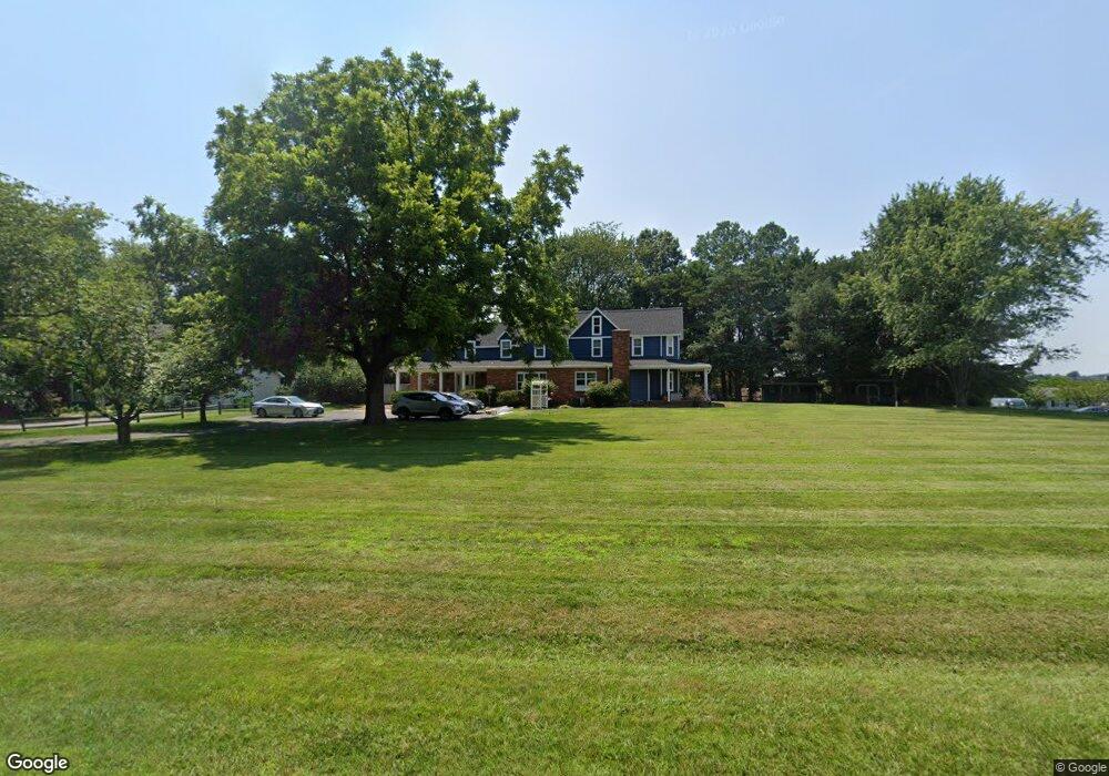
2733 Harrington Rd Chester, MD 21619
Estimated Value: $648,000 - $839,147
--
Bed
4
Baths
3,524
Sq Ft
$204/Sq Ft
Est. Value
About This Home
This home is located at 2733 Harrington Rd, Chester, MD 21619 and is currently estimated at $719,037, approximately $204 per square foot. 2733 Harrington Rd is a home located in Queen Anne's County with nearby schools including Kent Island Elementary School, Bayside Elementary School, and Matapeake Middle School.
Ownership History
Date
Name
Owned For
Owner Type
Purchase Details
Closed on
Dec 27, 2001
Sold by
Cowden John Michael
Bought by
Clark Todd M and Clark Kimberly S
Current Estimated Value
Purchase Details
Closed on
Feb 11, 2000
Sold by
Butz Inc
Bought by
Cameron James M and Cameron Lisa A
Purchase Details
Closed on
Apr 9, 1999
Sold by
Tremblay Richard and Tremblay Jean
Bought by
Cowden John Michael and Cowden Bonnie Irene
Purchase Details
Closed on
May 13, 1998
Sold by
Tremblay Richard and Tremblay Jean
Bought by
Butz Inc
Purchase Details
Closed on
Oct 28, 1987
Sold by
Rupp Mary E
Bought by
Tremblay Richard and Tremblay Jean
Home Financials for this Owner
Home Financials are based on the most recent Mortgage that was taken out on this home.
Original Mortgage
$140,000
Interest Rate
11.36%
Create a Home Valuation Report for This Property
The Home Valuation Report is an in-depth analysis detailing your home's value as well as a comparison with similar homes in the area
Home Values in the Area
Average Home Value in this Area
Purchase History
| Date | Buyer | Sale Price | Title Company |
|---|---|---|---|
| Clark Todd M | $300,000 | -- | |
| Cameron James M | $179,926 | -- | |
| Cowden John Michael | $226,000 | -- | |
| Butz Inc | -- | -- | |
| Butz Inc | $45,000 | -- | |
| Tremblay Richard | $175,000 | -- |
Source: Public Records
Mortgage History
| Date | Status | Borrower | Loan Amount |
|---|---|---|---|
| Previous Owner | Tremblay Richard | $140,000 | |
| Closed | Cowden John Michael | -- |
Source: Public Records
Tax History Compared to Growth
Tax History
| Year | Tax Paid | Tax Assessment Tax Assessment Total Assessment is a certain percentage of the fair market value that is determined by local assessors to be the total taxable value of land and additions on the property. | Land | Improvement |
|---|---|---|---|---|
| 2025 | $5,124 | $543,900 | $0 | $0 |
| 2024 | $5,107 | $542,100 | $0 | $0 |
| 2023 | $4,961 | $540,300 | $179,700 | $360,600 |
| 2022 | $4,721 | $511,300 | $0 | $0 |
| 2021 | $4,348 | $482,300 | $0 | $0 |
| 2020 | $4,348 | $453,300 | $167,900 | $285,400 |
| 2019 | $4,144 | $432,800 | $0 | $0 |
| 2018 | $3,947 | $412,300 | $0 | $0 |
| 2017 | $3,758 | $391,800 | $0 | $0 |
| 2016 | -- | $389,667 | $0 | $0 |
| 2015 | $1,792 | $387,533 | $0 | $0 |
| 2014 | $1,792 | $385,400 | $0 | $0 |
Source: Public Records
Map
Nearby Homes
- 1839 Harbor Dr
- 1870 Harbor Dr
- 1872 Harbor Dr
- 1903 Churchhill Ln
- 1757 Harbor Dr
- 419 Creeks End Ln
- 104 Jib Way
- 2723 Cox Neck Rd
- 2653 Cox Neck Rd
- 1 UNIT 2 Compass Cir
- 18 Mariners Way Unit 4
- 9 Mariners Way Unit A-4
- 7014 Bridgepointe Dr
- 720 Thompson Creek Rd
- 205 Duke St
- 504 Main St
- 206 Marion Quimby Dr Unit B-6
- 102 Marion Quimby Dr
- 116 Creekside Commons Ct
- 224 Bayberry Dr
- 2729 Harrington Rd
- 2716 Sherman Dr
- 2714 Sherman Dr
- 1817 Anchorage Dr
- 1819 Anchorage Dr
- 0 Harrington Rd Unit QA4836907
- 1815 Anchorage Dr
- 2712 Sherman Dr
- 1821 Anchorage Dr
- 1813 Anchorage Dr
- 1823 Anchorage Dr
- 1841 Harbor Dr
- 1837 Harbor Dr
- 2709 Sherman Dr
- 1835 Harbor Dr
- 2710 Sherman Dr
- 1825 Anchorage Dr
- 1826 Sherman Dr
- 1817 Sherman Dr
- 1828 Sherman Dr