Estimated Value: $392,000 - $415,000
4
Beds
3
Baths
2,502
Sq Ft
$161/Sq Ft
Est. Value
About This Home
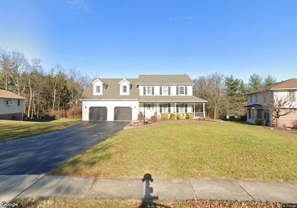
This home is located at 2733 Sparrow Dr, York, PA 17408 and is currently estimated at $401,871, approximately $160 per square foot. 2733 Sparrow Dr is a home located in York County with nearby schools including West York Area High School, York Adventist Christian School, and Christian School of York.
Ownership History
Date
Name
Owned For
Owner Type
Purchase Details
Closed on
Jun 30, 2010
Sold by
Morelli Karen E
Bought by
Raffensberger Kent A and Raffensberger Ann R
Current Estimated Value
Home Financials for this Owner
Home Financials are based on the most recent Mortgage that was taken out on this home.
Original Mortgage
$179,920
Outstanding Balance
$119,917
Interest Rate
4.78%
Mortgage Type
New Conventional
Estimated Equity
$281,954
Purchase Details
Closed on
Aug 24, 2006
Sold by
Morelli Mark M and Morelli Karen E
Bought by
Morelli Karen E
Create a Home Valuation Report for This Property
The Home Valuation Report is an in-depth analysis detailing your home's value as well as a comparison with similar homes in the area
Home Values in the Area
Average Home Value in this Area
Purchase History
| Date | Buyer | Sale Price | Title Company |
|---|---|---|---|
| Raffensberger Kent A | $224,900 | None Available | |
| Morelli Karen E | -- | None Available |
Source: Public Records
Mortgage History
| Date | Status | Borrower | Loan Amount |
|---|---|---|---|
| Open | Raffensberger Kent A | $179,920 |
Source: Public Records
Tax History Compared to Growth
Tax History
| Year | Tax Paid | Tax Assessment Tax Assessment Total Assessment is a certain percentage of the fair market value that is determined by local assessors to be the total taxable value of land and additions on the property. | Land | Improvement |
|---|---|---|---|---|
| 2025 | $6,957 | $206,300 | $44,740 | $161,560 |
| 2024 | $6,782 | $206,300 | $44,740 | $161,560 |
| 2023 | $6,782 | $206,300 | $44,740 | $161,560 |
| 2022 | $6,782 | $206,300 | $44,740 | $161,560 |
| 2021 | $6,576 | $206,300 | $44,740 | $161,560 |
| 2020 | $6,576 | $206,300 | $44,740 | $161,560 |
| 2019 | $6,452 | $206,300 | $44,740 | $161,560 |
| 2018 | $6,400 | $206,300 | $44,740 | $161,560 |
| 2017 | $6,204 | $206,300 | $44,740 | $161,560 |
| 2016 | $0 | $206,300 | $44,740 | $161,560 |
| 2015 | -- | $206,300 | $44,740 | $161,560 |
| 2014 | -- | $206,300 | $44,740 | $161,560 |
Source: Public Records
Map
Nearby Homes
- 2785 Sparrow Dr
- 2825 Sparrow Dr
- 2506 Westminster Dr
- 2762 Sunset Ln
- 2533 Sunset Ln
- 1769 Rainbow Cir
- 2154 Derry Rd
- 1670 Misty Dr
- 2208 Golden Eagle Dr Unit 111
- 2450 Walnut Bottom Rd Unit 85
- 2934 Ridings Way
- 2700 Thornbridge Rd E
- 2140 Thoroughbred Ct
- 2248 Chestnut Rd
- 2351 Birch Rd
- 2381 Sunset Ln
- 2540 Log Cabin Rd
- 1361 Wellington Dr Unit D3
- 2290 School St
- 2755 Anita Dr
- 2729 Sparrow Dr
- 2737 Sparrow Dr
- 2741 Sparrow Dr
- 2725 Sparrow Dr
- 2732 Sparrow Dr
- 2721 Sparrow Dr
- 2728 Sparrow Dr
- 2724 Sparrow Dr
- 2736 Sparrow Dr
- 2745 Sparrow Dr
- 2717 Sparrow Dr
- 2720 Sparrow Dr
- 1859 Michelle Dr
- 20 Sussex Cir
- 30 Sussex Cir
- 2753 Sparrow Dr
- 2716 Sparrow Dr
- 2713 Sparrow Dr
- 2006 Derry Rd
- 2002 Derry Rd