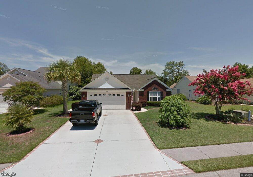
2736 Canvasback Trail Myrtle Beach, SC 29588
Estimated Value: $323,130 - $351,000
3
Beds
2
Baths
2,200
Sq Ft
$155/Sq Ft
Est. Value
About This Home
This home is located at 2736 Canvasback Trail, Myrtle Beach, SC 29588 and is currently estimated at $341,533, approximately $155 per square foot. 2736 Canvasback Trail is a home located in Horry County with nearby schools including Forestbrook Elementary School, Forestbrook Middle School, and Socastee High School.
Ownership History
Date
Name
Owned For
Owner Type
Purchase Details
Closed on
Nov 18, 2008
Sold by
Boykin Patrick
Bought by
Gomes Nelson B
Current Estimated Value
Purchase Details
Closed on
Jun 12, 2006
Sold by
Mclean Thomas L
Bought by
Boykin Patrick and Boykin Carrie
Home Financials for this Owner
Home Financials are based on the most recent Mortgage that was taken out on this home.
Original Mortgage
$50,000
Interest Rate
6.49%
Mortgage Type
Purchase Money Mortgage
Purchase Details
Closed on
Sep 9, 2005
Sold by
Tom Mclean Llc
Bought by
Mclean Thomas L
Purchase Details
Closed on
Mar 4, 2005
Sold by
Beach Flowers Inc
Bought by
Tom Mclean Llc
Home Financials for this Owner
Home Financials are based on the most recent Mortgage that was taken out on this home.
Original Mortgage
$152,975
Interest Rate
5.6%
Mortgage Type
Purchase Money Mortgage
Purchase Details
Closed on
Mar 26, 2004
Sold by
Hunters Ridge Of Myrtle Beach Inc
Bought by
Beach Flowers Inc
Create a Home Valuation Report for This Property
The Home Valuation Report is an in-depth analysis detailing your home's value as well as a comparison with similar homes in the area
Home Values in the Area
Average Home Value in this Area
Purchase History
| Date | Buyer | Sale Price | Title Company |
|---|---|---|---|
| Gomes Nelson B | $220,000 | -- | |
| Boykin Patrick | $235,000 | None Available | |
| Mclean Thomas L | -- | -- | |
| Tom Mclean Llc | $44,900 | -- | |
| Beach Flowers Inc | $101,700 | -- |
Source: Public Records
Mortgage History
| Date | Status | Borrower | Loan Amount |
|---|---|---|---|
| Previous Owner | Boykin Patrick | $50,000 | |
| Previous Owner | Tom Mclean Llc | $152,975 |
Source: Public Records
Tax History
| Year | Tax Paid | Tax Assessment Tax Assessment Total Assessment is a certain percentage of the fair market value that is determined by local assessors to be the total taxable value of land and additions on the property. | Land | Improvement |
|---|---|---|---|---|
| 2025 | $696 | $0 | $0 | $0 |
| 2024 | $696 | $12,607 | $4,301 | $8,306 |
| 2023 | $627 | $7,479 | $1,534 | $5,945 |
| 2021 | $608 | $7,767 | $1,791 | $5,976 |
| 2020 | $521 | $7,767 | $1,791 | $5,976 |
| 2019 | $521 | $7,767 | $1,791 | $5,976 |
| 2018 | $448 | $6,504 | $1,308 | $5,196 |
| 2017 | $612 | $6,504 | $1,308 | $5,196 |
| 2016 | -- | $6,504 | $1,308 | $5,196 |
| 2015 | $612 | $6,504 | $1,308 | $5,196 |
| 2014 | $565 | $6,504 | $1,308 | $5,196 |
Source: Public Records
Map
Nearby Homes
- 2540 Bearstand Trail
- 2611 Ringneck Trail
- 2560 Wild Game Trail Unit Hunters Ridge
- 281 La Patos Dr
- 425 Dog Pen Ct
- 6096 Zoe Way Unit 819
- 6108 Zoe Way Unit 822
- 6100 Zoe Way Unit 820
- 2425 Hunters Trail
- 629 Cottontail Trail Unit Hunters Ridge Crossi
- 6104 Zoe Way Unit 821
- 6316 Zoe Way Unit 829
- 6120 Zoe Way Unit 825
- 6265 Zoe Way
- 6293 Zoe Way Unit 862
- 6112 Zoe Way Unit 823
- 6116 Zoe Way Unit 824
- 407 Big Woods Ct
- 787 Laconic Dr Unit Starling- Lot 416
- 803 Laconic Dr Unit Ibis- Lot 420
- 2738 Canvasback Trail
- 2734 Canvasback Trail
- 2732 Canvasback Trail
- 2740 Canvasback Trail
- 2600 Corn Pile Rd
- 2601 Corn Pile Rd
- 2601 Corn Pile Rd
- 2730 Canvasback Trail
- 2602 Corn Pile Rd
- 2731 Canvasback Trail
- 2800 Six Shot Ct
- 2802 Six Shot Ct
- 2599 Buck Scrape Rd
- 2728 Canvasback Trail
- 2729 Canvasback Trail
- 2605 Corn Pile Rd
- 2597 Buck Scrape Rd
- 2604 Corn Pile Rd
- 2726 Canvasback Trail Unit Hunters Ridge
- 2726 Canvasback Trail
Your Personal Tour Guide
Ask me questions while you tour the home.