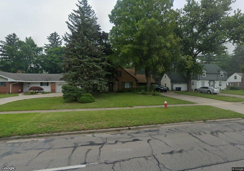
2736 Secor Rd Toledo, OH 43606
Ottawa NeighborhoodEstimated Value: $241,000 - $299,545
4
Beds
3
Baths
1,963
Sq Ft
$141/Sq Ft
Est. Value
About This Home
This home is located at 2736 Secor Rd, Toledo, OH 43606 and is currently estimated at $276,886, approximately $141 per square foot. 2736 Secor Rd is a home located in Lucas County with nearby schools including Old Orchard Elementary School, Start High School, and Horizon Science Academy - Toledo High School.
Ownership History
Date
Name
Owned For
Owner Type
Purchase Details
Closed on
Jun 13, 2005
Sold by
Sarver Timothy and Sarver Reba
Bought by
Hill Wilbur A and Hill Belinda J
Current Estimated Value
Home Financials for this Owner
Home Financials are based on the most recent Mortgage that was taken out on this home.
Original Mortgage
$150,000
Outstanding Balance
$77,102
Interest Rate
5.82%
Mortgage Type
Fannie Mae Freddie Mac
Estimated Equity
$199,784
Purchase Details
Closed on
Feb 26, 2004
Sold by
Keene John L
Bought by
Sarver Timothy and Sarver Reba
Purchase Details
Closed on
Nov 20, 1998
Sold by
Geer Elsye D
Bought by
Keene John L
Create a Home Valuation Report for This Property
The Home Valuation Report is an in-depth analysis detailing your home's value as well as a comparison with similar homes in the area
Home Values in the Area
Average Home Value in this Area
Purchase History
| Date | Buyer | Sale Price | Title Company |
|---|---|---|---|
| Hill Wilbur A | $187,500 | -- | |
| Sarver Timothy | $70,000 | -- | |
| Keene John L | -- | -- |
Source: Public Records
Mortgage History
| Date | Status | Borrower | Loan Amount |
|---|---|---|---|
| Open | Hill Wilbur A | $150,000 |
Source: Public Records
Tax History
| Year | Tax Paid | Tax Assessment Tax Assessment Total Assessment is a certain percentage of the fair market value that is determined by local assessors to be the total taxable value of land and additions on the property. | Land | Improvement |
|---|---|---|---|---|
| 2025 | -- | $80,115 | $13,965 | $66,150 |
| 2024 | $2,411 | $80,115 | $13,965 | $66,150 |
| 2023 | $4,085 | $64,820 | $12,670 | $52,150 |
| 2022 | $4,086 | $64,820 | $12,670 | $52,150 |
| 2021 | $4,194 | $64,820 | $12,670 | $52,150 |
| 2020 | $3,926 | $53,655 | $10,430 | $43,225 |
| 2019 | $3,831 | $53,655 | $10,430 | $43,225 |
| 2018 | $3,860 | $53,655 | $10,430 | $43,225 |
| 2017 | $3,938 | $52,430 | $10,185 | $42,245 |
| 2016 | $3,922 | $149,800 | $29,100 | $120,700 |
| 2015 | $3,882 | $149,800 | $29,100 | $120,700 |
| 2014 | $3,298 | $52,440 | $10,190 | $42,250 |
| 2013 | $3,298 | $52,440 | $10,190 | $42,250 |
Source: Public Records
Map
Nearby Homes
- 3456 Gallatin Rd
- 3010 W Central Ave Unit 105
- 3010 W Central Ave
- 2509 Meadowwood Dr
- 2804 Goddard Rd
- 2702 Goddard Rd
- 2850 Kenwood Blvd
- 2356 Secor Rd
- 2714 Evergreen Rd
- 2904 Isha Laye Way
- 2410 Drummond Rd
- 3175 Cheltenham Rd
- 3127 Evergreen Rd
- 2360 Cheltenham Rd
- 3433 Goddard Rd
- 3305 W Bancroft St
- 3446 Stanhope Dr
- 3155 Kylemore Rd
- 3205 Kylemore Rd
- 4302 Monroe St
- 2728 Secor Rd
- 2808 Secor Rd
- 2605 Christie Blvd
- 2718 Secor Rd
- 2803 Densmore Dr
- 2814 Secor Rd
- 2731 Densmore Dr
- 2807 Densmore Dr
- 2723 Densmore Dr
- 3306 Christie Blvd
- 2710 Secor Rd
- 2817 Densmore Dr
- 2715 Densmore Dr
- 3303 Hughes Blvd
- 2823 Densmore Dr
- 2707 Densmore Dr
- 3305 Christie Blvd
- 2704 Secor Rd
- 2830 Secor Rd
- 2827 Densmore Dr
Your Personal Tour Guide
Ask me questions while you tour the home.