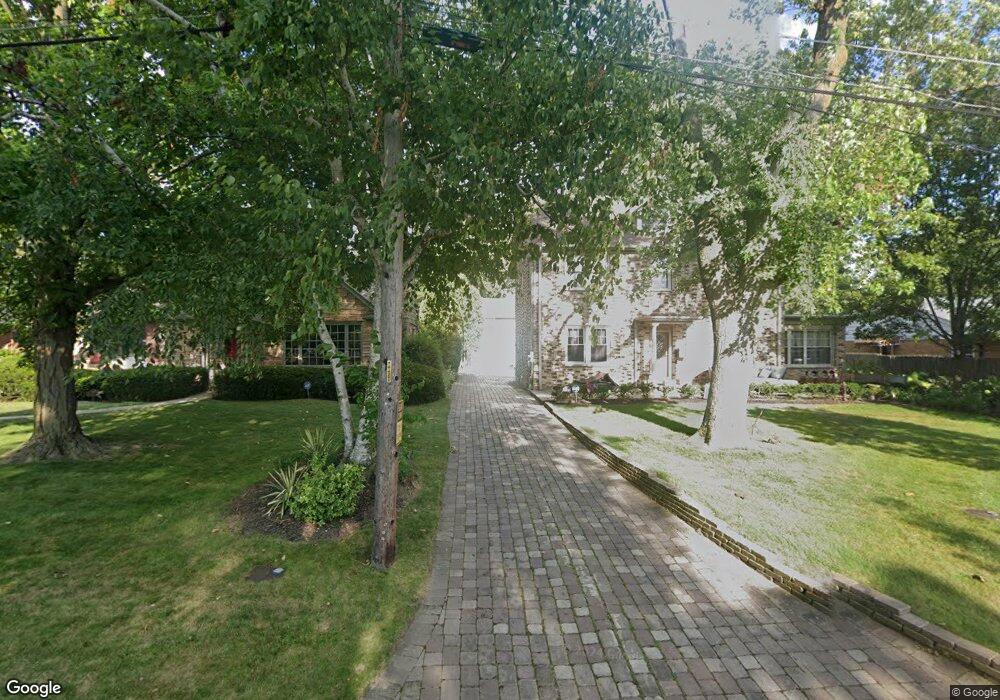
2737 Port Clinton Rd Highland Park, IL 60035
East Highland Park NeighborhoodEstimated Value: $864,000 - $1,316,000
5
Beds
5
Baths
3,084
Sq Ft
$321/Sq Ft
Est. Value
About This Home
This home is located at 2737 Port Clinton Rd, Highland Park, IL 60035 and is currently estimated at $990,361, approximately $321 per square foot. 2737 Port Clinton Rd is a home located in Lake County with nearby schools including Indian Trail Elementary School, Edgewood Middle School, and Highland Park High School.
Ownership History
Date
Name
Owned For
Owner Type
Purchase Details
Closed on
May 31, 2005
Sold by
Saliba Frank D and Frank D Saliba Trust
Bought by
Bass David R and Bass Denise K
Current Estimated Value
Home Financials for this Owner
Home Financials are based on the most recent Mortgage that was taken out on this home.
Original Mortgage
$472,000
Outstanding Balance
$238,276
Interest Rate
5.25%
Mortgage Type
Purchase Money Mortgage
Estimated Equity
$752,085
Create a Home Valuation Report for This Property
The Home Valuation Report is an in-depth analysis detailing your home's value as well as a comparison with similar homes in the area
Home Values in the Area
Average Home Value in this Area
Purchase History
| Date | Buyer | Sale Price | Title Company |
|---|---|---|---|
| Bass David R | $590,000 | -- |
Source: Public Records
Mortgage History
| Date | Status | Borrower | Loan Amount |
|---|---|---|---|
| Open | Bass David R | $472,000 |
Source: Public Records
Tax History Compared to Growth
Tax History
| Year | Tax Paid | Tax Assessment Tax Assessment Total Assessment is a certain percentage of the fair market value that is determined by local assessors to be the total taxable value of land and additions on the property. | Land | Improvement |
|---|---|---|---|---|
| 2024 | $19,352 | $253,604 | $52,738 | $200,866 |
| 2023 | $14,815 | $228,595 | $47,537 | $181,058 |
| 2022 | $14,815 | $170,516 | $52,223 | $118,293 |
| 2021 | $13,652 | $164,829 | $50,481 | $114,348 |
| 2020 | $13,210 | $164,829 | $50,481 | $114,348 |
| 2019 | $12,766 | $164,058 | $50,245 | $113,813 |
| 2018 | $11,282 | $154,085 | $46,507 | $107,578 |
| 2017 | $11,105 | $153,197 | $46,239 | $106,958 |
| 2016 | $10,697 | $145,846 | $44,020 | $101,826 |
| 2015 | $10,354 | $135,506 | $40,899 | $94,607 |
| 2014 | $10,486 | $134,034 | $39,727 | $94,307 |
| 2012 | $10,205 | $134,816 | $39,959 | $94,857 |
Source: Public Records
Map
Nearby Homes
- 0 Moraine Rd
- 417 Temple Ave
- 2542 Green Bay Rd
- 2500 Green Bay Rd
- 1 Burtis Ave
- 2441 Woodbridge Ln
- 0 Skokie Ave
- 0 Patten Rd
- 221 Burchell Ave
- 0 Wrendale Ave Unit MRD12487576
- 560 Vine Ave Unit 103
- 228 Llewellyn Ave
- 2046 Saint Johns Ave Unit 2A
- 2086 Saint Johns Ave Unit 207
- 239 Sheridan Ave
- 2066 Saint Johns Ave Unit 404
- 2514 Hidden Oak (Lot 9) Cir
- 282 Linden Park Place
- 525 Lockard Ln
- 535 Lockard Ln
- 2745 Port Clinton Rd
- 2725 Port Clinton Rd
- 2749 Port Clinton Rd
- 2734 Roslyn Ln
- 2724 Roslyn Ln
- 2746 Roslyn Ln
- 187 Bloom St
- 2713 Port Clinton Rd
- 179 Bloom St
- 2754 Roslyn Ln
- 2765 Port Clinton Rd
- 171 Bloom St
- 2736 Port Clinton Rd
- 2726 Port Clinton Rd
- 2746 Port Clinton Rd
- 2712 Port Clinton Rd
- 2766 Roslyn Ln
- 2754 Port Clinton Rd
- 2710 Roslyn Ln
- 2775 Port Clinton Rd