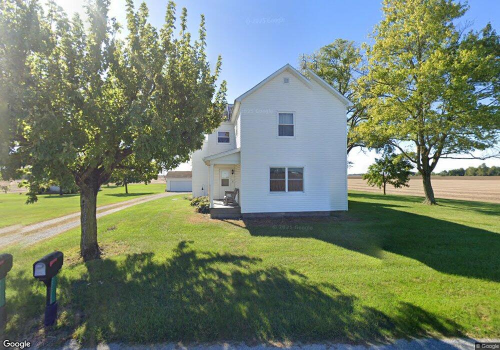
27388 State Route 67 Waynesfield, OH 45896
Estimated Value: $194,820 - $304,000
3
Beds
1
Bath
1,992
Sq Ft
$127/Sq Ft
Est. Value
About This Home
This home is located at 27388 State Route 67, Waynesfield, OH 45896 and is currently estimated at $252,705, approximately $126 per square foot. 27388 State Route 67 is a home located in Auglaize County with nearby schools including Waynesfield-Goshen Local Elementary School and Waynesfield-Goshen Local High School.
Ownership History
Date
Name
Owned For
Owner Type
Purchase Details
Closed on
Dec 1, 1989
Bought by
Young Dennis E
Current Estimated Value
Create a Home Valuation Report for This Property
The Home Valuation Report is an in-depth analysis detailing your home's value as well as a comparison with similar homes in the area
Home Values in the Area
Average Home Value in this Area
Purchase History
| Date | Buyer | Sale Price | Title Company |
|---|---|---|---|
| Young Dennis E | $46,000 | -- |
Source: Public Records
Mortgage History
| Date | Status | Borrower | Loan Amount |
|---|---|---|---|
| Previous Owner | Young Dennis E | $50,000 | |
| Previous Owner | Young Dennis E | $41,000 | |
| Previous Owner | Young Dennis E | $40,000 | |
| Previous Owner | Young Dennis E | $31,400 | |
| Previous Owner | Young Dennis E | $20,000 | |
| Previous Owner | Young Dennis E | $35,000 |
Source: Public Records
Tax History Compared to Growth
Tax History
| Year | Tax Paid | Tax Assessment Tax Assessment Total Assessment is a certain percentage of the fair market value that is determined by local assessors to be the total taxable value of land and additions on the property. | Land | Improvement |
|---|---|---|---|---|
| 2024 | $3,056 | $48,590 | $7,770 | $40,820 |
| 2023 | $1,389 | $48,590 | $7,770 | $40,820 |
| 2022 | $1,234 | $38,170 | $7,190 | $30,980 |
| 2021 | $1,224 | $38,170 | $7,190 | $30,980 |
| 2020 | $1,204 | $38,168 | $7,186 | $30,982 |
| 2019 | $925 | $31,809 | $5,989 | $25,820 |
| 2018 | $899 | $31,809 | $5,989 | $25,820 |
| 2017 | $896 | $31,809 | $5,989 | $25,820 |
| 2016 | $754 | $28,631 | $5,702 | $22,929 |
| 2015 | $754 | $28,631 | $5,702 | $22,929 |
| 2014 | $752 | $28,631 | $5,702 | $22,929 |
| 2013 | $834 | $28,631 | $5,702 | $22,929 |
Source: Public Records
Map
Nearby Homes
- 25836 Ohio 67
- 202 W Mulberry St
- 105 Guthrie St
- 8150 Amherst Rd
- 0 Ohio 235
- 22275 Buckland Holden Rd
- 5065 Amherst Rd
- 13793 Ohio 235 Unit 75
- 11352 N Township Road 88
- 2444 County Road 200
- 11524 Powhatan Path
- 11588 Blackhawk Path
- 11496 Powhatan Path
- 13501 Eagle Path
- 12102 Shannon Dr Unit 89
- 11372 Kickapoo Path
- 12015 Holly Dr
- 11344 Mohawk Path
- 11579 Cooper Ave
- 11773 Sunview Ave
- 27251 State Route 67
- 27128 Ohio 67
- 27683 State Route 67
- 16895 Pepple Rd
- 16849 Pepple Rd
- 16791 Pepple Rd
- 16718 Pepple Rd
- 16771 Heit Rd
- 17104 Heit Rd
- 26938 State Route 67
- 16755 Pepple Rd
- 16631 Heit Rd
- 0 Waynesfield Unit 102134
- 25434 W Us Rt 33a
- 0 State Route 67 Unit 344633
- 0 Buckland-Holden Rd Unit 349409
- 0 Center St Unit 364541
- 0 Waynesfield Unit 378568
- xxx Gant Rd