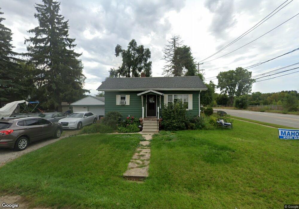
2739 Berkley Ave Jackson, MI 49202
Estimated Value: $129,865 - $162,000
2
Beds
1
Bath
936
Sq Ft
$157/Sq Ft
Est. Value
About This Home
This home is located at 2739 Berkley Ave, Jackson, MI 49202 and is currently estimated at $146,716, approximately $156 per square foot. 2739 Berkley Ave is a home located in Jackson County with nearby schools including Hunt Elementary School, Middle School at Parkside, and Jackson High School.
Ownership History
Date
Name
Owned For
Owner Type
Purchase Details
Closed on
Feb 2, 2018
Sold by
French Cara D
Bought by
The Irving C French Trust
Current Estimated Value
Purchase Details
Closed on
Nov 12, 2012
Sold by
Jones Albert M and Jones Janice J
Bought by
The Irving C Frency Revocable Trust
Purchase Details
Closed on
Jul 12, 1999
Sold by
Farnham Jack Lee and Farnham Ann Marie
Bought by
Bauer Larry Charles and Bauer Judith Mae
Home Financials for this Owner
Home Financials are based on the most recent Mortgage that was taken out on this home.
Original Mortgage
$87,000
Interest Rate
7.43%
Create a Home Valuation Report for This Property
The Home Valuation Report is an in-depth analysis detailing your home's value as well as a comparison with similar homes in the area
Home Values in the Area
Average Home Value in this Area
Purchase History
| Date | Buyer | Sale Price | Title Company |
|---|---|---|---|
| The Irving C French Trust | -- | None Available | |
| The Irving C Frency Revocable Trust | -- | None Available | |
| Bauer Larry Charles | $67,000 | -- |
Source: Public Records
Mortgage History
| Date | Status | Borrower | Loan Amount |
|---|---|---|---|
| Previous Owner | Bauer Larry Charles | $87,000 |
Source: Public Records
Tax History
| Year | Tax Paid | Tax Assessment Tax Assessment Total Assessment is a certain percentage of the fair market value that is determined by local assessors to be the total taxable value of land and additions on the property. | Land | Improvement |
|---|---|---|---|---|
| 2025 | $1,761 | $54,250 | $0 | $0 |
| 2024 | $9 | $44,200 | $0 | $0 |
| 2023 | $847 | $43,400 | $0 | $0 |
| 2022 | $1,524 | $42,900 | $0 | $0 |
| 2021 | $1,306 | $43,900 | $0 | $0 |
| 2020 | $1,485 | $41,800 | $0 | $0 |
| 2019 | $1,400 | $32,200 | $0 | $0 |
| 2018 | $1,169 | $32,100 | $0 | $0 |
| 2017 | $1,435 | $28,600 | $0 | $0 |
| 2016 | $1,091 | $28,200 | $28,200 | $0 |
| 2015 | $844 | $28,058 | $28,058 | $0 |
| 2014 | $844 | $26,490 | $0 | $0 |
| 2013 | -- | $26,490 | $26,490 | $0 |
Source: Public Records
Map
Nearby Homes
- 0 Laurence Ave Unit 25062864
- 534 Barrett Ave
- VL Laurence Ave
- 0 VL Laurence Ave
- 406 Fern Ave
- 802 Concord Blvd
- 2318 Westminster Blvd
- 870 Bryant Ave
- 1050 Maynard Ave
- 242 Kenneth St
- 310 21st St
- 406 21st St
- 0 Evelyn St
- 693 Leo Rd
- 0 N Brown St
- 3250 Carlton Blvd
- 760 Woodbine Blvd
- 1604 W Washington Ave
- 923 Wayne St
- 723 22nd St
- 433 Laurence Ave
- 446 Barrett Ave
- 438 Barrett Ave
- 432 Barrett Ave
- 427 Laurence Ave
- 517 Laurence Ave
- 517 Laurence Ave Unit 697
- 445 Barrett Ave
- 431 Barrett Ave
- 522 Barrett Ave
- 523 Laurence Ave
- 527 Laurence Ave
- 513 Barrett Ave
- 526 Barrett Ave
- 444 Condad Ave
- 440 Condad Ave
- 436 Condad Ave
- 521 Barrett Ave
- 432 Condad Ave
- 510 Condad Ave
Your Personal Tour Guide
Ask me questions while you tour the home.