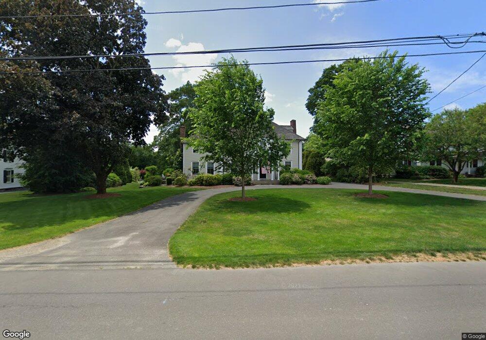
2739 Bronson Rd Fairfield, CT 06824
Greenfield Hill NeighborhoodEstimated Value: $2,089,000 - $3,824,000
Studio
--
Bath
--
Sq Ft
56,628
Sq Ft Lot
About This Home
This home is located at 2739 Bronson Rd, Fairfield, CT 06824 and is currently estimated at $2,735,245. 2739 Bronson Rd is a home located in Fairfield County with nearby schools including Dwight Elementary School, Roger Ludlowe Middle School, and Fairfield Ludlowe High School.
Ownership History
Date
Name
Owned For
Owner Type
Purchase Details
Closed on
Oct 8, 2002
Sold by
Billet Eleanor D
Bought by
Mullen Geoffrey G and Mullen Susan P
Current Estimated Value
Purchase Details
Closed on
Jun 5, 1989
Sold by
Houston James C
Bought by
Billet David S
Create a Home Valuation Report for This Property
The Home Valuation Report is an in-depth analysis detailing your home's value as well as a comparison with similar homes in the area
Home Values in the Area
Average Home Value in this Area
Purchase History
| Date | Buyer | Sale Price | Title Company |
|---|---|---|---|
| Mullen Geoffrey G | $1,500,000 | -- | |
| Mullen Geoffrey G | $1,500,000 | -- | |
| Billet David S | $585,000 | -- |
Source: Public Records
Mortgage History
| Date | Status | Borrower | Loan Amount |
|---|---|---|---|
| Open | Billet David S | $700,000 | |
| Closed | Billet David S | $410,000 | |
| Closed | Billet David S | $417,000 |
Source: Public Records
Tax History
| Year | Tax Paid | Tax Assessment Tax Assessment Total Assessment is a certain percentage of the fair market value that is determined by local assessors to be the total taxable value of land and additions on the property. | Land | Improvement |
|---|---|---|---|---|
| 2025 | $20,849 | $734,370 | $271,880 | $462,490 |
| 2024 | $20,489 | $734,370 | $271,880 | $462,490 |
| 2023 | $20,203 | $734,370 | $271,880 | $462,490 |
| 2022 | $20,004 | $734,370 | $271,880 | $462,490 |
| 2021 | $19,813 | $734,370 | $271,880 | $462,490 |
| 2020 | $22,580 | $842,870 | $329,700 | $513,170 |
| 2019 | $22,580 | $842,870 | $329,700 | $513,170 |
| 2018 | $22,218 | $842,870 | $329,700 | $513,170 |
| 2017 | $21,763 | $842,870 | $329,700 | $513,170 |
| 2016 | $21,451 | $842,870 | $329,700 | $513,170 |
| 2015 | $20,660 | $833,420 | $373,030 | $460,390 |
| 2014 | $20,335 | $833,420 | $373,030 | $460,390 |
Source: Public Records
Map
Nearby Homes
- 2683 Bronson Rd
- 1380 Old Academy Rd
- 688 Hulls Farm Rd
- 110 Queens Grant Dr
- 360 Duck Farm Rd
- 148 Millspaugh Dr
- 3674 Congress St
- 218 Lower Farm Rd
- 1 Sturges Hwy Unit 2
- 1353 Mill Plain Rd
- 2177 Cross Hwy
- 21 Sturges Commons
- 10 Debra Ln
- 1115 Galloping Hill Rd
- 54 Ridgedale Rd
- 1091 Round Hill Rd
- 647 Bronson Rd
- 3 Hunt Club Ln
- 6 Buckboard Ln
- 53 Hilltop Dr
- 2759 Bronson Rd
- 2713 Bronson Rd
- 2761 Bronson Rd
- 2793 Bronson Rd
- 2824 Bronson Rd
- 2550 Bronson Rd
- 2829 Bronson Rd
- 703 Verna Hill Rd
- 745 Verna Hill Rd
- 2641 Bronson Rd
- 2644 Bronson Rd
- 2860 Bronson Rd
- 799 Verna Hill Rd
- 539 Verna Hill Rd
- 2615 Bronson Rd
- 821 Verna Hill Rd
- 537 Verna Hill Rd
- 2905 Bronson Rd
- 424 Redding Rd
- 470 Redding Rd
Your Personal Tour Guide
Ask me questions while you tour the home.