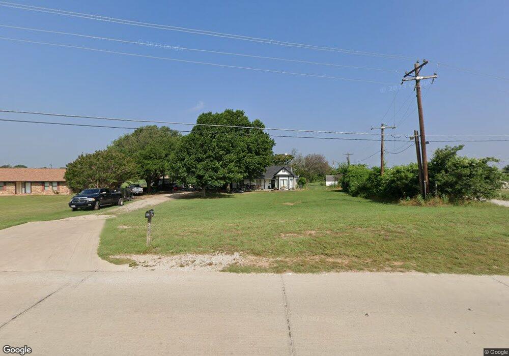
274 Buchanan Rd Decatur, TX 76234
Estimated Value: $386,561 - $533,000
--
Bed
--
Bath
1,716
Sq Ft
$253/Sq Ft
Est. Value
About This Home
This home is located at 274 Buchanan Rd, Decatur, TX 76234 and is currently estimated at $434,890, approximately $253 per square foot. 274 Buchanan Rd is a home located in Wise County with nearby schools including Decatur High School and Victory Christian Academy.
Ownership History
Date
Name
Owned For
Owner Type
Purchase Details
Closed on
May 3, 2007
Sold by
Eggers David W and Eggers Anne M
Bought by
Wingert Jason Edward and Wingert Mandy Monne
Current Estimated Value
Home Financials for this Owner
Home Financials are based on the most recent Mortgage that was taken out on this home.
Original Mortgage
$124,000
Outstanding Balance
$75,261
Interest Rate
6.13%
Mortgage Type
New Conventional
Estimated Equity
$359,629
Purchase Details
Closed on
Jun 19, 2000
Sold by
Zoorob Adib and Zoorob Claressa
Bought by
Wingert Jason and Wingert Mandy
Purchase Details
Closed on
Feb 24, 1986
Bought by
Wingert Jason and Wingert Mandy
Create a Home Valuation Report for This Property
The Home Valuation Report is an in-depth analysis detailing your home's value as well as a comparison with similar homes in the area
Home Values in the Area
Average Home Value in this Area
Purchase History
| Date | Buyer | Sale Price | Title Company |
|---|---|---|---|
| Wingert Jason Edward | -- | -- | |
| Wingert Jason | -- | -- | |
| Wingert Jason | -- | -- |
Source: Public Records
Mortgage History
| Date | Status | Borrower | Loan Amount |
|---|---|---|---|
| Open | Wingert Jason Edward | $124,000 |
Source: Public Records
Tax History Compared to Growth
Tax History
| Year | Tax Paid | Tax Assessment Tax Assessment Total Assessment is a certain percentage of the fair market value that is determined by local assessors to be the total taxable value of land and additions on the property. | Land | Improvement |
|---|---|---|---|---|
| 2025 | $2,807 | $351,082 | -- | -- |
| 2024 | $2,807 | $319,165 | $0 | $0 |
| 2023 | $3,505 | $290,150 | $0 | $0 |
| 2022 | $4,048 | $263,773 | $0 | $0 |
| 2021 | $3,844 | $239,790 | $57,280 | $182,510 |
| 2020 | $3,662 | $227,010 | $53,980 | $173,030 |
| 2019 | $3,863 | $224,800 | $53,980 | $170,820 |
| 2018 | $3,735 | $211,270 | $44,080 | $167,190 |
| 2017 | $3,396 | $196,720 | $40,900 | $155,820 |
| 2016 | $3,087 | $179,860 | $40,900 | $138,960 |
| 2015 | -- | $170,550 | $40,900 | $129,650 |
| 2014 | -- | $143,720 | $18,480 | $125,240 |
Source: Public Records
Map
Nearby Homes
- 363 County Road 3198
- 3500 S Murvil St
- 4170 S Fm 51
- 3200 S Fm 51
- 3106 S Lipsey St
- 3300 S Murvil St
- 702 Old Reunion Rd
- 3005 S Lipsey St
- 378 County Road 3170
- 1521 Old Reunion Rd
- 2705 S Lipsey St
- TBD 10.01+/- Acres Preskitt Rd
- 3790 S Fm 730
- 1617 Thousand Oaks Dr
- 289 County Road 4196
- 105 Spring Run Dr
- 3198 S Fm 730
- 3009 Treasure View Dr
- 402 Brookview Dr
- 2997 Timber Trail Dr
- 310 Buchanan Rd
- 342 Buchanan Rd
- 3601 S Fm 51
- 364 Buchanan Rd
- 3625 S Fm 51
- 3639 S Fm 51
- 228 Buchanan Rd
- 372 Buchanan Rd
- 380 Buchanan Rd
- 3675 Farm To Market 51
- 398 Buchanan Rd
- 398 Buchanan Rd
- 164 Buchanan Rd
- 3592 S Fm 51
- 101 County Road 3198
- 404 Buchanan Rd
- 3691 S Fm 51
- 3687 S Fm 51
- 113 County Rd Unit CR 3198
- 4191 Cr