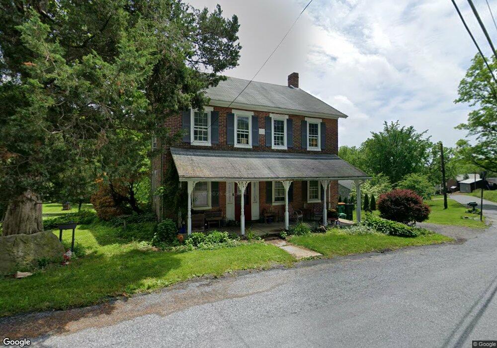
274 Granger Rd Northampton, PA 18067
Estimated Value: $281,000 - $346,000
4
Beds
1
Bath
1,792
Sq Ft
$172/Sq Ft
Est. Value
About This Home
This home is located at 274 Granger Rd, Northampton, PA 18067 and is currently estimated at $307,812, approximately $171 per square foot. 274 Granger Rd is a home located in Northampton County with nearby schools including Lehigh Elementary School, Northampton Area Middle School, and Northampton Area High School.
Ownership History
Date
Name
Owned For
Owner Type
Purchase Details
Closed on
Oct 24, 2018
Sold by
Biery Scott D and Biery Lucia J
Bought by
Burke Kimberly A
Current Estimated Value
Home Financials for this Owner
Home Financials are based on the most recent Mortgage that was taken out on this home.
Original Mortgage
$117,924
Outstanding Balance
$104,157
Interest Rate
5.12%
Mortgage Type
FHA
Estimated Equity
$203,655
Purchase Details
Closed on
Aug 4, 2015
Sold by
Biery Scott D and Estate Of Nany Ann Biery
Bought by
Biery Scott D and Biery Lucia J
Create a Home Valuation Report for This Property
The Home Valuation Report is an in-depth analysis detailing your home's value as well as a comparison with similar homes in the area
Home Values in the Area
Average Home Value in this Area
Purchase History
| Date | Buyer | Sale Price | Title Company |
|---|---|---|---|
| Burke Kimberly A | $120,100 | Principle Abstract And Settl | |
| Biery Scott D | -- | Atgf |
Source: Public Records
Mortgage History
| Date | Status | Borrower | Loan Amount |
|---|---|---|---|
| Open | Burke Kimberly A | $117,924 |
Source: Public Records
Tax History Compared to Growth
Tax History
| Year | Tax Paid | Tax Assessment Tax Assessment Total Assessment is a certain percentage of the fair market value that is determined by local assessors to be the total taxable value of land and additions on the property. | Land | Improvement |
|---|---|---|---|---|
| 2025 | $449 | $41,600 | $17,000 | $24,600 |
| 2024 | $3,058 | $41,600 | $17,000 | $24,600 |
| 2023 | $3,004 | $41,600 | $17,000 | $24,600 |
| 2022 | $3,004 | $41,600 | $17,000 | $24,600 |
| 2021 | $3,011 | $41,600 | $17,000 | $24,600 |
| 2020 | $3,011 | $41,600 | $17,000 | $24,600 |
| 2019 | $2,967 | $41,600 | $17,000 | $24,600 |
| 2018 | $2,923 | $41,600 | $17,000 | $24,600 |
| 2017 | $2,860 | $41,600 | $17,000 | $24,600 |
| 2016 | -- | $41,600 | $17,000 | $24,600 |
| 2015 | -- | $41,600 | $17,000 | $24,600 |
| 2014 | -- | $41,600 | $17,000 | $24,600 |
Source: Public Records
Map
Nearby Homes
- 3537 Spruce Dr
- 0 Millrace Rd Unit PM-132818
- 0 Millrace Rd Unit PANH2007852
- 388 Kohls Rd
- 4015 Sycamore Dr
- 1021 Aspen St
- 1086 Birch St Unit 286
- 723 Fir Dr
- 3507 High Meadow Dr
- 3550 High Meadow Dr
- 3552 High Meadow Dr
- Alberti Ranch Plan at High Meadow Estates
- Columbia Plan at High Meadow Estates
- Corsica Plan at High Meadow Estates
- Lehigh Plan at High Meadow Estates
- Normandy Plan at High Meadow Estates
- 3449 Cherryville Rd
- 711 Fir Dr
- 1135 Sherwood Dr
- 253 W Center Rd Unit Lot 123