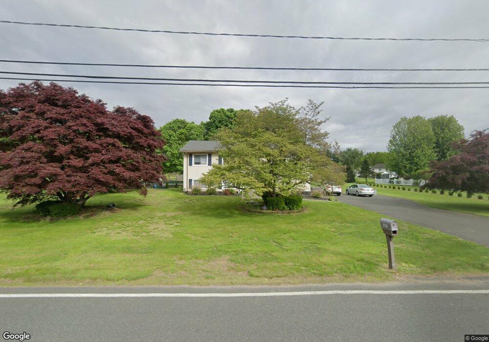
274 Hillside Rd Westfield, MA 01085
Estimated Value: $388,968 - $413,000
3
Beds
1
Bath
1,544
Sq Ft
$258/Sq Ft
Est. Value
About This Home
This home is located at 274 Hillside Rd, Westfield, MA 01085 and is currently estimated at $397,992, approximately $257 per square foot. 274 Hillside Rd is a home located in Hampden County with nearby schools including Westfield High School and Saint Mary High School.
Ownership History
Date
Name
Owned For
Owner Type
Purchase Details
Closed on
Oct 21, 2024
Sold by
St Mary Katherine A
Bought by
St Mary Jason A and Nadeau Mary A
Current Estimated Value
Purchase Details
Closed on
Oct 17, 2016
Sold by
Stmary Michael B and Stmary Katherine A
Bought by
Stmary Jason A and Nadeau Mary A
Home Financials for this Owner
Home Financials are based on the most recent Mortgage that was taken out on this home.
Original Mortgage
$159,900
Interest Rate
3.46%
Mortgage Type
New Conventional
Purchase Details
Closed on
Apr 17, 2007
Sold by
Stmary Katherine Ann
Bought by
Stmary Michael B and Stmary Katherine A
Home Financials for this Owner
Home Financials are based on the most recent Mortgage that was taken out on this home.
Original Mortgage
$226,000
Interest Rate
6.24%
Mortgage Type
Purchase Money Mortgage
Create a Home Valuation Report for This Property
The Home Valuation Report is an in-depth analysis detailing your home's value as well as a comparison with similar homes in the area
Home Values in the Area
Average Home Value in this Area
Purchase History
| Date | Buyer | Sale Price | Title Company |
|---|---|---|---|
| St Mary Jason A | -- | None Available | |
| St Mary Jason A | -- | None Available | |
| Stmary Jason A | $200,000 | -- | |
| Stmary Michael B | -- | -- | |
| Stmary Michael B | -- | -- | |
| Stmary Michael B | -- | -- | |
| Stmary Michael B | -- | -- | |
| Stmary Jason A | $200,000 | -- | |
| Stmary Michael B | -- | -- |
Source: Public Records
Mortgage History
| Date | Status | Borrower | Loan Amount |
|---|---|---|---|
| Previous Owner | Stmary Jason A | $159,900 | |
| Previous Owner | Stmary Michael B | $226,000 |
Source: Public Records
Tax History
| Year | Tax Paid | Tax Assessment Tax Assessment Total Assessment is a certain percentage of the fair market value that is determined by local assessors to be the total taxable value of land and additions on the property. | Land | Improvement |
|---|---|---|---|---|
| 2025 | $5,105 | $336,300 | $127,900 | $208,400 |
| 2024 | $5,098 | $319,200 | $116,600 | $202,600 |
| 2023 | $47 | $290,700 | $110,900 | $179,800 |
| 2022 | $4,748 | $256,800 | $98,700 | $158,100 |
| 2021 | $4,594 | $243,300 | $93,100 | $150,200 |
| 2020 | $4,568 | $237,300 | $93,100 | $144,200 |
| 2019 | $4,455 | $226,500 | $88,400 | $138,100 |
| 2018 | $4,385 | $226,500 | $88,400 | $138,100 |
| 2017 | $4,303 | $221,600 | $89,700 | $131,900 |
| 2016 | $4,308 | $221,600 | $89,700 | $131,900 |
| 2015 | $4,305 | $232,200 | $89,700 | $142,500 |
| 2014 | $3,220 | $232,200 | $89,700 | $142,500 |
Source: Public Records
Map
Nearby Homes
- 419 Southwick Rd Unit P66
- 61 Plantation Cir
- 27 Rosewood Ln
- 44 Tannery Rd
- 240 Hillside Rd
- 112 Sunnyside Rd
- 74 S Maple St
- 60 Mill St
- 70 S Maple St
- 30 Wynnfield Cir
- 91 Squawfield Rd
- 0 Fox Hill Dr
- 16 Squawfield Rd
- 5 Sawgrass Ln
- 198 Hillside Rd
- 65 Old Farm Rd
- 44 Kensington Ave
- 42 Putnam Dr
- 324 Russell Rd Unit 204
- 324 Russell Rd Unit 109
- 284 Hillside Rd
- 200 Hillside Rd
- 277 Hillside Rd
- 266 Hillside Rd
- 265 Hillside Rd
- 303 Hillside Rd
- 308 Hillside Rd
- 11 Tanglewood Dr
- 12 Tanglewood Dr
- 315 Hillside Rd
- 236 Hillside Rd
- 239 Hillside Rd
- 316 Hillside Rd
- 32 Deborah Ln
- 26 Deborah Ln
- 17 Tanglewood Dr
- 38 Deborah Ln
- 12 Castle Hill Rd
- 327 Hillside Rd
- 18 Tanglewood Dr
Your Personal Tour Guide
Ask me questions while you tour the home.