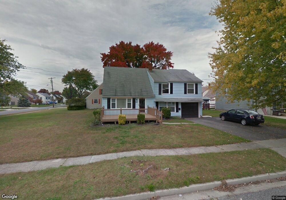
274 Justice Dr Penns Grove, NJ 08069
Estimated Value: $223,000 - $348,000
--
Bed
--
Bath
1,736
Sq Ft
$170/Sq Ft
Est. Value
About This Home
This home is located at 274 Justice Dr, Penns Grove, NJ 08069 and is currently estimated at $295,229, approximately $170 per square foot. 274 Justice Dr is a home located in Salem County with nearby schools including Lafayette-Pershing Elementary School, Paul W. Carleton Elementary School, and Field Street Elementary School.
Ownership History
Date
Name
Owned For
Owner Type
Purchase Details
Closed on
Oct 31, 2007
Sold by
Everingham Rhonda J
Bought by
Bratton Dennis L
Current Estimated Value
Home Financials for this Owner
Home Financials are based on the most recent Mortgage that was taken out on this home.
Original Mortgage
$187,064
Outstanding Balance
$118,906
Interest Rate
6.47%
Mortgage Type
FHA
Estimated Equity
$176,323
Purchase Details
Closed on
Jul 31, 2006
Sold by
Colletti Louis and Colletti Patricia
Bought by
Everingham Michael D and Everingham Rhonda J
Home Financials for this Owner
Home Financials are based on the most recent Mortgage that was taken out on this home.
Original Mortgage
$172,000
Interest Rate
8.15%
Mortgage Type
Purchase Money Mortgage
Create a Home Valuation Report for This Property
The Home Valuation Report is an in-depth analysis detailing your home's value as well as a comparison with similar homes in the area
Home Values in the Area
Average Home Value in this Area
Purchase History
| Date | Buyer | Sale Price | Title Company |
|---|---|---|---|
| Bratton Dennis L | $190,000 | -- | |
| Everingham Michael D | $192,000 | Heritage Title & Abstract Ag |
Source: Public Records
Mortgage History
| Date | Status | Borrower | Loan Amount |
|---|---|---|---|
| Open | Bratton Dennis L | $187,064 | |
| Previous Owner | Everingham Michael D | $172,000 |
Source: Public Records
Tax History Compared to Growth
Tax History
| Year | Tax Paid | Tax Assessment Tax Assessment Total Assessment is a certain percentage of the fair market value that is determined by local assessors to be the total taxable value of land and additions on the property. | Land | Improvement |
|---|---|---|---|---|
| 2025 | $5,487 | $261,700 | $52,700 | $209,000 |
| 2024 | $5,289 | $155,600 | $39,600 | $116,000 |
| 2023 | $5,289 | $155,600 | $39,600 | $116,000 |
| 2022 | $4,963 | $155,600 | $39,600 | $116,000 |
| 2021 | $4,913 | $155,600 | $39,600 | $116,000 |
| 2020 | $4,958 | $155,600 | $39,600 | $116,000 |
| 2019 | $5,002 | $155,600 | $39,600 | $116,000 |
| 2018 | $5,560 | $184,500 | $47,000 | $137,500 |
| 2017 | $5,417 | $184,500 | $47,000 | $137,500 |
| 2016 | $5,220 | $184,500 | $47,000 | $137,500 |
| 2015 | $4,976 | $184,500 | $47,000 | $137,500 |
| 2014 | $4,710 | $184,500 | $47,000 | $137,500 |
Source: Public Records
Map
Nearby Homes
- 371 Annabelle Ave
- 272 Justice Dr
- 372 Erie Ave
- 369 Annabelle Ave
- 275 Justice Dr
- 273 Justice Dr
- 280 Justice Dr
- 370 Erie Ave
- 372 Annabelle Ave
- 380 Erie Ave
- 367 Annabelle Ave
- 279 Justice Dr
- 370 Annabelle Ave
- 368 Erie Ave
- 375 Erie Ave
- 368 Annabelle Ave
- 373 Erie Ave
- 281 Justice Dr
- 282 Justice Dr
- 377 Erie Ave