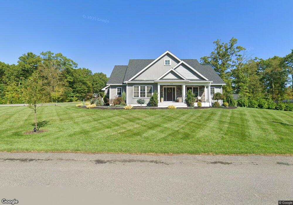
274 Keiths Cir Swansea, MA 02777
Northeast Swansea NeighborhoodEstimated Value: $869,360 - $940,000
3
Beds
3
Baths
2,590
Sq Ft
$348/Sq Ft
Est. Value
About This Home
This home is located at 274 Keiths Cir, Swansea, MA 02777 and is currently estimated at $901,840, approximately $348 per square foot. 274 Keiths Cir is a home with nearby schools including Joseph Case High School.
Ownership History
Date
Name
Owned For
Owner Type
Purchase Details
Closed on
May 9, 2016
Sold by
Roseland T
Bought by
Wood Jeffrey J and Wood Tracy A
Current Estimated Value
Home Financials for this Owner
Home Financials are based on the most recent Mortgage that was taken out on this home.
Original Mortgage
$331,000
Outstanding Balance
$267,211
Interest Rate
3.71%
Mortgage Type
New Conventional
Estimated Equity
$634,629
Purchase Details
Closed on
Sep 18, 2015
Sold by
Roseland T
Bought by
Roseland T
Create a Home Valuation Report for This Property
The Home Valuation Report is an in-depth analysis detailing your home's value as well as a comparison with similar homes in the area
Home Values in the Area
Average Home Value in this Area
Purchase History
| Date | Buyer | Sale Price | Title Company |
|---|---|---|---|
| Wood Jeffrey J | $127,000 | -- | |
| Roseland T | -- | -- | |
| Roseland T | -- | -- |
Source: Public Records
Mortgage History
| Date | Status | Borrower | Loan Amount |
|---|---|---|---|
| Open | Wood Jeffrey J | $331,000 |
Source: Public Records
Tax History Compared to Growth
Tax History
| Year | Tax Paid | Tax Assessment Tax Assessment Total Assessment is a certain percentage of the fair market value that is determined by local assessors to be the total taxable value of land and additions on the property. | Land | Improvement |
|---|---|---|---|---|
| 2025 | $9,703 | $814,000 | $221,000 | $593,000 |
| 2024 | $9,592 | $800,000 | $221,000 | $579,000 |
| 2023 | $10,680 | $813,400 | $161,900 | $651,500 |
| 2022 | $7,809 | $542,700 | $135,400 | $407,300 |
| 2021 | $2,173 | $139,000 | $139,000 | $0 |
| 2020 | $1,106 | $71,000 | $71,000 | $0 |
| 2019 | $1,000 | $64,500 | $64,500 | $0 |
| 2018 | $993 | $65,000 | $65,000 | $0 |
| 2017 | $898 | $67,600 | $67,600 | $0 |
| 2016 | $746 | $55,200 | $55,200 | $0 |
| 2015 | $725 | $55,200 | $55,200 | $0 |
| 2014 | $709 | $55,200 | $55,200 | $0 |
Source: Public Records
Map
Nearby Homes
- 2660 Courtlyn Rd
- 19 Cedar St Unit 21
- 48 Laurie Ln
- 1352 Main St
- 35 Clubhouse Dr Unit RR35
- RR33 Club House Dr Unit Lot RR33
- 16 Ashlynn Way
- 3064 Clubhouse Dr
- 3045 Clubhouse Dr Unit Lot 75
- 3035 Clubhouse Dr Unit 6
- 3035 Clubhouse Dr Unit 8
- 3049 Clubhouse Dr Unit 77
- 3035 Clubhouse Dr Unit 2
- 3055 Clubhouse Dr Unit 80
- 3035 Clubhouse Dr
- 3035 Clubhouse Dr Unit 4
- 3035 Clubhouse Dr Unit 1
- 3051 Clubhouse Dr Unit 78
- 3035 Clubhouse Dr Unit 3
- 3035 Clubhouse Dr Unit 7
- 264 Keiths Cir
- 79 Keiths Cir
- 112 Keith's Cir
- 112 Keiths Cir
- 65 Keiths Cir
- 50 Keiths Cir
- 95 Keiths Cir
- 132 Keiths Cir
- 50 Keith's Cir
- 50 Keiths Cir
- 234 Keiths Cir
- 49 Keith's Cir
- Lot 33 Keiths Cir
- Lot 1 Keith's Cir
- Lot 21 Keiths Cir
- 152 Keiths Cir
- Lot 36 Keith's Cir
- Lot 20 Keiths Cir
- Lot 22 Keith's Cir
- Lot 25 Keith's Cir