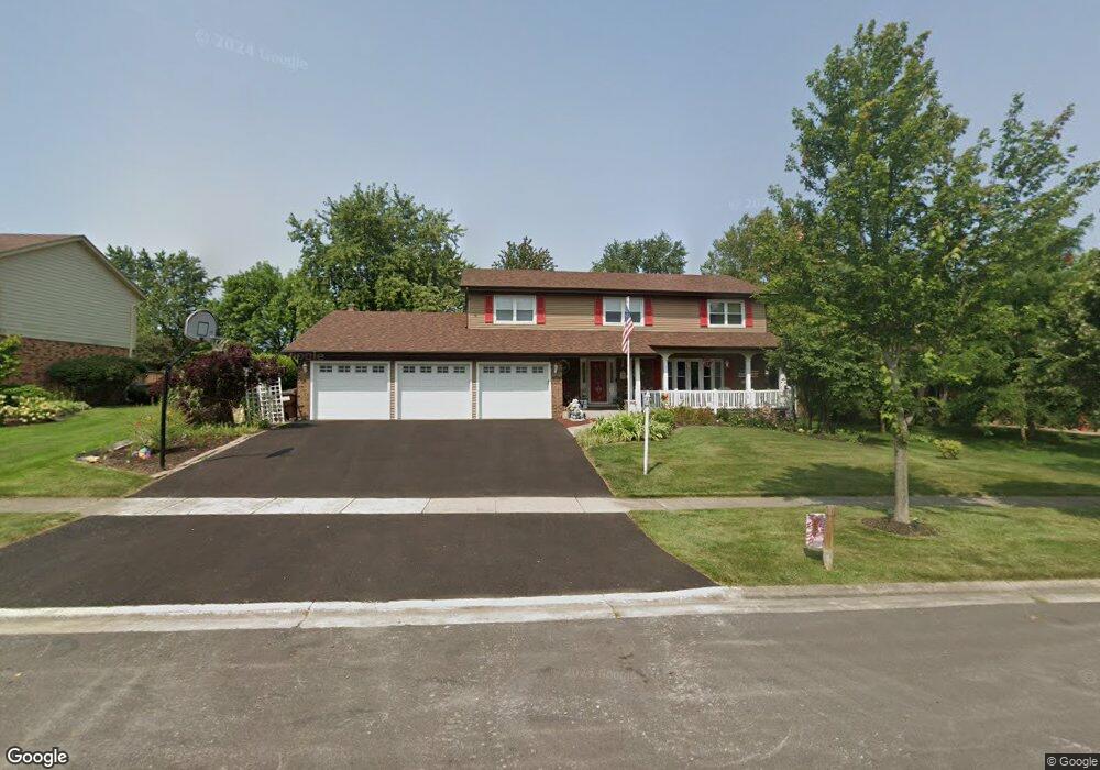
274 Mulberry Rd Frankfort, IL 60423
North Frankfort NeighborhoodEstimated Value: $508,514 - $598,000
3
Beds
4
Baths
2,682
Sq Ft
$203/Sq Ft
Est. Value
About This Home
This home is located at 274 Mulberry Rd, Frankfort, IL 60423 and is currently estimated at $543,129, approximately $202 per square foot. 274 Mulberry Rd is a home located in Will County with nearby schools including Grand Prairie Elementary School, Chelsea Intermediate School, and Hickory Creek Middle School.
Ownership History
Date
Name
Owned For
Owner Type
Purchase Details
Closed on
Oct 11, 2024
Sold by
Gold Brian A and Gold Marilyn L
Bought by
Gold Family Trust and Gold
Current Estimated Value
Purchase Details
Closed on
May 29, 2003
Sold by
Emmeloth Daniel L and Emmeloth Deborah
Bought by
Gold Brian and Gold Marilyn L
Home Financials for this Owner
Home Financials are based on the most recent Mortgage that was taken out on this home.
Original Mortgage
$235,000
Interest Rate
3.62%
Mortgage Type
Stand Alone First
Create a Home Valuation Report for This Property
The Home Valuation Report is an in-depth analysis detailing your home's value as well as a comparison with similar homes in the area
Home Values in the Area
Average Home Value in this Area
Purchase History
| Date | Buyer | Sale Price | Title Company |
|---|---|---|---|
| Gold Family Trust | -- | None Listed On Document | |
| Gold Brian | $295,000 | Chicago Title Insurance Comp |
Source: Public Records
Mortgage History
| Date | Status | Borrower | Loan Amount |
|---|---|---|---|
| Previous Owner | Gold Brian | $235,000 |
Source: Public Records
Tax History Compared to Growth
Tax History
| Year | Tax Paid | Tax Assessment Tax Assessment Total Assessment is a certain percentage of the fair market value that is determined by local assessors to be the total taxable value of land and additions on the property. | Land | Improvement |
|---|---|---|---|---|
| 2024 | $11,366 | $151,455 | $22,871 | $128,584 |
| 2023 | $11,366 | $135,264 | $20,426 | $114,838 |
| 2022 | $9,947 | $133,990 | $18,605 | $115,385 |
| 2021 | $10,243 | $125,353 | $17,406 | $107,947 |
| 2020 | $10,064 | $121,820 | $16,915 | $104,905 |
| 2019 | $9,668 | $118,559 | $16,462 | $102,097 |
| 2018 | $9,497 | $115,151 | $15,989 | $99,162 |
| 2017 | $9,490 | $112,463 | $15,616 | $96,847 |
| 2016 | $9,268 | $108,608 | $15,081 | $93,527 |
| 2015 | $8,912 | $104,783 | $14,550 | $90,233 |
| 2014 | $8,912 | $104,055 | $14,449 | $89,606 |
| 2013 | $8,912 | $105,404 | $14,636 | $90,768 |
Source: Public Records
Map
Nearby Homes
- 425 Cottonwood Rd
- 481 Pleasant Hill Rd
- 935 N Butternut Cir
- 9748 Folkers Dr
- 10214 Frankfort Main
- 725 Birchwood Rd
- 9772 Folkers Dr
- 9736 Folkers Dr
- 9724 Folkers Dr
- 728 Stonebridge Rd
- 21709 Cappel Ln
- 764 Leslie Ln
- 14 Old Frankfort Way
- 8551 W Lincoln Hwy
- 1018 S Butternut Cir
- Lot 3 Town Center Dr
- 10993 Pioneer Trail
- 117 Linden Dr
- 130 Evergreen Dr
- 267 Center Rd
- 286 Mulberry Rd
- 262 Mulberry Rd
- 273 Johnson Ave
- 250 Mulberry Rd
- 298 Mulberry Rd
- 261 Johnson Ave
- 285 Johnson Ave
- 273 Mulberry Rd
- 249 Johnson Ave
- 297 Johnson Ave
- 285 Mulberry Rd
- 261 Mulberry Rd
- 238 Mulberry Rd
- 297 Mulberry Rd
- 249 Mulberry Rd
- 237 Johnson Ave
- 633 Johnson Ave Unit 633
- 635 Johnson Ave Unit 635
- 226 Mulberry Rd
- 237 Mulberry Rd