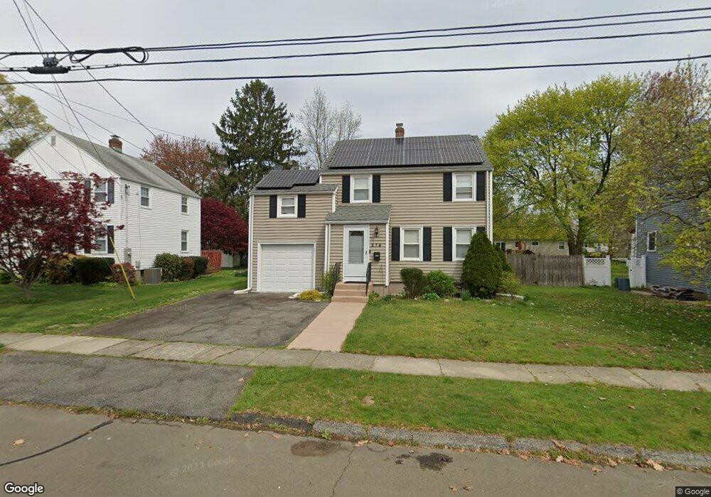
274 Roger Dr Stratford, CT 06614
Estimated Value: $498,000 - $521,575
3
Beds
2
Baths
1,417
Sq Ft
$359/Sq Ft
Est. Value
About This Home
This home is located at 274 Roger Dr, Stratford, CT 06614 and is currently estimated at $508,394, approximately $358 per square foot. 274 Roger Dr is a home located in Fairfield County with nearby schools including Eli Whitney Elementary School, Harry B. Flood Middle School, and Bunnell High School.
Ownership History
Date
Name
Owned For
Owner Type
Purchase Details
Closed on
May 17, 2007
Sold by
Bannon Scott and Bannon Stacy
Bought by
Pepe Anthony and Pepe Rosemary
Current Estimated Value
Home Financials for this Owner
Home Financials are based on the most recent Mortgage that was taken out on this home.
Original Mortgage
$270,800
Outstanding Balance
$164,809
Interest Rate
6.18%
Estimated Equity
$343,585
Purchase Details
Closed on
Apr 27, 2001
Sold by
Lostracco David R and Lostracco Jeanne M
Bought by
Bannon Scott P and Blake Stacey E
Home Financials for this Owner
Home Financials are based on the most recent Mortgage that was taken out on this home.
Original Mortgage
$182,750
Interest Rate
6.88%
Purchase Details
Closed on
Feb 9, 1990
Sold by
Silverfarb Lena
Bought by
Lostracco David
Create a Home Valuation Report for This Property
The Home Valuation Report is an in-depth analysis detailing your home's value as well as a comparison with similar homes in the area
Home Values in the Area
Average Home Value in this Area
Purchase History
| Date | Buyer | Sale Price | Title Company |
|---|---|---|---|
| Pepe Anthony | $338,500 | -- | |
| Bannon Scott P | $215,000 | -- | |
| Lostracco David | $168,000 | -- |
Source: Public Records
Mortgage History
| Date | Status | Borrower | Loan Amount |
|---|---|---|---|
| Open | Lostracco David | $25,400 | |
| Open | Lostracco David | $270,800 | |
| Previous Owner | Lostracco David | $175,000 | |
| Previous Owner | Lostracco David | $182,750 |
Source: Public Records
Tax History Compared to Growth
Tax History
| Year | Tax Paid | Tax Assessment Tax Assessment Total Assessment is a certain percentage of the fair market value that is determined by local assessors to be the total taxable value of land and additions on the property. | Land | Improvement |
|---|---|---|---|---|
| 2025 | $7,986 | $198,660 | $98,140 | $100,520 |
| 2024 | $7,986 | $198,660 | $98,140 | $100,520 |
| 2023 | $7,986 | $198,660 | $98,140 | $100,520 |
| 2022 | $7,839 | $198,660 | $98,140 | $100,520 |
| 2021 | $7,841 | $198,660 | $98,140 | $100,520 |
| 2020 | $7,875 | $198,660 | $98,140 | $100,520 |
| 2019 | $7,354 | $184,450 | $83,930 | $100,520 |
| 2018 | $7,360 | $184,450 | $83,930 | $100,520 |
| 2017 | $7,372 | $184,450 | $83,930 | $100,520 |
| 2016 | $7,192 | $184,450 | $83,930 | $100,520 |
| 2015 | $6,821 | $184,450 | $83,930 | $100,520 |
| 2014 | $7,183 | $201,600 | $91,070 | $110,530 |
Source: Public Records
Map
Nearby Homes
- 248 Roger Dr
- 150 San Gabriel Ave
- 155 Burbank Ave
- 71 Glenfield Ave
- 145 Dahl Ave
- 195 Lobdell Dr
- 90 Mercer St
- 217 Huntington Rd
- 309 Freeman Ave
- 39 Parkway Dr
- 1257 Nichols Ave
- 46 Parkway Dr
- 877 Nichols Ave
- 810 Nichols Ave
- 125 Meadowbrook Rd
- 45 Albright Ave
- 100 Lambert Dr
- 24 Brewster St
- 55 Leighton Dr
- 405 Highland Ave