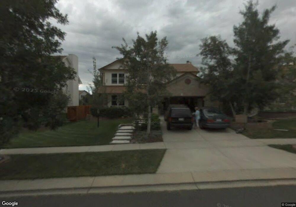
2740 Helmsdale Dr Colorado Springs, CO 80920
Briargate NeighborhoodEstimated Value: $579,526 - $634,000
4
Beds
4
Baths
1,882
Sq Ft
$327/Sq Ft
Est. Value
About This Home
This home is located at 2740 Helmsdale Dr, Colorado Springs, CO 80920 and is currently estimated at $615,382, approximately $326 per square foot. 2740 Helmsdale Dr is a home located in El Paso County with nearby schools including Academy International Elementary School, Mountain Ridge Middle School, and Rampart High School.
Ownership History
Date
Name
Owned For
Owner Type
Purchase Details
Closed on
Dec 15, 2016
Sold by
Massey Robert A and Massey Lisa A
Bought by
Dickey James and Dickey Rebecca
Current Estimated Value
Home Financials for this Owner
Home Financials are based on the most recent Mortgage that was taken out on this home.
Original Mortgage
$54,750
Outstanding Balance
$44,237
Interest Rate
3.54%
Mortgage Type
Credit Line Revolving
Estimated Equity
$571,145
Purchase Details
Closed on
Apr 30, 1999
Sold by
Massey Robert A
Bought by
Massey Robert A and Massey Lisa A
Home Financials for this Owner
Home Financials are based on the most recent Mortgage that was taken out on this home.
Original Mortgage
$169,600
Interest Rate
6.99%
Purchase Details
Closed on
Jun 10, 1993
Bought by
Dickey Rebecca
Purchase Details
Closed on
Mar 9, 1993
Bought by
Dickey Rebecca
Purchase Details
Closed on
Oct 16, 1992
Bought by
Dickey Rebecca
Create a Home Valuation Report for This Property
The Home Valuation Report is an in-depth analysis detailing your home's value as well as a comparison with similar homes in the area
Home Values in the Area
Average Home Value in this Area
Purchase History
| Date | Buyer | Sale Price | Title Company |
|---|---|---|---|
| Dickey James | $373,500 | Land Title Guarantee | |
| Massey Robert A | -- | Land Title | |
| Dickey Rebecca | $137,100 | -- | |
| Dickey Rebecca | $24,000 | -- | |
| Dickey Rebecca | -- | -- |
Source: Public Records
Mortgage History
| Date | Status | Borrower | Loan Amount |
|---|---|---|---|
| Open | Dickey James | $54,750 | |
| Previous Owner | Massey Robert A | $169,600 |
Source: Public Records
Tax History Compared to Growth
Tax History
| Year | Tax Paid | Tax Assessment Tax Assessment Total Assessment is a certain percentage of the fair market value that is determined by local assessors to be the total taxable value of land and additions on the property. | Land | Improvement |
|---|---|---|---|---|
| 2025 | $2,437 | $40,400 | -- | -- |
| 2024 | $2,410 | $41,660 | $6,700 | $34,960 |
| 2022 | $1,966 | $27,850 | $5,420 | $22,430 |
| 2021 | $2,174 | $28,660 | $5,580 | $23,080 |
| 2020 | $2,086 | $25,630 | $4,650 | $20,980 |
| 2019 | $2,065 | $25,630 | $4,650 | $20,980 |
| 2018 | $1,829 | $22,330 | $3,600 | $18,730 |
| 2017 | $1,823 | $22,330 | $3,600 | $18,730 |
| 2016 | $1,877 | $22,970 | $3,660 | $19,310 |
| 2015 | $1,874 | $22,970 | $3,660 | $19,310 |
| 2014 | $1,753 | $21,470 | $3,660 | $17,810 |
Source: Public Records
Map
Nearby Homes
- 8735 Chapel Square Ct
- 2715 Heathrow Dr
- 2560 Wimbleton Ct
- 8935 Coberdale Ct
- 2730 Kenton Green Ct
- 2656 Marston Heights
- 2644 Marston Heights
- 2340 Winstead View
- 2130 Wimbleton Ct
- 2270 Cloverdale Dr
- 9659 Carriage Creek Point
- 8335 Sutterfield Dr
- 9506 Hollydale Ct
- 8213 Caravel Dr
- 3142 Soaring Bird Cir
- 2479 Pine Valley View
- 8112 Old Exchange Dr
- 3279 Greenmoor Ct
- 8135 Portsmouth Ct
- 2360 Pine Valley View
- 2730 Helmsdale Dr
- 8810 Bloombury Ct
- 2720 Helmsdale Dr
- 2760 Helmsdale Dr
- 8820 Bloombury Ct
- 8805 Bloombury Ct
- 2755 Helmsdale Dr
- 2630 Helmsdale Dr
- 2770 Helmsdale Dr
- 2640 Helmsdale Dr
- 2745 Helmsdale Dr
- 2620 Helmsdale Dr
- 2650 Helmsdale Dr
- 8815 Bloombury Ct
- 2735 Helmsdale Dr
- 8830 Bloombury Ct
- 2765 Helmsdale Dr
- 2610 Helmsdale Dr
- 8810 Liverpool Ln
- 8820 Liverpool Ln